Right side scores higher (3.5 vs 2.5) because it captures meaningful scenery during both critical flight phases: Warsaw's Vistula River and urban core during takeoff, and the Saigon River estuary plus Ho Chi Minh City's dense urban landscape during approach. Left side faces predominantly flat plains during departure and open ocean during most of the cruise and descent, offering minimal visual interest. The right side provides genuine geographic and urban landmarks at both ends of the journey.
Flight Path
Eastern European plains (Poland, Ukraine, Moldova), Black Sea coast and Turkish Anatolia, Levantine coast (Syria, Lebanon), Arabian Peninsula and Persian Gulf, Iranian plateau, Arabian Sea, Indian subcontinent (India, Pakistan), Bay of Bengal, Myanmar coast, Thailand and Laos, Mekong River valley approaching Vietnam
Great circle distance and headings ›

.jpg?width=600)

Phase by phase
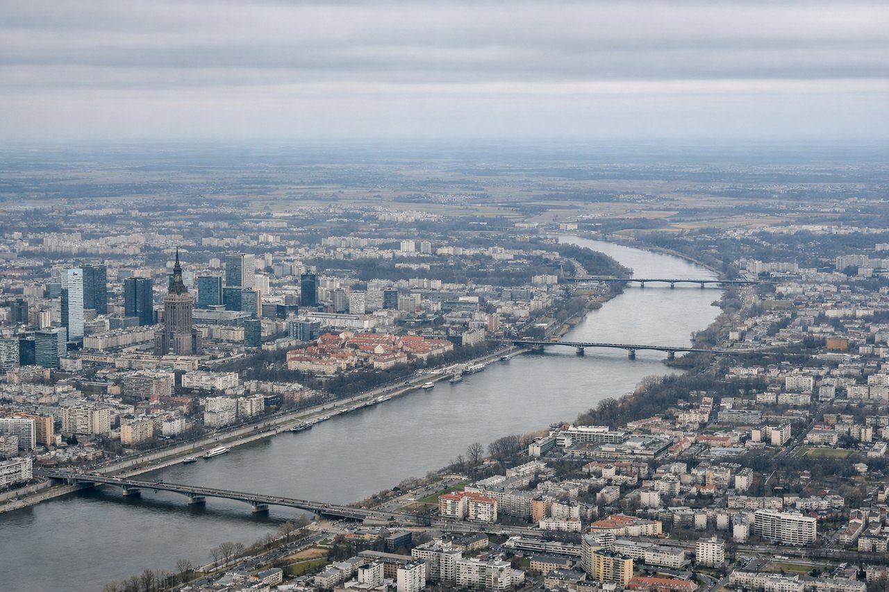
Takeoff from WAW
RIGHTRight side captures Warsaw's urban sprawl and the Vistula River valley during initial climb. Left side faces open countryside with minimal landmarks during the critical takeoff and early climb phase.
Landing at SGN
RIGHTRight side offers superior approach scenery: the Saigon River estuary, Mekong Delta waterways, and Ho Chi Minh City's sprawling urban landscape during descent and final approach. Left side faces the South China Sea with minimal distinguishing features during the critical landing phase.
Landmarks on this routeAll landmarks →
Will your flight be in sunlight?
See exactly which side of the plane gets sun and shade at your departure time.
About This Route
Which side of the plane should I sit on flying from Okecie (WAW) to Tansonnhat International (SGN)?
Sit on the Right side of the plane for the best views on flights from Warsaw to Ho Chi Minh City. Right side scores higher (3.5 vs 2.5) because it captures meaningful scenery during both critical flight phases: Warsaw's Vistula River and urban core during takeoff, and the Saigon River estuary plus Ho Chi Minh City's dense urban landscape during approach. Left side faces predominantly flat plains during departure and open ocean during most of the cruise and descent, offering minimal visual interest. The right side provides genuine geographic and urban landmarks at both ends of the journey.
What can I see during takeoff from Okecie in Warsaw?
During takeoff from Okecie (WAW), sit on the Right side for the best views. Right side captures Warsaw's urban sprawl and the Vistula River valley during initial climb. Left side faces open countryside with minimal landmarks during the critical takeoff and early climb phase. Notable sights include: Vistula River winding through Warsaw, Warsaw city center and Praga district, Masovian plains extending eastward.
What can I see when landing at Tansonnhat International in Ho Chi Minh City?
When landing at Tansonnhat International (SGN), sit on the Right side for the best views. Right side offers superior approach scenery: the Saigon River estuary, Mekong Delta waterways, and Ho Chi Minh City's sprawling urban landscape during descent and final approach. Left side faces the South China Sea with minimal distinguishing features during the critical landing phase. Notable sights include: Saigon River estuary and its intricate delta channels, Ho Chi Minh City's dense urban grid and harbor, Mekong Delta rice paddies and waterways.
How long is the flight from Warsaw to Ho Chi Minh City?
The flight from Okecie (WAW) to Tansonnhat International (SGN) takes 10h 15m.
What does the Warsaw to Ho Chi Minh City flight path pass over?
Eastern European plains (Poland, Ukraine, Moldova), Black Sea coast and Turkish Anatolia, Levantine coast (Syria, Lebanon), Arabian Peninsula and Persian Gulf, Iranian plateau, Arabian Sea, Indian subcontinent (India, Pakistan), Bay of Bengal, Myanmar coast, Thailand and Laos, Mekong River valley approaching Vietnam