Left side captures the Vistula's dramatic loops on departure and the Guadalquivir's iconic oxbow on arrival. The landing view is particularly rewarding, offering unobstructed sightlines of Seville's historic core and river geography.
Flown WAW to SVQ? Did we get it right?
Flight Path
Warsaw to Sevilla is 1,649 miles (2,654 km), a flight of about 3 hours 15 minutes.
The flight path crosses the Carpathian Mountains' western foothills (visible around 1.5 hours out), then the Danube valley near Budapest, before crossing the Balkans. The Alps' southern edge appears briefly near the Austrian-Italian border. Southern France's Rhône valley and Provence plateau follow, with the Pyrenees visible as a distant ridge before descent into Andalusia. The Mediterranean coast is not crossed on this routing.
Great circle distance and headings ›


Phase by phase
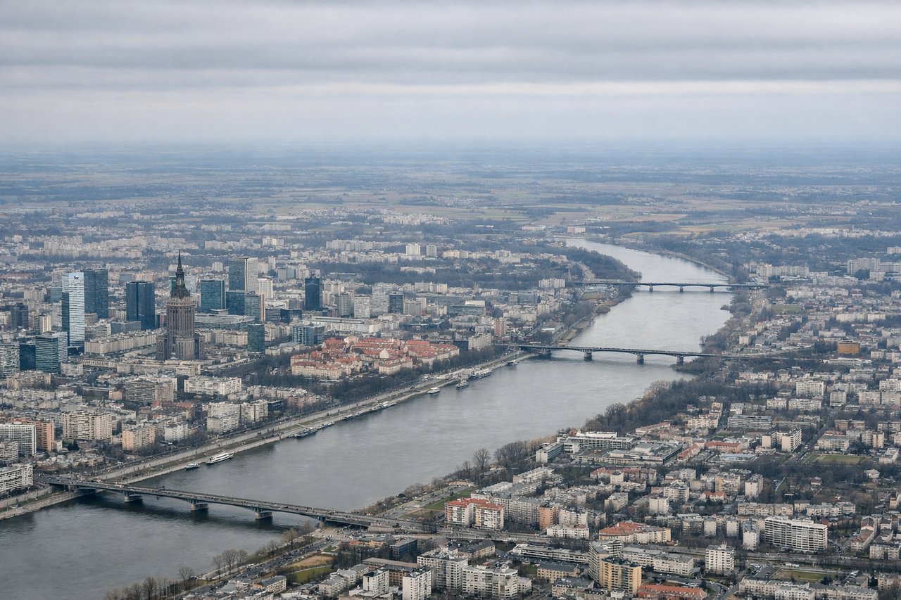
Takeoff from WAW
RIGHTWarsaw typically departs eastbound (Runway 33L/R) or westbound (Runway 15L/R). For southbound routing to Seville, westbound departure is standard. Right-side seats capture the Vistula River's distinctive loops through central Warsaw and the city's eastern sprawl receding behind.
Landing at SVQ
LEFTSeville airport (SVQ) sits 7 km northeast of the city center. Typical approach is from the northeast (Runway 33L/R). Left-side seats provide direct views of the Guadalquivir River's dramatic meander through Seville's historic core, including the cathedral and alcázar silhouettes on approach.
Will your flight be in sunlight?
Pick a date and time in the Sun Map to watch the sun move across your whole flight.
About This Route
Which side of the plane should I sit on flying from Okecie (WAW) to Sevilla (SVQ)?
Sit on the Left side of the plane for the best views on flights from Warsaw to Sevilla. Left side captures the Vistula's dramatic loops on departure and the Guadalquivir's iconic oxbow on arrival. The landing view is particularly rewarding, offering unobstructed sightlines of Seville's historic core and river geography.
What can I see during takeoff from Okecie in Warsaw?
During takeoff from Okecie (WAW), sit on the Right side for the best views. Warsaw typically departs eastbound (Runway 33L/R) or westbound (Runway 15L/R). For southbound routing to Seville, westbound departure is standard. Right-side seats capture the Vistula River's distinctive loops through central Warsaw and the city's eastern sprawl receding behind. Notable sights include: Vistula River (meandering through Warsaw), Praga district (east bank), Masovian Lowlands extending south, Warsaw city center (diminishing behind).
What can I see when landing at Sevilla in Sevilla?
When landing at Sevilla (SVQ), sit on the Left side for the best views. Seville airport (SVQ) sits 7 km northeast of the city center. Typical approach is from the northeast (Runway 33L/R). Left-side seats provide direct views of the Guadalquivir River's dramatic meander through Seville's historic core, including the cathedral and alcázar silhouettes on approach. Notable sights include: Guadalquivir River (sharp oxbow bend), Seville city center (cathedral spire visible), Sierra Morena foothills (distant northeast), Triana district (west bank).
How long is the flight from Warsaw to Sevilla?
The flight from Okecie (WAW) to Sevilla (SVQ) takes about 3 hours 15 minutes. The shortest flight path between them is 1,649 miles (2,654 km); winds and air traffic control usually add a few percent.
What does the Warsaw to Sevilla flight path pass over?
The flight path crosses the Carpathian Mountains' western foothills (visible around 1.5 hours out), then the Danube valley near Budapest, before crossing the Balkans. The Alps' southern edge appears briefly near the Austrian-Italian border. Southern France's Rhône valley and Provence plateau follow, with the Pyrenees visible as a distant ridge before descent into Andalusia. The Mediterranean coast is not crossed on this routing.