Warsaw to Vilnius is 246 miles (396 km), a flight of about 50 minutes.
Right side captures Warsaw's Vistula River and urban features during departure, while the flight path northeastward means left side dominates the cruise segment over Lithuanian forests. However, right-side seats offer the strongest scenic payoff at takeoff from a major city, making it the better overall choice.
Flight Path
Narew River valley (tributary of Vistula, visible as a green corridor), transition from Masovian Lowlands to Lithuanian plains, extensive forests of the Lithuanian landscape, agricultural patchwork with field boundaries, occasional small towns and road networks connecting Warsaw to Vilnius
Great circle distance and headings ›Phase by phase
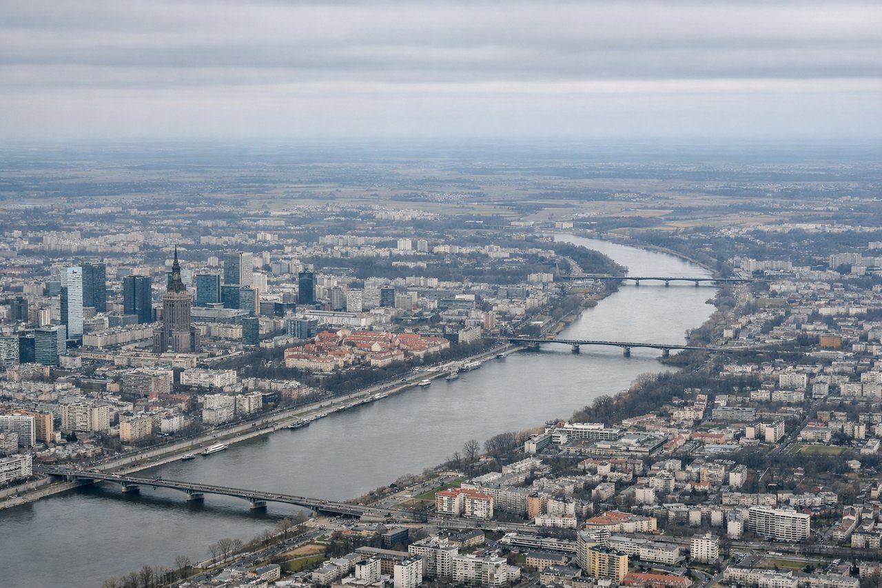
Takeoff from WAW
RIGHTWarsaw's urban sprawl and the Vistula River bend are best viewed from the right side during northeastward climb-out. You'll see the city grid and river meanders clearly as you gain altitude.
Landing at VNO
LEFTVilnius approach from the southwest brings the Neris River valley and city center into view on the left side during descent. The river's distinctive curves and the surrounding forested terrain are prominent visual markers.
Will your flight be in sunlight?
Pick a date and time in the Sun Map to watch the sun move across your whole flight.
About This Route
Which side of the plane should I sit on flying from Okecie (WAW) to Vilnius International Airport (VNO)?
Sit on the Right side of the plane for the best views on flights from Warsaw to Vilnius. Right side captures Warsaw's Vistula River and urban features during departure, while the flight path northeastward means left side dominates the cruise segment over Lithuanian forests. However, right-side seats offer the strongest scenic payoff at takeoff from a major city, making it the better overall choice.
What can I see during takeoff from Okecie in Warsaw?
During takeoff from Okecie (WAW), sit on the Right side for the best views. Warsaw's urban sprawl and the Vistula River bend are best viewed from the right side during northeastward climb-out. You'll see the city grid and river meanders clearly as you gain altitude. Notable sights include: Vistula River (distinctive loops through Warsaw), Warsaw city center and suburbs, Masovian Lowlands extending northeast.
What can I see when landing at Vilnius International Airport in Vilnius?
When landing at Vilnius International Airport (VNO), sit on the Left side for the best views. Vilnius approach from the southwest brings the Neris River valley and city center into view on the left side during descent. The river's distinctive curves and the surrounding forested terrain are prominent visual markers. Notable sights include: Neris River (winding through Vilnius), Vilnius old town and modern districts, Lithuanian forests and agricultural plains to the southwest.
How long is the flight from Warsaw to Vilnius?
The flight from Okecie (WAW) to Vilnius International Airport (VNO) takes about 50 minutes. The shortest flight path between them is 246 miles (396 km); winds and air traffic control usually add a few percent.
What does the Warsaw to Vilnius flight path pass over?
Narew River valley (tributary of Vistula, visible as a green corridor), transition from Masovian Lowlands to Lithuanian plains, extensive forests of the Lithuanian landscape, agricultural patchwork with field boundaries, occasional small towns and road networks connecting Warsaw to Vilnius