While takeoff offers interesting Warsaw views from the right, the landing approach on the left provides far more dramatic and visually distinctive scenery—the Strait of Georgia, Gulf Islands, and the North Shore Mountains create a memorable finale to the flight.
Flown WAW to YVR? Did we get it right?
Flight Path
Warsaw to Vancouver is 5,124 miles (8,247 km), a flight of about 10 hours.
The flight path crosses the Atlantic Ocean (no visible landmarks for 5-6 hours), then enters North American airspace over Newfoundland and Labrador. Passengers may glimpse the Canadian Shield's rocky terrain and boreal forest as the aircraft descends toward the Pacific coast. The Hudson Bay region and the Canadian Prairies (Manitoba, Saskatchewan) pass beneath during mid-flight, though at cruise altitude these appear as subtle variations in terrain color and vegetation. The Rocky Mountains become visible approximately 1-2 hours before landing, with peaks like Mount Robson appearing on the horizon as the aircraft descends toward British Columbia's coastal approach.
Great circle distance and headings ›


Phase by phase
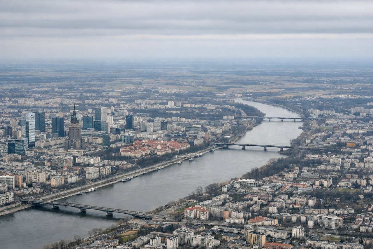
Takeoff from WAW
RIGHTRight-side seats offer views of the Vistula River winding through Warsaw's city center and the surrounding flat Polish plains extending eastward. The left side faces westward toward less distinctive terrain.
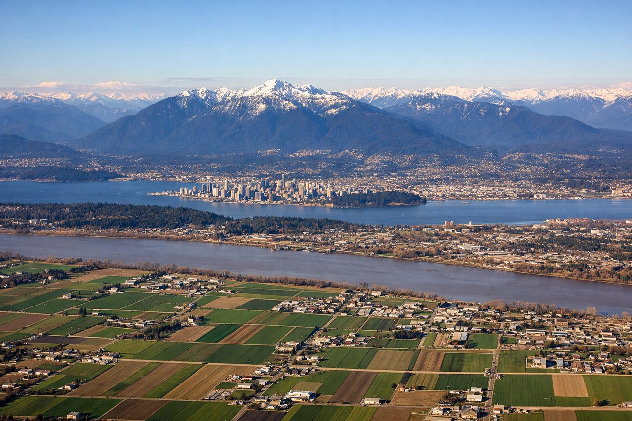
Landing at YVR
LEFTLeft-side seats provide excellent views during approach to YVR. The descent path over the Strait of Georgia and the North Shore Mountains offers dramatic scenery—the water, islands, and the snow-capped peaks of the Coast Mountains rising sharply inland from the coast.
Will your flight be in sunlight?
Pick a date and time in the Sun Map to watch the sun move across your whole flight.
About This Route
Which side of the plane should I sit on flying from Okecie (WAW) to Vancouver International (YVR)?
Sit on the Left side of the plane for the best views on flights from Warsaw to Vancouver. While takeoff offers interesting Warsaw views from the right, the landing approach on the left provides far more dramatic and visually distinctive scenery—the Strait of Georgia, Gulf Islands, and the North Shore Mountains create a memorable finale to the flight.
What can I see during takeoff from Okecie in Warsaw?
During takeoff from Okecie (WAW), sit on the Right side for the best views. Right-side seats offer views of the Vistula River winding through Warsaw's city center and the surrounding flat Polish plains extending eastward. The left side faces westward toward less distinctive terrain. Notable sights include: Vistula River (central Warsaw), Warsaw city grid and districts, flat agricultural plains extending to the horizon, Masovian Lowland terrain.
What can I see when landing at Vancouver International in Vancouver?
When landing at Vancouver International (YVR), sit on the Left side for the best views. Left-side seats provide excellent views during approach to YVR. The descent path over the Strait of Georgia and the North Shore Mountains offers dramatic scenery—the water, islands, and the snow-capped peaks of the Coast Mountains rising sharply inland from the coast. Notable sights include: Strait of Georgia (body of water), North Shore Mountains (Grouse, Seymour, Cypress peaks), Gulf Islands (scattered islands in the strait), Vancouver city and harbor.
How long is the flight from Warsaw to Vancouver?
The flight from Okecie (WAW) to Vancouver International (YVR) takes about 10 hours. The shortest flight path between them is 5,124 miles (8,247 km); winds and air traffic control usually add a few percent.
What does the Warsaw to Vancouver flight path pass over?
The flight path crosses the Atlantic Ocean (no visible landmarks for 5-6 hours), then enters North American airspace over Newfoundland and Labrador. Passengers may glimpse the Canadian Shield's rocky terrain and boreal forest as the aircraft descends toward the Pacific coast. The Hudson Bay region and the Canadian Prairies (Manitoba, Saskatchewan) pass beneath during mid-flight, though at cruise altitude these appear as subtle variations in terrain color and vegetation. The Rocky Mountains become visible approximately 1-2 hours before landing, with peaks like Mount Robson appearing on the horizon as the aircraft descends toward British Columbia's coastal approach.