Wuhan to San Francisco is 6,466 miles (10,405 km), a flight of about 11 hours 30 minutes.
While takeoff offers good Yangtze River views from the right, the landing approach from the east provides more dramatic and sustained scenery—the Sierra Nevada mountains are visually striking and visible for an extended period during descent. Left-side seats capture this premium final-approach experience.
Flight Path
The flight path typically crosses central Russia (Urals visible as low mountain ridges), then transitions over Siberian plains and taiga forests. Over the North Pacific, no major landmarks are visible—open ocean dominates for 6–7 hours. As the aircraft approaches North America, the Aleutian Islands may be visible in clear conditions, followed by the Alaska Range and coastal mountain ranges of British Columbia. The Rocky Mountains become visible during the final descent into California.
Great circle distance and headings ›


Phase by phase
Takeoff from WUH
RIGHTRight-side seats offer views of the Yangtze River as it curves through Wuhan's urban landscape during the initial climb-out. The river's distinctive meanders and the city's layout along its banks are clearly visible from 5,000–15,000 feet.
Landing at SFO
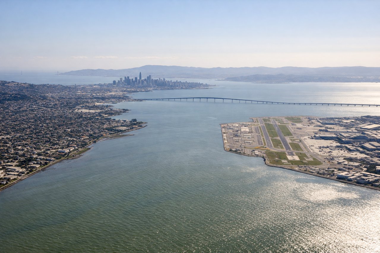
LEFTLeft-side seats provide excellent views of the Sierra Nevada mountains as the aircraft descends into the San Francisco Bay Area from the east. The snow-capped peaks and dramatic ridge lines are striking during the final approach, typically visible from 25,000 feet down to 10,000 feet.
Landmarks on this routeAll landmarks →
Will your flight be in sunlight?
Pick a date and time in the Sun Map to watch the sun move across your whole flight.
About This Route
Which side of the plane should I sit on flying from Tianhe (WUH) to San Francisco International (SFO)?
Sit on the Left side of the plane for the best views on flights from Wuhan to San Francisco. While takeoff offers good Yangtze River views from the right, the landing approach from the east provides more dramatic and sustained scenery—the Sierra Nevada mountains are visually striking and visible for an extended period during descent. Left-side seats capture this premium final-approach experience.
What can I see during takeoff from Tianhe in Wuhan?
During takeoff from Tianhe (WUH), sit on the Right side for the best views. Right-side seats offer views of the Yangtze River as it curves through Wuhan's urban landscape during the initial climb-out. The river's distinctive meanders and the city's layout along its banks are clearly visible from 5,000–15,000 feet. Notable sights include: Yangtze River (main channel and oxbow bends), Wuhan urban districts (Hankou, Hanyang, Wuchang separated by water), East Lake (Donghu) to the east of the city center.
What can I see when landing at San Francisco International in San Francisco?
When landing at San Francisco International (SFO), sit on the Left side for the best views. Left-side seats provide excellent views of the Sierra Nevada mountains as the aircraft descends into the San Francisco Bay Area from the east. The snow-capped peaks and dramatic ridge lines are striking during the final approach, typically visible from 25,000 feet down to 10,000 feet. Notable sights include: Sierra Nevada range (including peaks near Lake Tahoe region), Central Valley floor (flat agricultural terrain), San Francisco Bay (large blue water body with Golden Gate strait visible), Diablo Range foothills.
How long is the flight from Wuhan to San Francisco?
The flight from Tianhe (WUH) to San Francisco International (SFO) takes about 11 hours 30 minutes. The shortest flight path between them is 6,466 miles (10,405 km); winds and air traffic control usually add a few percent.
What does the Wuhan to San Francisco flight path pass over?
The flight path typically crosses central Russia (Urals visible as low mountain ridges), then transitions over Siberian plains and taiga forests. Over the North Pacific, no major landmarks are visible—open ocean dominates for 6–7 hours. As the aircraft approaches North America, the Aleutian Islands may be visible in clear conditions, followed by the Alaska Range and coastal mountain ranges of British Columbia. The Rocky Mountains become visible during the final descent into California.