Vancouver to Montpelier is 2,378 miles (3,827 km), a flight of about 5 hours 15 minutes.
The takeoff view of the North Shore Mountains and Burrard Inlet is more dramatic and sustained than the landing approach. The flight path itself crosses the Cascade Range and northern Appalachians, but these are viewed from altitude and distance; the most memorable window views occur during the first 15 minutes out of YVR.
Flight Path
The flight crosses the Cascade Range (Washington state, visible around 45 minutes out as a distant ridge), then transitions over the Columbia Plateau and northern Rocky Mountains. The Wallowa Mountains in northeastern Oregon and the Blue Mountains are visible as distant ridges roughly 2.5 hours into the flight. The flight then crosses into the Great Basin and the northern Appalachian region, with the Green Mountains becoming visible about 30 minutes before descent into Montpelier.
Great circle distance and headings ›
.jpeg?width=600)
Phase by phase
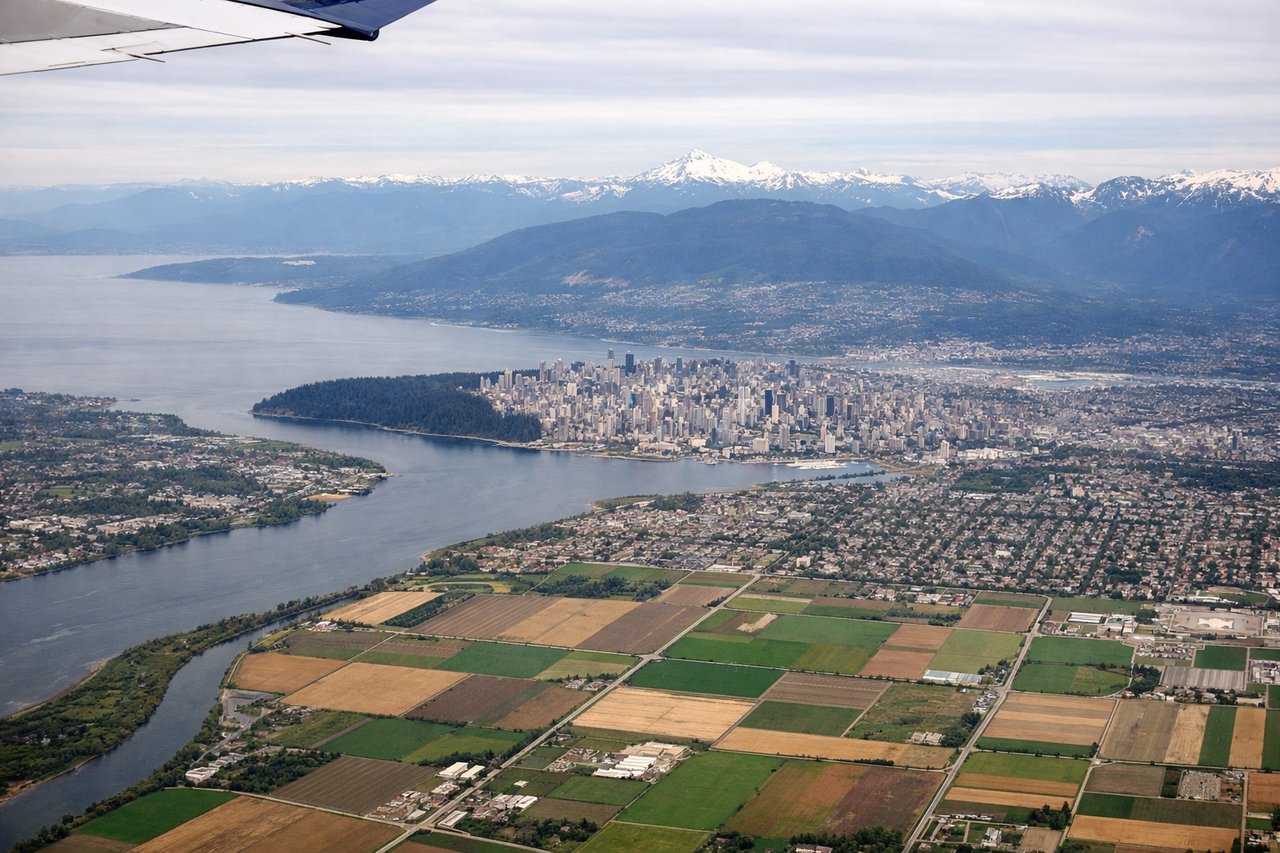
Takeoff from YVR
LEFTYVR typically departs westbound (runways 26L/26R), so left seats face north toward the North Shore Mountains and Burrard Inlet. Right seats look south over suburban Richmond and the Fraser River delta—less dramatic terrain.
Landing at MPV
RIGHTApproaching MPV from the west (typical descent path), right seats face north toward the Green Mountains and the spine of Vermont's terrain. Left seats look south over flatter Connecticut River Valley—less visually interesting.
Landmarks on this routeAll landmarks →
Will your flight be in sunlight?
Pick a date and time in the Sun Map to watch the sun move across your whole flight.
About This Route
Which side of the plane should I sit on flying from Vancouver International (YVR) to Edward F Knapp State (MPV)?
Sit on the Left side of the plane for the best views on flights from Vancouver to Montpelier. The takeoff view of the North Shore Mountains and Burrard Inlet is more dramatic and sustained than the landing approach. The flight path itself crosses the Cascade Range and northern Appalachians, but these are viewed from altitude and distance; the most memorable window views occur during the first 15 minutes out of YVR.
What can I see during takeoff from Vancouver International in Vancouver?
During takeoff from Vancouver International (YVR), sit on the Left side for the best views. YVR typically departs westbound (runways 26L/26R), so left seats face north toward the North Shore Mountains and Burrard Inlet. Right seats look south over suburban Richmond and the Fraser River delta—less dramatic terrain. Notable sights include: North Shore Mountains (immediate backdrop), Burrard Inlet (water body below), Vancouver downtown skyline (southeast), Cypress and Grouse peaks (northern ridge).
What can I see when landing at Edward F Knapp State in Montpelier?
When landing at Edward F Knapp State (MPV), sit on the Right side for the best views. Approaching MPV from the west (typical descent path), right seats face north toward the Green Mountains and the spine of Vermont's terrain. Left seats look south over flatter Connecticut River Valley—less visually interesting. Notable sights include: Green Mountains (main ridge), Connecticut River Valley (broad lowland), Montpelier downtown (small cluster), Winooski River drainage (visible as linear feature).
How long is the flight from Vancouver to Montpelier?
The flight from Vancouver International (YVR) to Edward F Knapp State (MPV) takes about 5 hours 15 minutes. The shortest flight path between them is 2,378 miles (3,827 km); winds and air traffic control usually add a few percent.
What does the Vancouver to Montpelier flight path pass over?
The flight crosses the Cascade Range (Washington state, visible around 45 minutes out as a distant ridge), then transitions over the Columbia Plateau and northern Rocky Mountains. The Wallowa Mountains in northeastern Oregon and the Blue Mountains are visible as distant ridges roughly 2.5 hours into the flight. The flight then crosses into the Great Basin and the northern Appalachian region, with the Green Mountains becoming visible about 30 minutes before descent into Montpelier.