Calgary to Manzanillo is 2,269 miles (3,651 km), a flight of about 5 hours.
While landing favors left, the takeoff view of the Rocky Mountains is more dramatic and memorable. The flight path itself crosses relatively featureless prairie and desert for most of the journey, making the departure climb-out the superior window seat experience.
Flight Path
The flight crosses the Great Plains of Alberta and Saskatchewan, then transitions over the high plains of Montana and Wyoming. The Rocky Mountain Front is visible briefly as you pass west of the mountains. Over the US interior, you'll see the Colorado Plateau region and eventually the Sierra Madre Occidental range in Mexico. The landscape transitions from grassland to semi-arid high desert to tropical coastal terrain. No major water bodies are crossed until approaching the Pacific coast near Manzanillo.
Great circle distance and headings ›.jpg?width=600)
.jpg?width=600)


Phase by phase
Takeoff from YYC
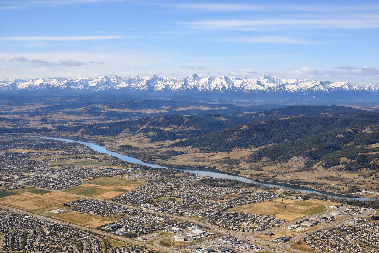
RIGHTCalgary typically departs runways 16L/R or 34L/R depending on wind. Right-side seats offer views of the Canadian Rockies to the west during climb-out, which dominate the landscape immediately after departure. Left seats face the flat prairie and industrial areas east of the airport.
Landing at ZLO
LEFTManzanillo typically uses runway 01 or 19 depending on wind. Left-side seats on approach to runway 01 (northbound) provide views of the Pacific coastline, Manzanillo Bay, and the distinctive peninsula geography. Runway 19 approaches would favor right seats, but runway 01 is more common for international arrivals.
Landmarks on this routeAll landmarks →
Will your flight be in sunlight?
Pick a date and time in the Sun Map to watch the sun move across your whole flight.
About This Route
Which side of the plane should I sit on flying from Calgary International (YYC) to Playa De Oro International (ZLO)?
Sit on the Right side of the plane for the best views on flights from Calgary to Manzanillo. While landing favors left, the takeoff view of the Rocky Mountains is more dramatic and memorable. The flight path itself crosses relatively featureless prairie and desert for most of the journey, making the departure climb-out the superior window seat experience.
What can I see during takeoff from Calgary International in Calgary?
During takeoff from Calgary International (YYC), sit on the Right side for the best views. Calgary typically departs runways 16L/R or 34L/R depending on wind. Right-side seats offer views of the Canadian Rockies to the west during climb-out, which dominate the landscape immediately after departure. Left seats face the flat prairie and industrial areas east of the airport. Notable sights include: Canadian Rocky Mountains (Mount Assiniboine, Mount Robson visible on clear days as distant peaks), Bow River valley running north-south through Calgary, Foothills transition zone between prairie and mountains.
What can I see when landing at Playa De Oro International in Manzanillo?
When landing at Playa De Oro International (ZLO), sit on the Left side for the best views. Manzanillo typically uses runway 01 or 19 depending on wind. Left-side seats on approach to runway 01 (northbound) provide views of the Pacific coastline, Manzanillo Bay, and the distinctive peninsula geography. Runway 19 approaches would favor right seats, but runway 01 is more common for international arrivals. Notable sights include: Pacific Ocean and Manzanillo Bay with its characteristic crescent shape, Manzanillo Peninsula jutting into the bay, Sierra Madre Occidental mountains inland to the east, coastal resort development along the bay shoreline.
How long is the flight from Calgary to Manzanillo?
The flight from Calgary International (YYC) to Playa De Oro International (ZLO) takes about 5 hours. The shortest flight path between them is 2,269 miles (3,651 km); winds and air traffic control usually add a few percent.
What does the Calgary to Manzanillo flight path pass over?
The flight crosses the Great Plains of Alberta and Saskatchewan, then transitions over the high plains of Montana and Wyoming. The Rocky Mountain Front is visible briefly as you pass west of the mountains. Over the US interior, you'll see the Colorado Plateau region and eventually the Sierra Madre Occidental range in Mexico. The landscape transitions from grassland to semi-arid high desert to tropical coastal terrain. No major water bodies are crossed until approaching the Pacific coast near Manzanillo.