St. John's to Seattle is 3,130 miles (5,037 km), a flight of about 7 hours 30 minutes.
The left side wins at takeoff for St. John's Harbour and Signal Hill, but the right side delivers the more sustained and spectacular scenery — the Quebec and Ontario lake country, the Canadian Rockies crossing, and then the dramatic Cascades-to-Seattle descent sequence. Right side edges it overall.
Flight Path
The flight tracks westward across Newfoundland's boreal interior, then over the Gulf of St. Lawrence and Quebec's Laurentian highlands. Over Ontario you cross the Canadian Shield with its thousands of lakes. The prairies of Manitoba and Saskatchewan appear as a vast flat grid. The Canadian Rockies are crossed over Alberta and British Columbia, with peaks including the Columbia Icefield visible on clear days. The flight then descends over the Coast Mountains and into the Puget Sound lowlands.
Great circle distance and headings ›.jpg?width=600)

Phase by phase
Takeoff from YYT
LEFTSt. John's airport runways 11/29 and 16/34 mean westbound departures typically head out over the city and St. John's Harbour. The left side gives you the dramatic view of the Narrows, the harbour entrance, and Signal Hill as you climb out heading west.
Landing at SEA
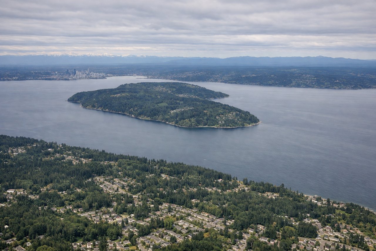
RIGHTSeaTac approaches from the east or south on runways 16L/16R or 34L/34R. Arrivals from the east typically cross the Cascades and descend over Lake Washington, putting Mount Rainier and the Seattle skyline on the right side as you turn onto final approach heading north or northwest.
Landmarks on this routeAll landmarks →
Will your flight be in sunlight?
Pick a date and time in the Sun Map to watch the sun move across your whole flight.
About This Route
Which side of the plane should I sit on flying from St Johns International (YYT) to Seattle Tacoma International (SEA)?
Sit on the Right side of the plane for the best views on flights from St. John's to Seattle. The left side wins at takeoff for St. John's Harbour and Signal Hill, but the right side delivers the more sustained and spectacular scenery — the Quebec and Ontario lake country, the Canadian Rockies crossing, and then the dramatic Cascades-to-Seattle descent sequence. Right side edges it overall.
What can I see during takeoff from St Johns International in St. John's?
During takeoff from St Johns International (YYT), sit on the Left side for the best views. St. John's airport runways 11/29 and 16/34 mean westbound departures typically head out over the city and St. John's Harbour. The left side gives you the dramatic view of the Narrows, the harbour entrance, and Signal Hill as you climb out heading west. Notable sights include: St. John's Harbour and the Narrows, Signal Hill, Conception Bay to the northwest, Avalon Peninsula coastline.
What can I see when landing at Seattle Tacoma International in Seattle?
When landing at Seattle Tacoma International (SEA), sit on the Right side for the best views. SeaTac approaches from the east or south on runways 16L/16R or 34L/34R. Arrivals from the east typically cross the Cascades and descend over Lake Washington, putting Mount Rainier and the Seattle skyline on the right side as you turn onto final approach heading north or northwest. Notable sights include: Mount Rainier, Lake Washington, Seattle city skyline, Puget Sound.
How long is the flight from St. John's to Seattle?
The flight from St Johns International (YYT) to Seattle Tacoma International (SEA) takes about 7 hours 30 minutes. The shortest flight path between them is 3,130 miles (5,037 km); winds and air traffic control usually add a few percent.
What does the St. John's to Seattle flight path pass over?
The flight tracks westward across Newfoundland's boreal interior, then over the Gulf of St. Lawrence and Quebec's Laurentian highlands. Over Ontario you cross the Canadian Shield with its thousands of lakes. The prairies of Manitoba and Saskatchewan appear as a vast flat grid. The Canadian Rockies are crossed over Alberta and British Columbia, with peaks including the Columbia Icefield visible on clear days. The flight then descends over the Coast Mountains and into the Puget Sound lowlands.