While takeoff favors the left for Chugach Mountain views, the landing approach on Oahu's leeward side and the dramatic Ko'olau cliffs visible on the right during descent make right seats the stronger choice overall for this route. The approach into Honolulu offers more sustained and visually distinctive scenery.
Flight Path
The flight path crosses the North Pacific Ocean with no significant landmarks visible for roughly 4 hours. Around the midpoint (2.5-3 hours into flight), the aircraft will be over open ocean at roughly 32°N latitude, 153°W longitude. As the flight approaches Hawaii (final 45-60 minutes), the Big Island of Hawaii becomes visible on the horizon—Mauna Kea and Mauna Loa appear as distant peaks. Oahu itself becomes visible approximately 30-40 minutes before landing, with the island's profile gradually resolving: the Ko'olau Mountains on the windward (northeast) side are typically the first distinct feature, followed by the central plateau and leeward coast.
Great circle distance and headings ›

Phase by phase
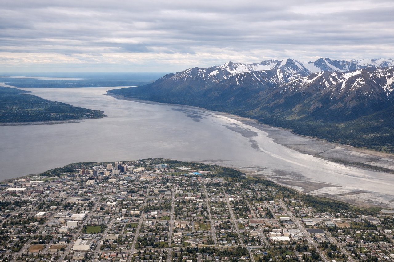
Takeoff from ANC
LEFTAnchorage typically departs northbound (Runway 1L/1R) or southbound (Runway 19L/19R). Left seats offer views of the Chugach Mountains immediately east of the airport during initial climb. The range rises sharply from sea level and dominates the eastern horizon during the first 10-15 minutes of flight.
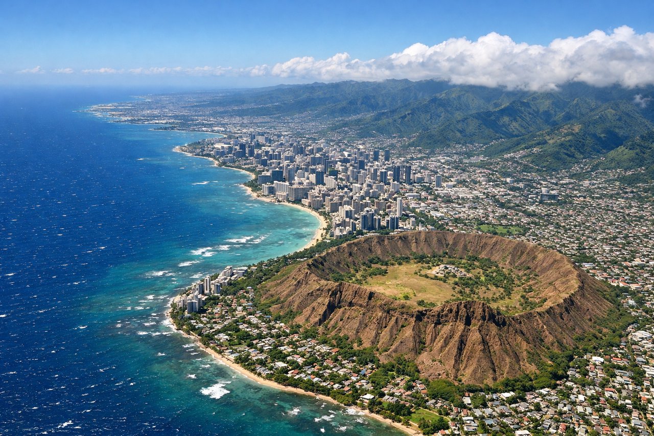
Landing at HNL
RIGHTHonolulu typically lands on Runway 8L/8R (eastbound) or 26L/26R (westbound). Right seats during approach offer views of the Ko'olau Mountains on Oahu's windward side and Diamond Head on the leeward side. If landing eastbound, the right side captures the dramatic pali (cliff) faces and the transition from ocean to island terrain.
Landmarks on this routeAll landmarks →
Will your flight be in sunlight?
See exactly which side of the plane gets sun and shade at your departure time.
About This Route
Which side of the plane should I sit on flying from Ted Stevens Anchorage International (ANC) to Honolulu International (HNL)?
Sit on the Right side of the plane for the best views on flights from Anchorage to Honolulu. While takeoff favors the left for Chugach Mountain views, the landing approach on Oahu's leeward side and the dramatic Ko'olau cliffs visible on the right during descent make right seats the stronger choice overall for this route. The approach into Honolulu offers more sustained and visually distinctive scenery.
What can I see during takeoff from Ted Stevens Anchorage International in Anchorage?
During takeoff from Ted Stevens Anchorage International (ANC), sit on the Left side for the best views. Anchorage typically departs northbound (Runway 1L/1R) or southbound (Runway 19L/19R). Left seats offer views of the Chugach Mountains immediately east of the airport during initial climb. The range rises sharply from sea level and dominates the eastern horizon during the first 10-15 minutes of flight. Notable sights include: Chugach Mountains (eastern escarpment), Knik Arm (water body west/left), Cook Inlet (southern water body), Anchorage city grid (directly below during climb).
What can I see when landing at Honolulu International in Honolulu?
When landing at Honolulu International (HNL), sit on the Right side for the best views. Honolulu typically lands on Runway 8L/8R (eastbound) or 26L/26R (westbound). Right seats during approach offer views of the Ko'olau Mountains on Oahu's windward side and Diamond Head on the leeward side. If landing eastbound, the right side captures the dramatic pali (cliff) faces and the transition from ocean to island terrain. Notable sights include: Ko'olau Mountain Range (windward cliffs), Diamond Head (Lē'ahi crater, leeward), Waikiki Beach district (south shore), Honolulu Harbor (central).
How long is the flight from Anchorage to Honolulu?
The flight from Ted Stevens Anchorage International (ANC) to Honolulu International (HNL) takes Approximately 5 hours 15 minutes to 5 hours 45 minutes.
What does the Anchorage to Honolulu flight path pass over?
The flight path crosses the North Pacific Ocean with no significant landmarks visible for roughly 4 hours. Around the midpoint (2.5-3 hours into flight), the aircraft will be over open ocean at roughly 32°N latitude, 153°W longitude. As the flight approaches Hawaii (final 45-60 minutes), the Big Island of Hawaii becomes visible on the horizon—Mauna Kea and Mauna Loa appear as distant peaks. Oahu itself becomes visible approximately 30-40 minutes before landing, with the island's profile gradually resolving: the Ko'olau Mountains on the windward (northeast) side are typically the first distinct feature, followed by the central plateau and leeward coast.