While the takeoff offers Paris views, the landing provides more dramatic and visually distinct scenery: the Atlantic coastline, ocean, and Libreville's coastal setting are more striking than inland French terrain. Right side captures the most memorable portion of this long-haul route.
Flown CDG to LBV? Did we get it right?
Flight Path
Paris to Libreville is 3,379 miles (5,438 km), a flight of about 6 hours 15 minutes.
The flight path crosses the Bay of Biscay (visible as open Atlantic from cruise altitude), then passes over the Iberian Peninsula's western coast and interior, continues across Morocco and the Atlas Mountains region, then over the Sahara Desert and West African savanna, eventually descending toward the Gabon coast. Major visible features include the Pyrenees (distant, on the left during early cruise), the Iberian interior plateaus, the Atlas Mountains, the vast Sahara with its erg formations and occasional wadis, and the transition zone from Sahel savanna to equatorial forest as the aircraft approaches West-Central Africa.
Great circle distance and headings ›


Phase by phase
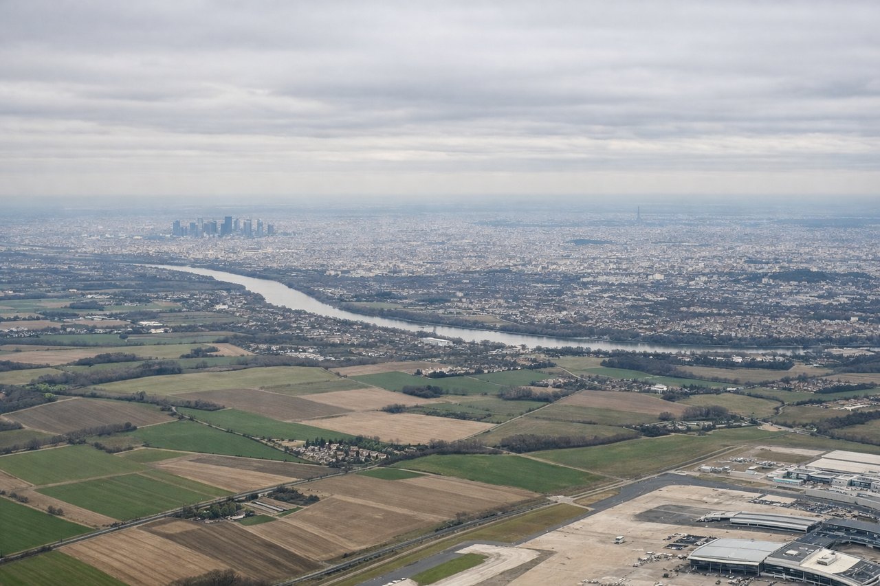
Takeoff from CDG
LEFTLeft side offers views of the Seine River valley and the urban sprawl of Paris and its suburbs as the aircraft climbs northwestward from CDG. The right side faces inland toward relatively flat, featureless terrain.
Landing at LBV
RIGHTRight side provides views of the Gabon coastline, the Atlantic Ocean, and Libreville's position on the coast as the aircraft descends toward LBV. The left side faces inland toward dense equatorial forest with minimal visual distinction.
Will your flight be in sunlight?
Pick a date and time in the Sun Map to watch the sun move across your whole flight.
About This Route
Which side of the plane should I sit on flying from Charles De Gaulle (CDG) to Libreville Leon M Ba (LBV)?
Sit on the Right side of the plane for the best views on flights from Paris to Libreville. While the takeoff offers Paris views, the landing provides more dramatic and visually distinct scenery: the Atlantic coastline, ocean, and Libreville's coastal setting are more striking than inland French terrain. Right side captures the most memorable portion of this long-haul route.
What can I see during takeoff from Charles De Gaulle in Paris?
During takeoff from Charles De Gaulle (CDG), sit on the Left side for the best views. Left side offers views of the Seine River valley and the urban sprawl of Paris and its suburbs as the aircraft climbs northwestward from CDG. The right side faces inland toward relatively flat, featureless terrain. Notable sights include: Seine River winding through Paris, Paris metropolitan area and outer suburbs, Île-de-France plains extending to the horizon.
What can I see when landing at Libreville Leon M Ba in Libreville?
When landing at Libreville Leon M Ba (LBV), sit on the Right side for the best views. Right side provides views of the Gabon coastline, the Atlantic Ocean, and Libreville's position on the coast as the aircraft descends toward LBV. The left side faces inland toward dense equatorial forest with minimal visual distinction. Notable sights include: Atlantic Ocean and coastal waters, Libreville city and harbor, Gabon's mangrove-lined coastline, estuary systems near the airport.
How long is the flight from Paris to Libreville?
The flight from Charles De Gaulle (CDG) to Libreville Leon M Ba (LBV) takes about 6 hours 15 minutes. The shortest flight path between them is 3,379 miles (5,438 km); winds and air traffic control usually add a few percent.
What does the Paris to Libreville flight path pass over?
The flight path crosses the Bay of Biscay (visible as open Atlantic from cruise altitude), then passes over the Iberian Peninsula's western coast and interior, continues across Morocco and the Atlas Mountains region, then over the Sahara Desert and West African savanna, eventually descending toward the Gabon coast. Major visible features include the Pyrenees (distant, on the left during early cruise), the Iberian interior plateaus, the Atlas Mountains, the vast Sahara with its erg formations and occasional wadis, and the transition zone from Sahel savanna to equatorial forest as the aircraft approaches West-Central Africa.