The right side wins overall because it captures the flight's most dramatic terrain and landmarks: distant views of the southern Rockies and Colorado Plateau red-rock country during cruise, followed by the unmistakable Las Vegas Strip, Lake Mead, and Spring Mountains on final approach. The left side, by contrast, spends most of the flight over flat plains and open desert with far fewer named features.
Flight Path
The route crosses the Texas Panhandle and eastern New Mexico near Amarillo and Tucumcari, flying over the flat Llano Estacado plateau with the Sangre de Cristo Mountains and southern Rockies visible as a distant northern skyline before the descent toward Arizona and Nevada.
Great circle distance and headings ›.jpeg?width=600)

.jpg?width=600)

.jpg?width=600)
.jpeg?width=600)


Phase by phase
Takeoff from CLT
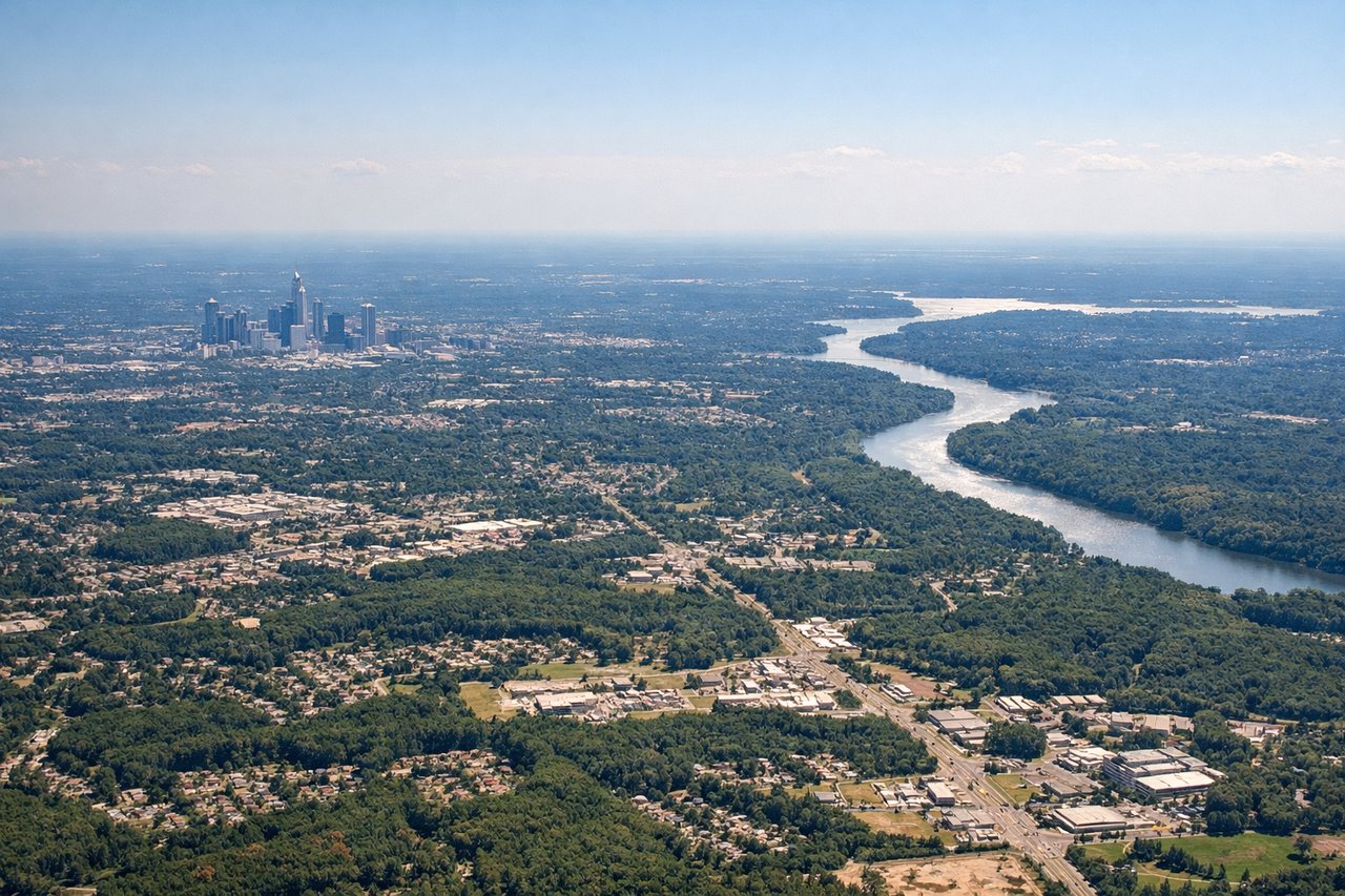
LEFTIn CLT's common south-flow departure, aircraft climb southbound before banking west toward Las Vegas, giving left-side passengers a brief look at Charlotte's Uptown skyline and the rolling Piedmont foothills that lead toward the Blue Ridge. The right side mostly shows suburban sprawl during this same turn.
Landing at LAS
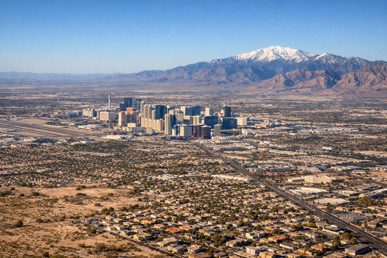
RIGHTArrivals from the east typically land westbound on runway 26 at LAS, and the standard approach path keeps the Las Vegas Strip and Lake Mead/Hoover Dam area to the north of the flight track — squarely on the right side. Passengers get a sweeping view of the Strip's towers just before touchdown, one of the most famous approach views in US commercial aviation.
Landmarks on this routeAll landmarks →
Will your flight be in sunlight?
See exactly which side of the plane gets sun and shade at your departure time.
About This Route
Which side of the plane should I sit on flying from Charlotte Douglas International (CLT) to Mc Carran International (LAS)?
Sit on the Right side of the plane for the best views on flights from Charlotte to Las Vegas. The right side wins overall because it captures the flight's most dramatic terrain and landmarks: distant views of the southern Rockies and Colorado Plateau red-rock country during cruise, followed by the unmistakable Las Vegas Strip, Lake Mead, and Spring Mountains on final approach. The left side, by contrast, spends most of the flight over flat plains and open desert with far fewer named features.
What can I see during takeoff from Charlotte Douglas International in Charlotte?
During takeoff from Charlotte Douglas International (CLT), sit on the Left side for the best views. In CLT's common south-flow departure, aircraft climb southbound before banking west toward Las Vegas, giving left-side passengers a brief look at Charlotte's Uptown skyline and the rolling Piedmont foothills that lead toward the Blue Ridge. The right side mostly shows suburban sprawl during this same turn. Notable sights include: Charlotte Uptown skyline, Catawba River, Blue Ridge foothills on the horizon.
What can I see when landing at Mc Carran International in Las Vegas?
When landing at Mc Carran International (LAS), sit on the Right side for the best views. Arrivals from the east typically land westbound on runway 26 at LAS, and the standard approach path keeps the Las Vegas Strip and Lake Mead/Hoover Dam area to the north of the flight track — squarely on the right side. Passengers get a sweeping view of the Strip's towers just before touchdown, one of the most famous approach views in US commercial aviation. Notable sights include: Las Vegas Strip skyline, Lake Mead, Hoover Dam, Spring Mountains/Red Rock Canyon escarpment.
How long is the flight from Charlotte to Las Vegas?
The flight from Charlotte Douglas International (CLT) to Mc Carran International (LAS) takes 4h 35m.
What does the Charlotte to Las Vegas flight path pass over?
The route crosses the Texas Panhandle and eastern New Mexico near Amarillo and Tucumcari, flying over the flat Llano Estacado plateau with the Sangre de Cristo Mountains and southern Rockies visible as a distant northern skyline before the descent toward Arizona and Nevada.