The right side captures the most dramatic scenery on this short route: the Great Barrier Reef's turquoise waters and color gradients during takeoff, then the coastal reef structures and islands along the flight path southward. The left side offers urban and bay views but less distinctive natural features overall.
Flown CNS to TSV? Did we get it right?
Flight Path
Cairns to Townsville is 177 miles (285 km), a flight of about 50 minutes.
The flight path runs roughly south-southwest along the Queensland coast. Notable features include the reef-studded waters of the Coral Sea visible to the east throughout the flight, the coastal strip with scattered towns and islands, and the gradual transition from Cairns' tropical rainforest hinterland to the drier inland plains south of Townsville. Hinchinbrook Island (large, mountainous) lies roughly 40 miles south of Cairns and may be visible on the right side mid-flight if altitude and visibility permit. The coastal waters show consistent turquoise coloring from shallow reef areas, with darker blue indicating deeper channels between reef structures.
Great circle distance and headings ›Phase by phase
Takeoff from CNS
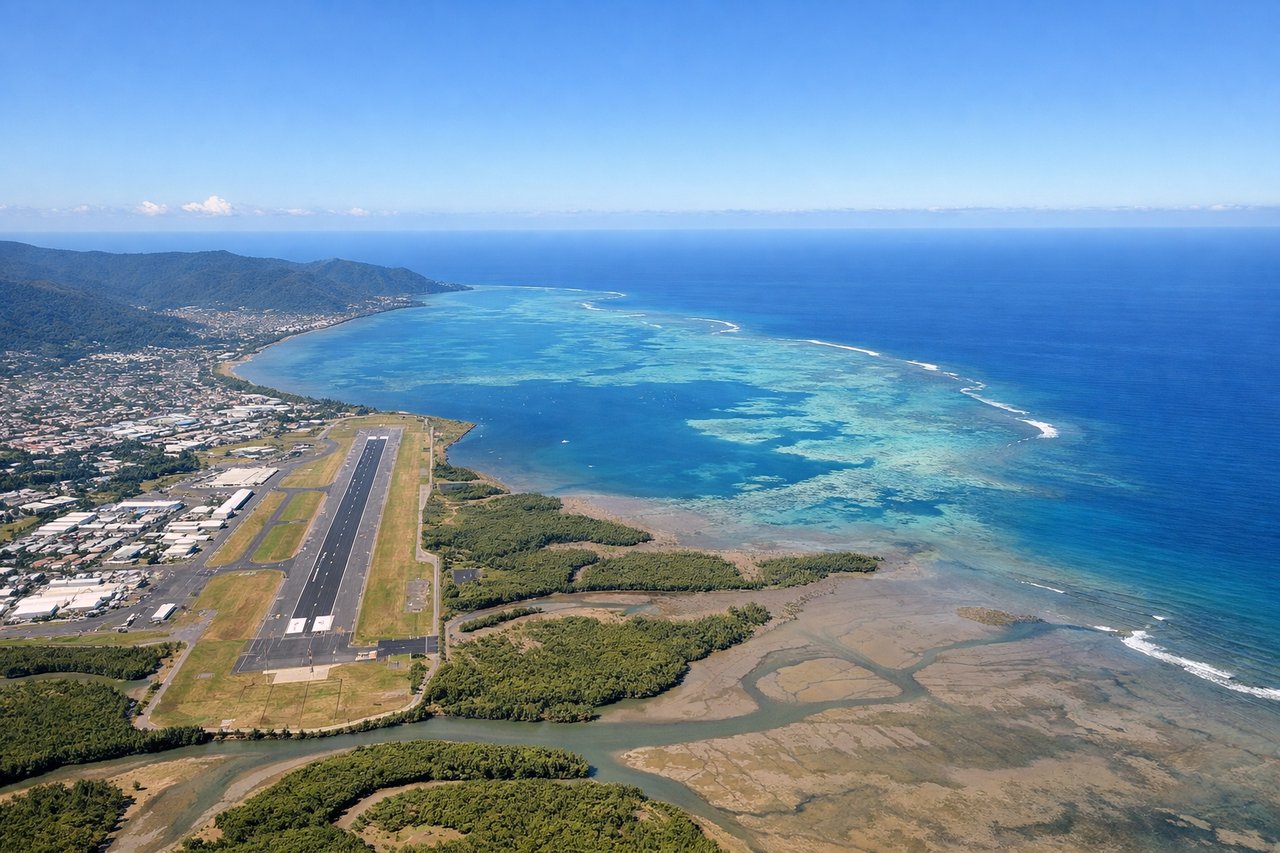
RIGHTRight side captures the Coral Sea and the Great Barrier Reef structure as you climb out northeastward from Cairns. You'll see the reef's pale turquoise waters contrasting sharply with the deeper ocean, plus the coastal strip of Cairns itself receding below.
Landing at TSV
LEFTLeft side on descent into Townsville gives you the Cleveland Bay and the Strand beachfront, plus views of the city's urban layout spreading inland. You'll also see Magnetic Island offshore to the northeast, a distinctive dark landmass in the bay.
Will your flight be in sunlight?
Pick a date and time in the Sun Map to watch the sun move across your whole flight.
About This Route
Which side of the plane should I sit on flying from Cairns International (CNS) to Townsville (TSV)?
Sit on the Right side of the plane for the best views on flights from Cairns to Townsville. The right side captures the most dramatic scenery on this short route: the Great Barrier Reef's turquoise waters and color gradients during takeoff, then the coastal reef structures and islands along the flight path southward. The left side offers urban and bay views but less distinctive natural features overall.
What can I see during takeoff from Cairns International in Cairns?
During takeoff from Cairns International (CNS), sit on the Right side for the best views. Right side captures the Coral Sea and the Great Barrier Reef structure as you climb out northeastward from Cairns. You'll see the reef's pale turquoise waters contrasting sharply with the deeper ocean, plus the coastal strip of Cairns itself receding below. Notable sights include: Coral Sea (turquoise reef waters), Great Barrier Reef edge (visible as color gradient), Trinity Bay, Cairns coastal strip.
What can I see when landing at Townsville in Townsville?
When landing at Townsville (TSV), sit on the Left side for the best views. Left side on descent into Townsville gives you the Cleveland Bay and the Strand beachfront, plus views of the city's urban layout spreading inland. You'll also see Magnetic Island offshore to the northeast, a distinctive dark landmass in the bay. Notable sights include: Cleveland Bay, Magnetic Island (offshore), The Strand beachfront, Townsville city grid.
How long is the flight from Cairns to Townsville?
The flight from Cairns International (CNS) to Townsville (TSV) takes about 50 minutes. The shortest flight path between them is 177 miles (285 km); winds and air traffic control usually add a few percent.
What does the Cairns to Townsville flight path pass over?
The flight path runs roughly south-southwest along the Queensland coast. Notable features include the reef-studded waters of the Coral Sea visible to the east throughout the flight, the coastal strip with scattered towns and islands, and the gradual transition from Cairns' tropical rainforest hinterland to the drier inland plains south of Townsville. Hinchinbrook Island (large, mountainous) lies roughly 40 miles south of Cairns and may be visible on the right side mid-flight if altitude and visibility permit. The coastal waters show consistent turquoise coloring from shallow reef areas, with darker blue indicating deeper channels between reef structures.