While takeoff from Cartagena offers coastal charm, the landing approach into Cali provides more dramatic and varied scenery. The Cauca Valley's mountain-framed descent, combined with the visible contrast between urban development and surrounding terrain, creates a more engaging full-flight experience than the relatively flat cruise segment between the two cities. The right side captures both the valley's geographic drama and the approach sequence, offsetting the left side's strong coastal departure.
Flown CTG to CLO? Did we get it right?
Flight Path
Cartagena to Cali is 480 miles (773 km), a flight of about 1 hour 40 minutes.
The flight path crosses inland from the Caribbean coast over the Magdalena River valley and its tributaries, transitioning from coastal lowlands through foothills into the Cauca Valley. The terrain gradually rises from sea level to approximately 3,000 feet at Cali's elevation. The Cordillera Occidental (Western Range) becomes increasingly prominent as the aircraft approaches Cali from the north, with the valley narrowing and mountains rising on both sides during descent.
Great circle distance and headings ›Phase by phase
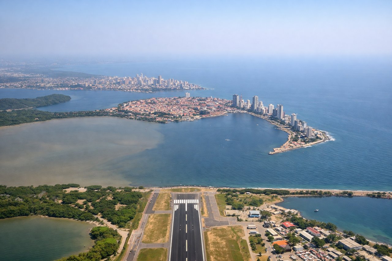
Takeoff from CTG
LEFTLeft side captures Cartagena's Caribbean coastline and historic walled city during initial climb. The turquoise waters of Cartagena Bay and the contrast between urban development and coastal mangroves are distinctive during the first 5-10 minutes of flight.
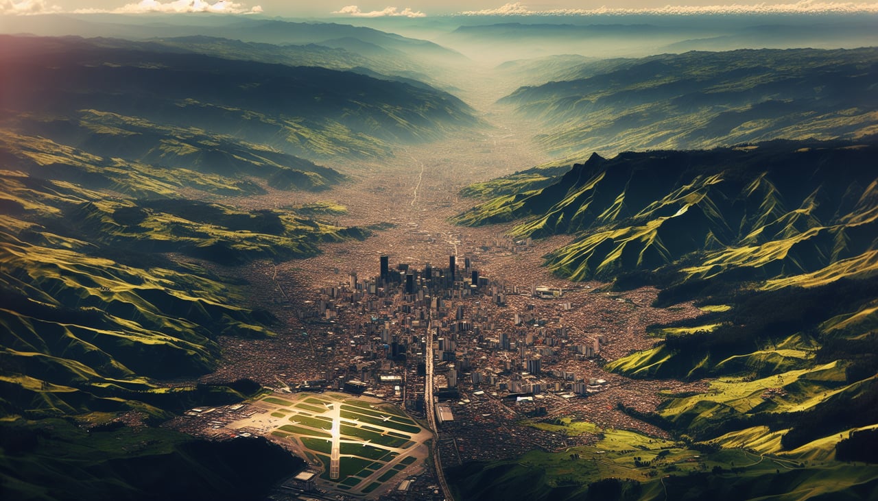
Landing at CLO
RIGHTRight side offers superior approach views into Cali. As the aircraft descends into the Cauca Valley from the north (typical runway 20 approach), the right side reveals the valley's dramatic topography, the Cordillera Occidental mountain range, and Cali's urban sprawl against the valley floor during final approach.
Will your flight be in sunlight?
Pick a date and time in the Sun Map to watch the sun move across your whole flight.
About This Route
Which side of the plane should I sit on flying from Rafael Nunez (CTG) to Alfonso Bonilla Aragon International (CLO)?
Sit on the Right side of the plane for the best views on flights from Cartagena to Cali. While takeoff from Cartagena offers coastal charm, the landing approach into Cali provides more dramatic and varied scenery. The Cauca Valley's mountain-framed descent, combined with the visible contrast between urban development and surrounding terrain, creates a more engaging full-flight experience than the relatively flat cruise segment between the two cities. The right side captures both the valley's geographic drama and the approach sequence, offsetting the left side's strong coastal departure.
What can I see during takeoff from Rafael Nunez in Cartagena?
During takeoff from Rafael Nunez (CTG), sit on the Left side for the best views. Left side captures Cartagena's Caribbean coastline and historic walled city during initial climb. The turquoise waters of Cartagena Bay and the contrast between urban development and coastal mangroves are distinctive during the first 5-10 minutes of flight. Notable sights include: Cartagena walled old city (Ciudad Vieja), Cartagena Bay with its distinctive turquoise waters, Caribbean coastline with mangrove fringes, Rosario Islands archipelago (visible as small dots on the horizon to the northwest).
What can I see when landing at Alfonso Bonilla Aragon International in Cali?
When landing at Alfonso Bonilla Aragon International (CLO), sit on the Right side for the best views. Right side offers superior approach views into Cali. As the aircraft descends into the Cauca Valley from the north (typical runway 20 approach), the right side reveals the valley's dramatic topography, the Cordillera Occidental mountain range, and Cali's urban sprawl against the valley floor during final approach. Notable sights include: Cauca Valley floor with agricultural patchwork, Cordillera Occidental (Western Range) peaks rising to the east and south, Cali city sprawl across the valley floor, Rio Cauca river valley visible as a linear feature through the terrain.
How long is the flight from Cartagena to Cali?
The flight from Rafael Nunez (CTG) to Alfonso Bonilla Aragon International (CLO) takes about 1 hour 40 minutes. The shortest flight path between them is 480 miles (773 km); winds and air traffic control usually add a few percent.
What does the Cartagena to Cali flight path pass over?
The flight path crosses inland from the Caribbean coast over the Magdalena River valley and its tributaries, transitioning from coastal lowlands through foothills into the Cauca Valley. The terrain gradually rises from sea level to approximately 3,000 feet at Cali's elevation. The Cordillera Occidental (Western Range) becomes increasingly prominent as the aircraft approaches Cali from the north, with the valley narrowing and mountains rising on both sides during descent.