While takeoff favors left seats for Caribbean views, the landing approach over the Amazon confluence and Iquitos' river position is more visually distinctive and geographically significant. Right seats capture the dramatic transition from forest to river systems during descent.
Flight Path
The flight crosses the Caribbean coast, then inland over Colombia's Magdalena Valley and northern Amazon basin. Around the midpoint (roughly over southern Colombia near the Putumayo River region), the landscape transitions from agricultural land and scattered settlements to unbroken rainforest. The Caquetá River and its tributaries become visible as the aircraft approaches Peru. The terrain is uniformly forested with occasional river meanders visible as brown serpentine lines through the canopy. No significant mountain ranges are crossed—the Andes lie to the west. The flight path stays within the lowland Amazon basin throughout, with altitude gradually increasing only during the final descent into Iquitos.
Great circle distance and headings ›


Phase by phase
Takeoff from CTG
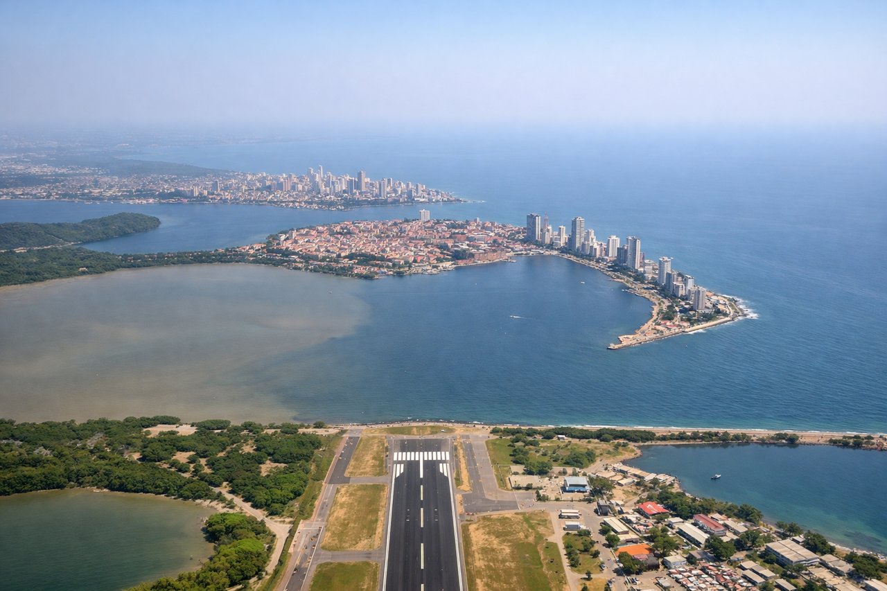
LEFTCTG typically departs runway 01/19 (north-south orientation). Left seats face west initially, offering views of the Caribbean coastline, Cartagena Bay, and the Rosario Islands archipelago as the aircraft climbs. Right seats see inland terrain and city sprawl.
Landing at IQT
RIGHTIQT uses runway 09/27 (east-west orientation). Approach typically comes from the east over the Amazon rainforest. Right seats face north during descent, providing views of the Napo River confluence, the Itaya River, and Iquitos' position on the Amazon's northern bank. Left seats see only dense forest canopy.
Landmarks on this routeAll landmarks →
Will your flight be in sunlight?
See exactly which side of the plane gets sun and shade at your departure time.
About This Route
Which side of the plane should I sit on flying from Rafael Nunez (CTG) to Coronel Fap Francisco Secada Vignetta (IQT)?
Sit on the Right side of the plane for the best views on flights from Cartagena to Iquitos. While takeoff favors left seats for Caribbean views, the landing approach over the Amazon confluence and Iquitos' river position is more visually distinctive and geographically significant. Right seats capture the dramatic transition from forest to river systems during descent.
What can I see during takeoff from Rafael Nunez in Cartagena?
During takeoff from Rafael Nunez (CTG), sit on the Left side for the best views. CTG typically departs runway 01/19 (north-south orientation). Left seats face west initially, offering views of the Caribbean coastline, Cartagena Bay, and the Rosario Islands archipelago as the aircraft climbs. Right seats see inland terrain and city sprawl. Notable sights include: Caribbean Sea (immediate west), Rosario Islands (small archipelago 15-20 nm offshore), Cartagena Bay, Magdalena River delta to the south.
What can I see when landing at Coronel Fap Francisco Secada Vignetta in Iquitos?
When landing at Coronel Fap Francisco Secada Vignetta (IQT), sit on the Right side for the best views. IQT uses runway 09/27 (east-west orientation). Approach typically comes from the east over the Amazon rainforest. Right seats face north during descent, providing views of the Napo River confluence, the Itaya River, and Iquitos' position on the Amazon's northern bank. Left seats see only dense forest canopy. Notable sights include: Amazon River (main channel, brown water), Napo River (major tributary confluence visible 10-15 nm out), Itaya River (smaller tributary), Iquitos city on elevated bluff on north bank.
How long is the flight from Cartagena to Iquitos?
The flight from Rafael Nunez (CTG) to Coronel Fap Francisco Secada Vignetta (IQT) takes Approximately 3 hours 15 minutes.
What does the Cartagena to Iquitos flight path pass over?
The flight crosses the Caribbean coast, then inland over Colombia's Magdalena Valley and northern Amazon basin. Around the midpoint (roughly over southern Colombia near the Putumayo River region), the landscape transitions from agricultural land and scattered settlements to unbroken rainforest. The Caquetá River and its tributaries become visible as the aircraft approaches Peru. The terrain is uniformly forested with occasional river meanders visible as brown serpentine lines through the canopy. No significant mountain ranges are crossed—the Andes lie to the west. The flight path stays within the lowland Amazon basin throughout, with altitude gradually increasing only during the final descent into Iquitos.