Cartagena to Santo Domingo is 676 miles (1,088 km), a flight of about 2 hours 5 minutes.
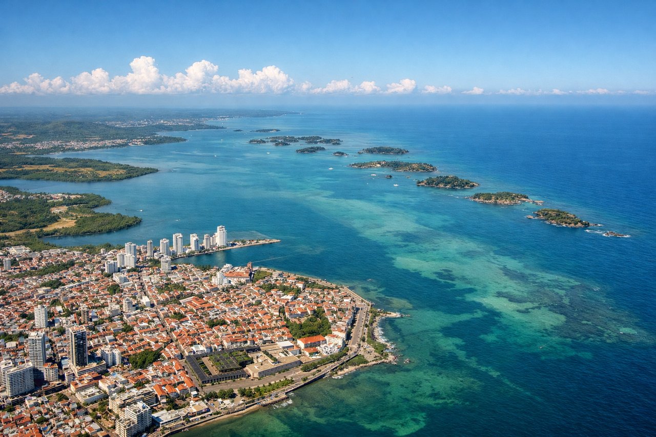
Right-side seats dominate both takeoff and landing phases. The departure offers superior views of Cartagena's coast and islands, while the approach provides excellent sightlines of the Dominican coastline and Cordillera Septentrional. Left seats only excel during the final descent.
Flight Path
The flight crosses the Caribbean Sea between Colombia and the Dominican Republic. Notable features include the Jamaica Channel (to the south, not directly visible but the flight path crosses open water), the Windward Passage region, and the transition from Colombian coastal waters to Dominican waters. At cruise altitude (around 25,000-30,000 feet), the Caribbean appears as open blue water with occasional cumulus cloud formations. No major islands lie directly on the typical flight path, though Jamaica sits approximately 100 miles to the south and would appear as a distant landmass on the southern horizon if visible through haze. The flight primarily crosses open ocean with no significant landmarks visible at cruise altitude except distant cloud formations and the curvature of the horizon.
Great circle distance and headings ›Phase by phase
Takeoff from CTG
RIGHTRight-side seats offer views of Cartagena's Caribbean coastline and the Rosario Islands archipelago during the northeastward climb-out. The left side faces inland toward the Sinú River valley and swampy terrain with less visual interest.
Landing at SDQ
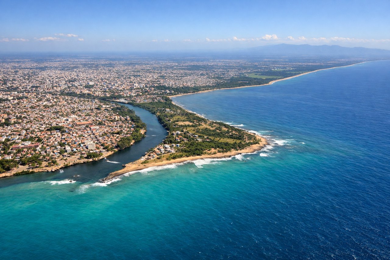
LEFTLeft-side seats capture the Dominican Republic's northern coast and the Cordillera Septentrional mountains during descent into Santo Domingo. The approach from the northeast provides views of the Atlantic coastline, coastal plains, and the mountain range's dramatic ridgeline before turning south toward the airport.
Landmarks on this routeAll landmarks →
Will your flight be in sunlight?
Pick a date and time in the Sun Map to watch the sun move across your whole flight.
About This Route
Which side of the plane should I sit on flying from Rafael Nunez (CTG) to Las Americas International (SDQ)?
Sit on the Right side of the plane for the best views on flights from Cartagena to Santo Domingo. Right-side seats dominate both takeoff and landing phases. The departure offers superior views of Cartagena's coast and islands, while the approach provides excellent sightlines of the Dominican coastline and Cordillera Septentrional. Left seats only excel during the final descent.
What can I see during takeoff from Rafael Nunez in Cartagena?
During takeoff from Rafael Nunez (CTG), sit on the Right side for the best views. Right-side seats offer views of Cartagena's Caribbean coastline and the Rosario Islands archipelago during the northeastward climb-out. The left side faces inland toward the Sinú River valley and swampy terrain with less visual interest. Notable sights include: Cartagena's walled old city and harbor, Rosario Islands (Islas del Rosario) dotting the Caribbean, Caribbean coastline with reef systems, Sinú River delta to the southwest.
What can I see when landing at Las Americas International in Santo Domingo?
When landing at Las Americas International (SDQ), sit on the Left side for the best views. Left-side seats capture the Dominican Republic's northern coast and the Cordillera Septentrional mountains during descent into Santo Domingo. The approach from the northeast provides views of the Atlantic coastline, coastal plains, and the mountain range's dramatic ridgeline before turning south toward the airport. Notable sights include: Cordillera Septentrional mountain range, Atlantic coastline of Dominican Republic, Yuna River valley, Santo Domingo's Ozama River and coastal urban sprawl.
How long is the flight from Cartagena to Santo Domingo?
The flight from Rafael Nunez (CTG) to Las Americas International (SDQ) takes about 2 hours 5 minutes. The shortest flight path between them is 676 miles (1,088 km); winds and air traffic control usually add a few percent.
What does the Cartagena to Santo Domingo flight path pass over?
The flight crosses the Caribbean Sea between Colombia and the Dominican Republic. Notable features include the Jamaica Channel (to the south, not directly visible but the flight path crosses open water), the Windward Passage region, and the transition from Colombian coastal waters to Dominican waters. At cruise altitude (around 25,000-30,000 feet), the Caribbean appears as open blue water with occasional cumulus cloud formations. No major islands lie directly on the typical flight path, though Jamaica sits approximately 100 miles to the south and would appear as a distant landmass on the southern horizon if visible through haze. The flight primarily crosses open ocean with no significant landmarks visible at cruise altitude except distant cloud formations and the curvature of the horizon.