The right (west) side captures Hokkaido's volcanic scenery at departure, likely views of the Japan Alps and possibly Mt Fuji's silhouette during cruise over central Honshu, and the Suzuka range on arrival — far more varied and dramatic than the mostly featureless Pacific-side views on the left.
Flight Path
Tohoku mountain ranges, the Kanto plain skirting Tokyo's outskirts, and the northern Japan Alps near Nagano before descent toward Ise Bay
Great circle distance and headings ›Phase by phase
Takeoff from CTS
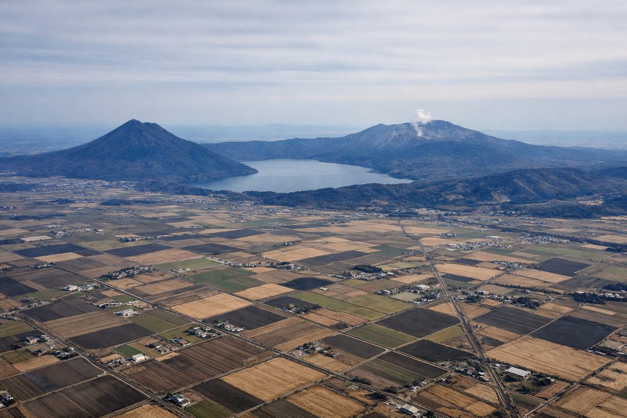
RIGHTDeparting CTS to the south, the right (west) side looks toward the volcanic peaks of Mt Yotei and the Shikotsu-Toya caldera lakes, dramatic contrast to the flatter Tomakomai industrial coast on the left.
Landing at NGO
RIGHTOn approach into Centrair, the right side offers views across Ise Bay toward the Suzuka mountain range and the Chita Peninsula, while the left side mostly shows open water with little variation.
Will your flight be in sunlight?
See exactly which side of the plane gets sun and shade at your departure time.
About This Route
Which side of the plane should I sit on flying from Chitose International Airport (CTS) to Chubu Centrair International Airport (NGO)?
Sit on the Right side of the plane for the best views on flights from Sapporo to Nagoya. The right (west) side captures Hokkaido's volcanic scenery at departure, likely views of the Japan Alps and possibly Mt Fuji's silhouette during cruise over central Honshu, and the Suzuka range on arrival — far more varied and dramatic than the mostly featureless Pacific-side views on the left.
What can I see during takeoff from Chitose International Airport in Sapporo?
During takeoff from Chitose International Airport (CTS), sit on the Right side for the best views. Departing CTS to the south, the right (west) side looks toward the volcanic peaks of Mt Yotei and the Shikotsu-Toya caldera lakes, dramatic contrast to the flatter Tomakomai industrial coast on the left. Notable sights include: Mt Yotei, Lake Shikotsu caldera rim, Tarumae volcano.
What can I see when landing at Chubu Centrair International Airport in Nagoya?
When landing at Chubu Centrair International Airport (NGO), sit on the Right side for the best views. On approach into Centrair, the right side offers views across Ise Bay toward the Suzuka mountain range and the Chita Peninsula, while the left side mostly shows open water with little variation. Notable sights include: Ise Bay, Suzuka Mountains, Chita Peninsula, Nagoya port area.
How long is the flight from Sapporo to Nagoya?
The flight from Chitose International Airport (CTS) to Chubu Centrair International Airport (NGO) takes 1h 50m.
What does the Sapporo to Nagoya flight path pass over?
Tohoku mountain ranges, the Kanto plain skirting Tokyo's outskirts, and the northern Japan Alps near Nagano before descent toward Ise Bay