Left side scores higher due to the dramatic Andean departure sequence from Cuzco, which provides concentrated high-altitude mountain scenery, deep canyons, and recognizable cultural landmarks (Sacred Valley, Urubamba River) during the first 30 minutes of flight. While the right side offers urban interest during the São Paulo approach, the cruise phase over central Brazil (5+ hours) is predominantly flat plateau and open terrain with minimal landmark density. The Cuzco departure's scenic intensity outweighs the landing-phase advantage on the right.
Flown CUZ to GRU? Did we get it right?
Flight Path
Cuzco to Sao Paulo is 1,800 miles (2,896 km), a flight of about 4 hours 5 minutes.
Eastern Andean foothills and cloud forest transition zone (first 90 minutes); central Brazilian plateau with scattered settlements and agricultural clearings; Tocantins and Araguaia river systems visible during mid-cruise; transition to São Paulo state's higher-density agricultural and industrial landscape in final 60 minutes before descent into Guarulhos approach corridor
Great circle distance and headings ›Phase by phase
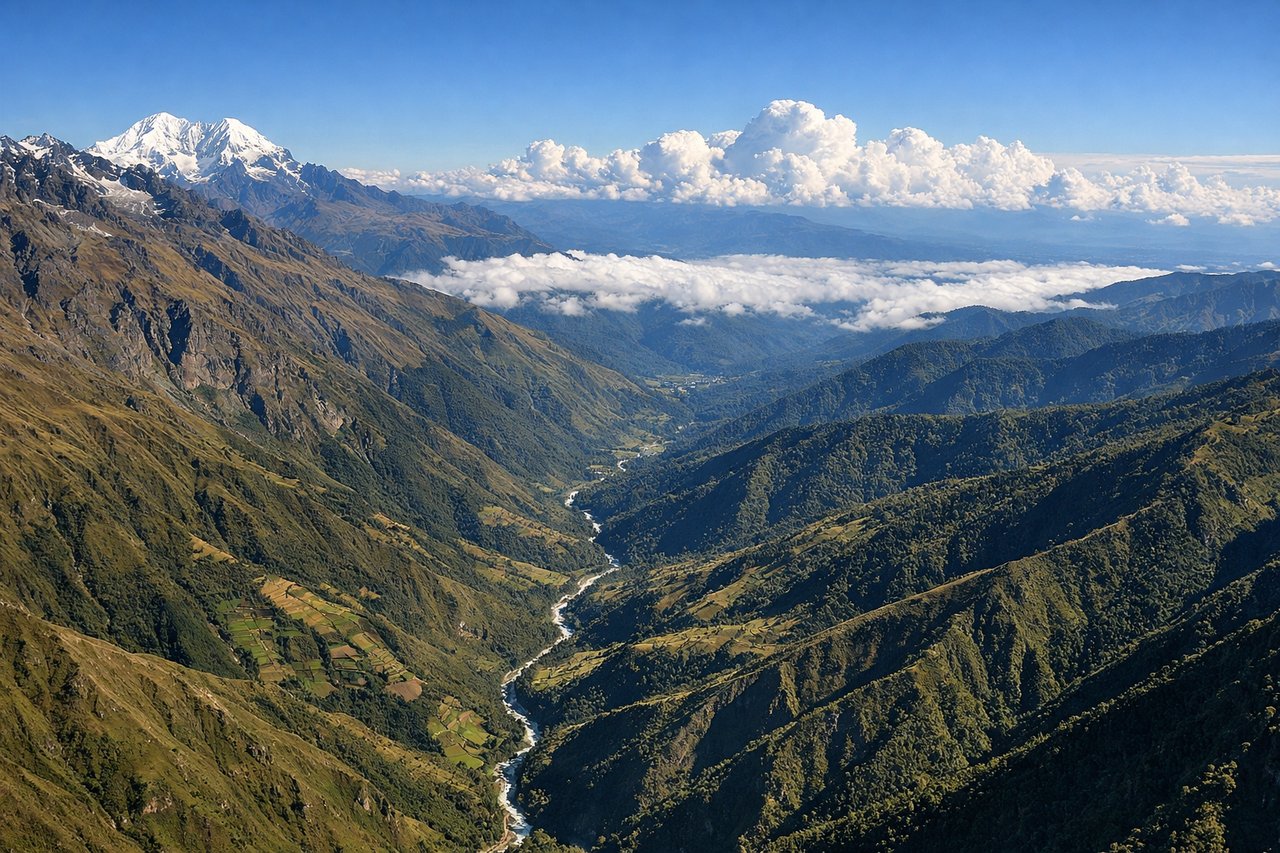
Takeoff from CUZ
LEFTLeft side captures the dramatic Andean terrain immediately after departure from Cuzco. The aircraft climbs eastbound (runway 10) with the Sacred Valley and surrounding peaks visible on the left wing, providing immediate high-altitude mountain scenery during the critical first 15 minutes of flight.
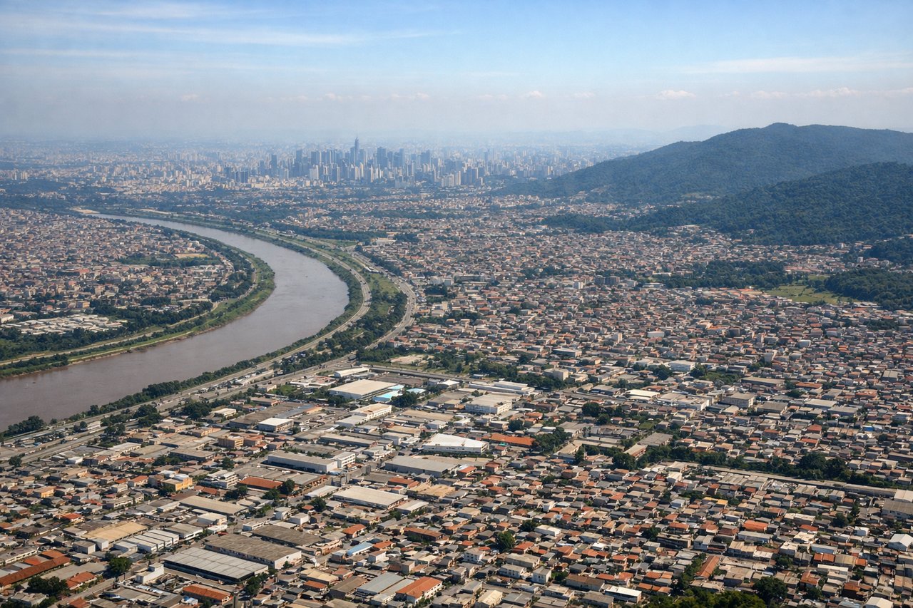
Landing at GRU
RIGHTRight side (south-facing) during approach to GRU captures the São Paulo metropolitan sprawl and surrounding plateau terrain. With typical westerly flow (runway 28) and approach vectors from the east, right-side passengers see the city's urban density, industrial zones, and the Tietê River system as the aircraft descends through 5,000–10,000 feet into the approach corridor.
Will your flight be in sunlight?
Pick a date and time in the Sun Map to watch the sun move across your whole flight.
About This Route
Which side of the plane should I sit on flying from Velazco Astete (CUZ) to Guarulhos (GRU)?
Sit on the Left side of the plane for the best views on flights from Cuzco to Sao Paulo. Left side scores higher due to the dramatic Andean departure sequence from Cuzco, which provides concentrated high-altitude mountain scenery, deep canyons, and recognizable cultural landmarks (Sacred Valley, Urubamba River) during the first 30 minutes of flight. While the right side offers urban interest during the São Paulo approach, the cruise phase over central Brazil (5+ hours) is predominantly flat plateau and open terrain with minimal landmark density. The Cuzco departure's scenic intensity outweighs the landing-phase advantage on the right.
What can I see during takeoff from Velazco Astete in Cuzco?
During takeoff from Velazco Astete (CUZ), sit on the Left side for the best views. Left side captures the dramatic Andean terrain immediately after departure from Cuzco. The aircraft climbs eastbound (runway 10) with the Sacred Valley and surrounding peaks visible on the left wing, providing immediate high-altitude mountain scenery during the critical first 15 minutes of flight. Notable sights include: Sacred Valley agricultural terraces, Urubamba River canyon, Machu Picchu region peaks (Huayna Picchu visible on clear days), eastern Cordillera ridgelines.
What can I see when landing at Guarulhos in Sao Paulo?
When landing at Guarulhos (GRU), sit on the Right side for the best views. Right side (south-facing) during approach to GRU captures the São Paulo metropolitan sprawl and surrounding plateau terrain. With typical westerly flow (runway 28) and approach vectors from the east, right-side passengers see the city's urban density, industrial zones, and the Tietê River system as the aircraft descends through 5,000–10,000 feet into the approach corridor. Notable sights include: São Paulo city skyline and central business district, Tietê River and reservoir system, Guarulhos industrial zone, Atlantic Plateau escarpment to the south.
How long is the flight from Cuzco to Sao Paulo?
The flight from Velazco Astete (CUZ) to Guarulhos (GRU) takes about 4 hours 5 minutes. The shortest flight path between them is 1,800 miles (2,896 km); winds and air traffic control usually add a few percent.
What does the Cuzco to Sao Paulo flight path pass over?
Eastern Andean foothills and cloud forest transition zone (first 90 minutes); central Brazilian plateau with scattered settlements and agricultural clearings; Tocantins and Araguaia river systems visible during mid-cruise; transition to São Paulo state's higher-density agricultural and industrial landscape in final 60 minutes before descent into Guarulhos approach corridor