The left side captures the dramatic Franklin Mountains and border geography on departure, then tracks along the western edge of the flight path with views of the White Sands region, the San Andres Mountains, and eventually the Spring Mountains on approach. The right side has a strong landing view but the left side delivers more consistently across the full flight.
Flown ELP to LAS? Did we get it right?
Flight Path
El Paso to Las Vegas is 583 miles (938 km), a flight of about 1 hour 15 minutes.
The flight crosses the Tularosa Basin and the edge of the White Sands region in southern New Mexico, then tracks over the Arizona Strip and the Virgin River Gorge area in northwestern Arizona before descending into the Las Vegas valley. The Colorado Plateau's southern edge and isolated volcanic fields near Flagstaff may be visible to the west on clear days.
Great circle distance and headings ›


Phase by phase
Takeoff from ELP
LEFTEl Paso typically departs northwest on runway 26L/R, putting the left side facing south toward the Franklin Mountains and the Rio Grande valley. You get a clear look at downtown El Paso and Ciudad Juárez sprawling across the border, with the Franklin Mountains rising sharply just north of the city.
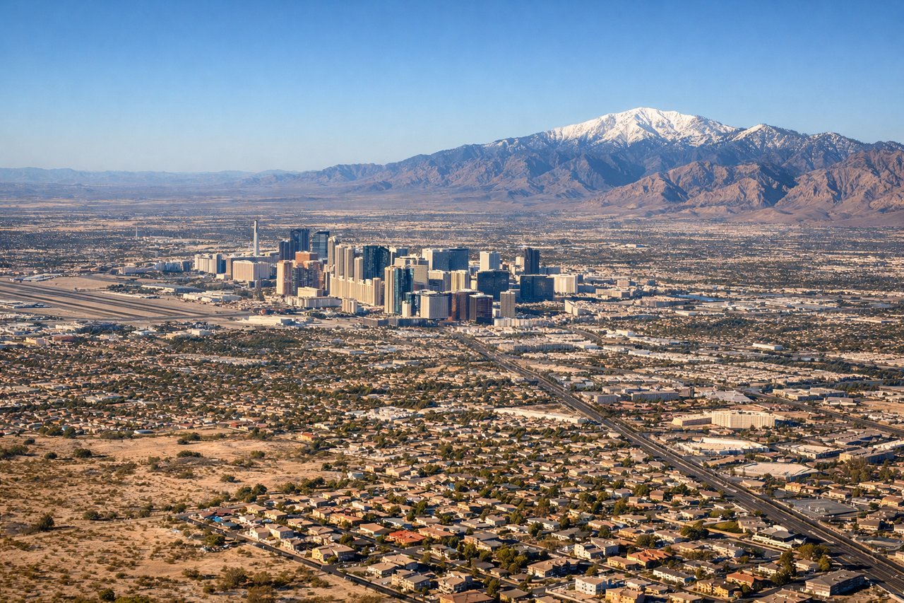
Landing at LAS
RIGHTLas Vegas McCarran typically lands from the northeast on runway 26L/R or from the east on runway 19R, meaning the right side faces north toward the Las Vegas Strip and downtown. The Strip's dense hotel corridor is unmistakable on approach, and Lake Mead sits to the northeast in the distance.
Will your flight be in sunlight?
Pick a date and time in the Sun Map to watch the sun move across your whole flight.
About This Route
Which side of the plane should I sit on flying from El Paso International (ELP) to Mc Carran International (LAS)?
Sit on the Left side of the plane for the best views on flights from El Paso to Las Vegas. The left side captures the dramatic Franklin Mountains and border geography on departure, then tracks along the western edge of the flight path with views of the White Sands region, the San Andres Mountains, and eventually the Spring Mountains on approach. The right side has a strong landing view but the left side delivers more consistently across the full flight.
What can I see during takeoff from El Paso International in El Paso?
During takeoff from El Paso International (ELP), sit on the Left side for the best views. El Paso typically departs northwest on runway 26L/R, putting the left side facing south toward the Franklin Mountains and the Rio Grande valley. You get a clear look at downtown El Paso and Ciudad Juárez sprawling across the border, with the Franklin Mountains rising sharply just north of the city. Notable sights include: Franklin Mountains State Park, Rio Grande/US-Mexico border, Ciudad Juárez urban grid, Hueco Tanks rock formations to the northeast.
What can I see when landing at Mc Carran International in Las Vegas?
When landing at Mc Carran International (LAS), sit on the Right side for the best views. Las Vegas McCarran typically lands from the northeast on runway 26L/R or from the east on runway 19R, meaning the right side faces north toward the Las Vegas Strip and downtown. The Strip's dense hotel corridor is unmistakable on approach, and Lake Mead sits to the northeast in the distance. Notable sights include: Las Vegas Strip hotel corridor, Lake Mead reservoir, Frenchman Mountain, Spring Mountains/Charleston Peak to the west.
How long is the flight from El Paso to Las Vegas?
The flight from El Paso International (ELP) to Mc Carran International (LAS) takes about 1 hour 15 minutes. The shortest flight path between them is 583 miles (938 km); winds and air traffic control usually add a few percent.
What does the El Paso to Las Vegas flight path pass over?
The flight crosses the Tularosa Basin and the edge of the White Sands region in southern New Mexico, then tracks over the Arizona Strip and the Virgin River Gorge area in northwestern Arizona before descending into the Las Vegas valley. The Colorado Plateau's southern edge and isolated volcanic fields near Flagstaff may be visible to the west on clear days.