Guatemala City to Bogota is 1,307 miles (2,103 km), a flight of about 2 hours 30 minutes.
While both sides offer distinct scenery, the right side captures the most dramatic and varied views: the volcanic highlands and Sierra de las Minas during departure, followed by the Cordillera Central's deep valleys and river systems during the approach. The right side also faces the general direction of the flight path for much of the journey.
Flight Path
The flight path crosses from Guatemala's volcanic highlands southeastward through Honduras and El Salvador airspace, passing over or near the Honduran highlands and the Salvadoran volcanic chain. The aircraft then enters Colombian airspace and descends toward the Cordillera Central and the Magdalena River valley. Notable midpoint features include the volcanic peaks of central Honduras, the Salvadoran volcanic arc (including Santa Ana and San Salvador volcanoes), and the transition from Central American terrain into the Colombian Andes. The Cauca River valley may be visible during the approach to Bogotá.
Great circle distance and headings ›
.jpg?width=600)
Phase by phase
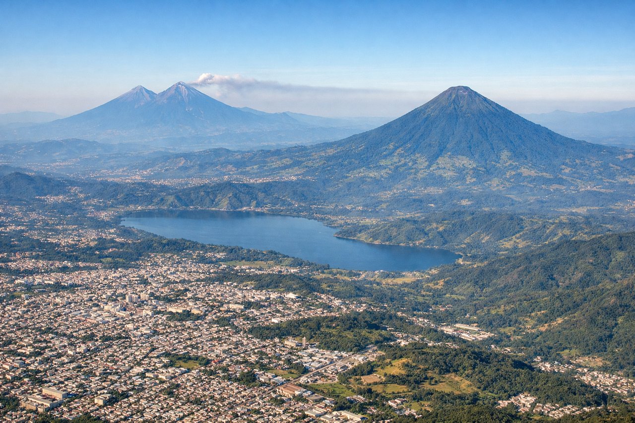
Takeoff from GUA
RIGHTRight-side seats offer views of the Sierra de las Minas and the volcanic highlands immediately south and southeast of Guatemala City during climb-out. The terrain rises dramatically in this direction, creating the most visually striking departure scenery.
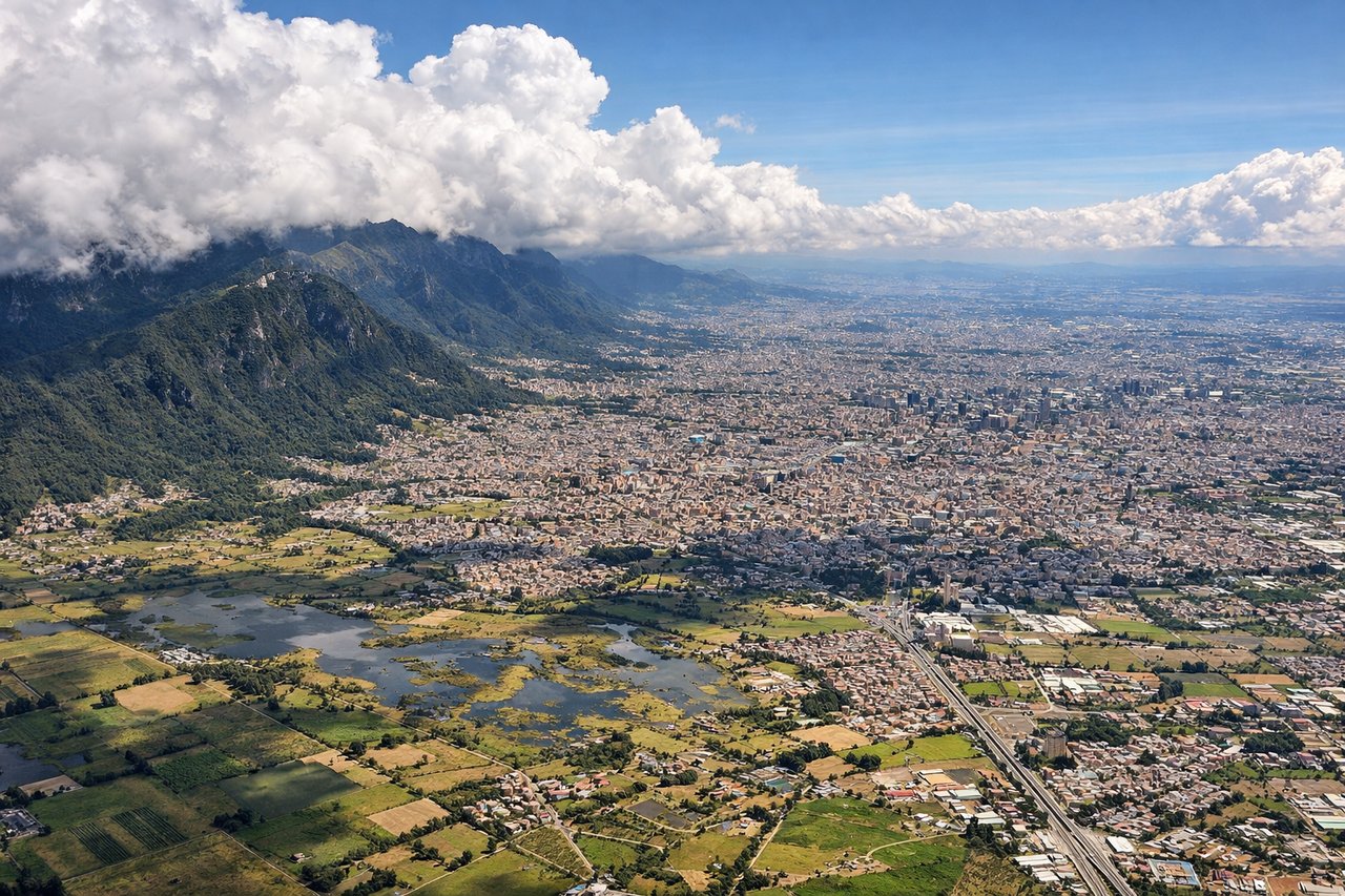
Landing at BOG
LEFTLeft-side seats provide views of the Cordillera Central and the Magdalena River valley as the aircraft descends into Bogotá from the north. The approach path typically brings aircraft over the high Andean plateau, and left-side windows capture the dramatic mountain terrain and the river system that defines the approach corridor.
Landmarks on this routeAll landmarks →
Will your flight be in sunlight?
Pick a date and time in the Sun Map to watch the sun move across your whole flight.
About This Route
Which side of the plane should I sit on flying from La Aurora (GUA) to Eldorado International (BOG)?
Sit on the Right side of the plane for the best views on flights from Guatemala City to Bogota. While both sides offer distinct scenery, the right side captures the most dramatic and varied views: the volcanic highlands and Sierra de las Minas during departure, followed by the Cordillera Central's deep valleys and river systems during the approach. The right side also faces the general direction of the flight path for much of the journey.
What can I see during takeoff from La Aurora in Guatemala City?
During takeoff from La Aurora (GUA), sit on the Right side for the best views. Right-side seats offer views of the Sierra de las Minas and the volcanic highlands immediately south and southeast of Guatemala City during climb-out. The terrain rises dramatically in this direction, creating the most visually striking departure scenery. Notable sights include: Sierra de las Minas (mountain range), Lake Amatitlán (visible to the south), volcanic peaks of the Central American highlands, Guatemala City urban sprawl below.
What can I see when landing at Eldorado International in Bogota?
When landing at Eldorado International (BOG), sit on the Left side for the best views. Left-side seats provide views of the Cordillera Central and the Magdalena River valley as the aircraft descends into Bogotá from the north. The approach path typically brings aircraft over the high Andean plateau, and left-side windows capture the dramatic mountain terrain and the river system that defines the approach corridor. Notable sights include: Cordillera Central (mountain range), Magdalena River valley, Bogotá's high-altitude plateau and urban grid, surrounding Andean peaks.
How long is the flight from Guatemala City to Bogota?
The flight from La Aurora (GUA) to Eldorado International (BOG) takes about 2 hours 30 minutes. The shortest flight path between them is 1,307 miles (2,103 km); winds and air traffic control usually add a few percent.
What does the Guatemala City to Bogota flight path pass over?
The flight path crosses from Guatemala's volcanic highlands southeastward through Honduras and El Salvador airspace, passing over or near the Honduran highlands and the Salvadoran volcanic chain. The aircraft then enters Colombian airspace and descends toward the Cordillera Central and the Magdalena River valley. Notable midpoint features include the volcanic peaks of central Honduras, the Salvadoran volcanic arc (including Santa Ana and San Salvador volcanoes), and the transition from Central American terrain into the Colombian Andes. The Cauca River valley may be visible during the approach to Bogotá.