Right side scores higher (3.5 vs 2.5) due to superior scenic variety across the full flight. Takeoff offers dramatic volcanic peaks and Guatemala City's urban landscape. The cruise segment crosses the Yucatan Peninsula and Gulf of Mexico with some coastal definition. Landing provides the Dallas skyline and Trinity River approach. Left side remains predominantly flat terrain and open water with minimal landmark density throughout.
Flown GUA to DAL? Did we get it right?
Flight Path
Guatemala City to Dallas is 1,323 miles (2,129 km), a flight of about 3 hours 15 minutes.
Yucatan Peninsula limestone plateau, Gulf of Mexico coastline near Veracruz, transition from tropical vegetation to North American plains, Rio Grande valley approaching Texas
Great circle distance and headings ›Phase by phase
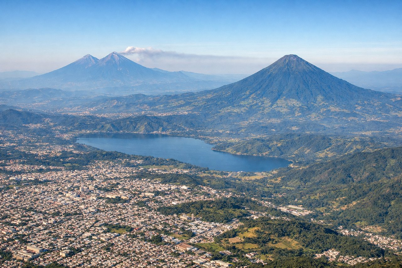
Takeoff from GUA
RIGHTRight side captures Guatemala City's urban sprawl and the surrounding volcanic highlands of the Central American plateau during climb-out. Left side faces open terrain with minimal immediate landmarks.
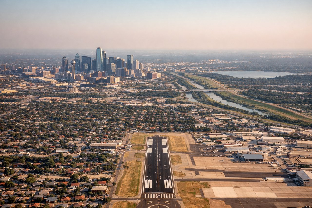
Landing at DAL
RIGHTRight side offers the approach into Dallas Love Field with views of the Dallas-Fort Worth urban corridor, the Trinity River, and surrounding North Texas plains. Left side shows only flat, featureless terrain with minimal visual interest during descent.
Will your flight be in sunlight?
Pick a date and time in the Sun Map to watch the sun move across your whole flight.
About This Route
Which side of the plane should I sit on flying from La Aurora (GUA) to Dallas Love Fld (DAL)?
Sit on the Right side of the plane for the best views on flights from Guatemala City to Dallas. Right side scores higher (3.5 vs 2.5) due to superior scenic variety across the full flight. Takeoff offers dramatic volcanic peaks and Guatemala City's urban landscape. The cruise segment crosses the Yucatan Peninsula and Gulf of Mexico with some coastal definition. Landing provides the Dallas skyline and Trinity River approach. Left side remains predominantly flat terrain and open water with minimal landmark density throughout.
What can I see during takeoff from La Aurora in Guatemala City?
During takeoff from La Aurora (GUA), sit on the Right side for the best views. Right side captures Guatemala City's urban sprawl and the surrounding volcanic highlands of the Central American plateau during climb-out. Left side faces open terrain with minimal immediate landmarks. Notable sights include: Guatemala City urban grid, Volcán de Agua (3,760m) to the south, Volcán Acatenango to the southwest, Central American highlands.
What can I see when landing at Dallas Love Fld in Dallas?
When landing at Dallas Love Fld (DAL), sit on the Right side for the best views. Right side offers the approach into Dallas Love Field with views of the Dallas-Fort Worth urban corridor, the Trinity River, and surrounding North Texas plains. Left side shows only flat, featureless terrain with minimal visual interest during descent. Notable sights include: Dallas skyline and downtown core, Trinity River, Dallas-Fort Worth metropolitan sprawl, North Texas plains.
How long is the flight from Guatemala City to Dallas?
The flight from La Aurora (GUA) to Dallas Love Fld (DAL) takes about 3 hours 15 minutes. The shortest flight path between them is 1,323 miles (2,129 km); winds and air traffic control usually add a few percent.
What does the Guatemala City to Dallas flight path pass over?
Yucatan Peninsula limestone plateau, Gulf of Mexico coastline near Veracruz, transition from tropical vegetation to North American plains, Rio Grande valley approaching Texas