While takeoff offers dramatic volcanic scenery on the right, the landing approach into Madrid provides more sustained visual interest with the Guadarrama Mountains, river valleys, and the approach over varied terrain. Left-side seats capture both the mountain approach and the city's geographic setting more comprehensively.
Flown GUA to MAD? Did we get it right?
Flight Path
Guatemala City to Madrid is 5,411 miles (8,708 km), a flight of about 10 hours 10 minutes.
The flight crosses the Atlantic Ocean for roughly 6-7 hours. Notable waypoints include the Yucatan Channel (visible if departing westbound before turning northeast), the Bahamas and Caribbean islands (if routed south of direct), the mid-Atlantic (featureless ocean), the Azores region (if passed to the south), and the Iberian Peninsula's western coast approaching Spain. The route typically follows a great-circle path across the Atlantic, passing south of Greenland and Iceland. Approaching Europe, the flight crosses the Bay of Biscay and the Pyrenees Mountains become visible before descent into Madrid.
Great circle distance and headings ›Phase by phase
Takeoff from GUA
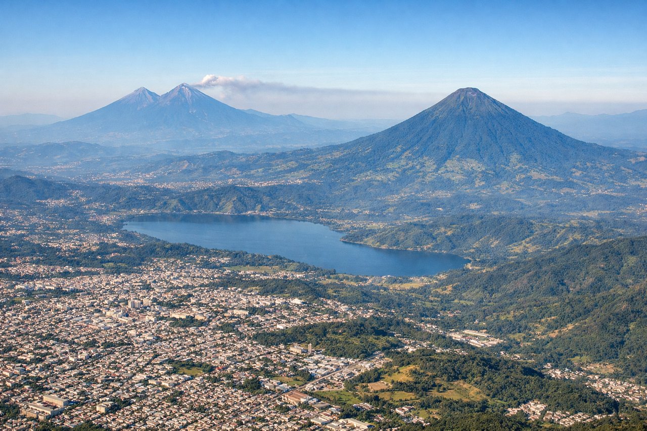
RIGHTLa Aurora typically departs eastbound (Runway 06) or westbound (Runway 24). Right-side seats offer the best view of the volcanic highlands immediately south and east of Guatemala City. The terrain rises sharply in these directions, creating dramatic relief as you climb out.
Landing at MAD
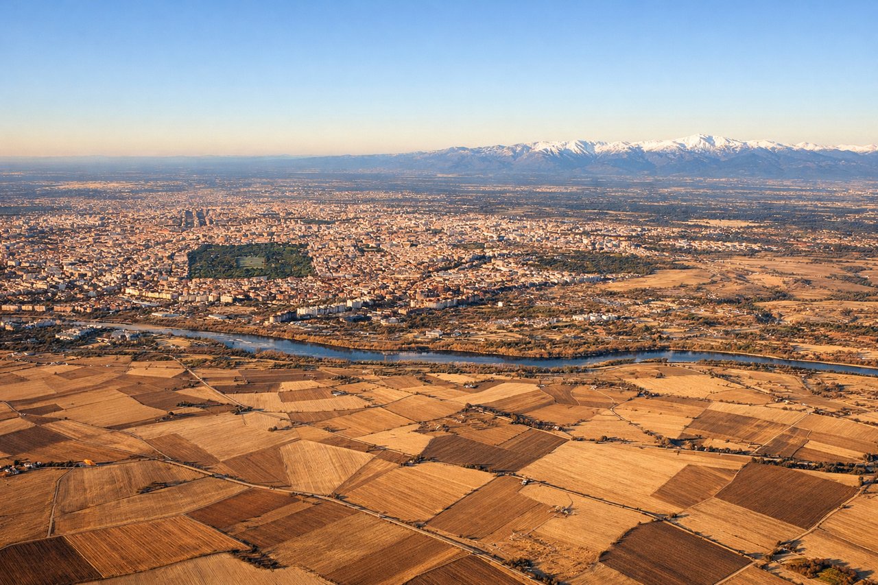
LEFTMadrid-Barajas typically lands on Runway 32L/32R (northwesterly approach) or Runway 14L/14R (southeasterly approach). Left-side seats during a northwest approach provide clear views of the Guadarrama Mountains and the approach path over the Castilian plateau. The terrain and city layout are more visually interesting from this angle.
Will your flight be in sunlight?
Pick a date and time in the Sun Map to watch the sun move across your whole flight.
About This Route
Which side of the plane should I sit on flying from La Aurora (GUA) to Barajas (MAD)?
Sit on the Left side of the plane for the best views on flights from Guatemala City to Madrid. While takeoff offers dramatic volcanic scenery on the right, the landing approach into Madrid provides more sustained visual interest with the Guadarrama Mountains, river valleys, and the approach over varied terrain. Left-side seats capture both the mountain approach and the city's geographic setting more comprehensively.
What can I see during takeoff from La Aurora in Guatemala City?
During takeoff from La Aurora (GUA), sit on the Right side for the best views. La Aurora typically departs eastbound (Runway 06) or westbound (Runway 24). Right-side seats offer the best view of the volcanic highlands immediately south and east of Guatemala City. The terrain rises sharply in these directions, creating dramatic relief as you climb out. Notable sights include: Volcán Pacaya (active volcano, ~30 miles southeast), Volcán de Agua (dormant, ~25 miles south), Lake Amatitlán (visible as a dark water body south of the city), Guatemala City urban sprawl in the central valley.
What can I see when landing at Barajas in Madrid?
When landing at Barajas (MAD), sit on the Left side for the best views. Madrid-Barajas typically lands on Runway 32L/32R (northwesterly approach) or Runway 14L/14R (southeasterly approach). Left-side seats during a northwest approach provide clear views of the Guadarrama Mountains and the approach path over the Castilian plateau. The terrain and city layout are more visually interesting from this angle. Notable sights include: Guadarrama Mountains (Sierra de Guadarrama, ~30 miles northwest of the airport), Manzanares River valley, Madrid's northern suburbs and urban expansion, Barajas airport runways and taxiways.
How long is the flight from Guatemala City to Madrid?
The flight from La Aurora (GUA) to Barajas (MAD) takes about 10 hours 10 minutes. The shortest flight path between them is 5,411 miles (8,708 km); winds and air traffic control usually add a few percent.
What does the Guatemala City to Madrid flight path pass over?
The flight crosses the Atlantic Ocean for roughly 6-7 hours. Notable waypoints include the Yucatan Channel (visible if departing westbound before turning northeast), the Bahamas and Caribbean islands (if routed south of direct), the mid-Atlantic (featureless ocean), the Azores region (if passed to the south), and the Iberian Peninsula's western coast approaching Spain. The route typically follows a great-circle path across the Atlantic, passing south of Greenland and Iceland. Approaching Europe, the flight crosses the Bay of Biscay and the Pyrenees Mountains become visible before descent into Madrid.