Right seats win for the full journey. Takeoff offers superior views of Tokyo Bay and the Kanto Plain, and while landing favors the left, the extended flight path over the open Philippine Sea offers minimal scenic advantage to either side—making the strong takeoff views the deciding factor.
Flown HND to GUM? Did we get it right?
Flight Path
Tokyo to Agana is 1,556 miles (2,504 km), a flight of about 4 hours.
After leaving the Japanese coast, the flight crosses the open Philippine Sea for nearly the entire journey. No major islands or landmarks are visible for roughly 2,000 miles—only open ocean. The Izu Islands (small volcanic islands south of Tokyo) may be briefly visible shortly after takeoff on the right side if flying at lower altitudes during initial climb. The flight path passes well south of the Bonin Islands and Iwo Jima. Approaching Guam from the north, the Mariana Islands chain becomes visible on the horizon, with Guam being the southernmost and largest island in the group.
Great circle distance and headings ›Phase by phase
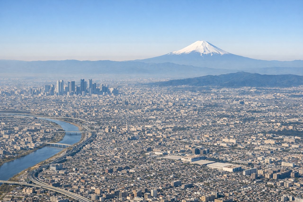
Takeoff from HND
RIGHTRight seats capture the Kanto Plain and Tokyo Bay as you climb southeastward. Haneda's primary departure routes head southeast over the bay, giving right-side passengers direct views of the urban sprawl and water before turning toward Guam.
Landing at GUM
LEFTLeft seats offer the best views during descent into Guam. The approach typically comes from the north over the Philippine Sea, and left-side passengers see the Mariana Trench's deep blue water, the volcanic profile of Guam itself, and the island's distinctive southern cliffs as you descend.
Will your flight be in sunlight?
Pick a date and time in the Sun Map to watch the sun move across your whole flight.
About This Route
Which side of the plane should I sit on flying from Tokyo International (HND) to Guam International (GUM)?
Sit on the Right side of the plane for the best views on flights from Tokyo to Agana. Right seats win for the full journey. Takeoff offers superior views of Tokyo Bay and the Kanto Plain, and while landing favors the left, the extended flight path over the open Philippine Sea offers minimal scenic advantage to either side—making the strong takeoff views the deciding factor.
What can I see during takeoff from Tokyo International in Tokyo?
During takeoff from Tokyo International (HND), sit on the Right side for the best views. Right seats capture the Kanto Plain and Tokyo Bay as you climb southeastward. Haneda's primary departure routes head southeast over the bay, giving right-side passengers direct views of the urban sprawl and water before turning toward Guam. Notable sights include: Tokyo Bay (immediate foreground), Kanto Plain urban grid extending west, Mount Fuji (distant western horizon on clear days, ~60 miles away), Boso Peninsula (eastern shoreline).
What can I see when landing at Guam International in Agana?
When landing at Guam International (GUM), sit on the Left side for the best views. Left seats offer the best views during descent into Guam. The approach typically comes from the north over the Philippine Sea, and left-side passengers see the Mariana Trench's deep blue water, the volcanic profile of Guam itself, and the island's distinctive southern cliffs as you descend. Notable sights include: Philippine Sea (deep indigo water, surrounding the island), Guam's volcanic ridgeline (central spine running north-south), Two Lovers Point cliffs (northern tip, white limestone), Apra Harbor (western anchorage, visible as a sheltered bay).
How long is the flight from Tokyo to Agana?
The flight from Tokyo International (HND) to Guam International (GUM) takes about 4 hours. The shortest flight path between them is 1,556 miles (2,504 km); winds and air traffic control usually add a few percent.
What does the Tokyo to Agana flight path pass over?
After leaving the Japanese coast, the flight crosses the open Philippine Sea for nearly the entire journey. No major islands or landmarks are visible for roughly 2,000 miles—only open ocean. The Izu Islands (small volcanic islands south of Tokyo) may be briefly visible shortly after takeoff on the right side if flying at lower altitudes during initial climb. The flight path passes well south of the Bonin Islands and Iwo Jima. Approaching Guam from the north, the Mariana Islands chain becomes visible on the horizon, with Guam being the southernmost and largest island in the group.