Tokyo to Hachijojima is 168 miles (271 km), a flight of about 50 minutes.
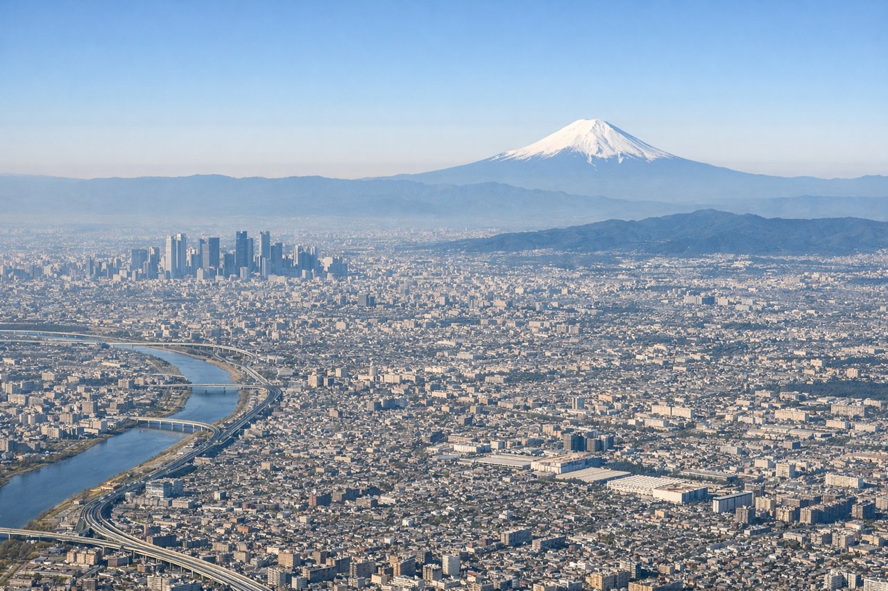
The right side captures the most dramatic moment of the flight — the Tokyo Bay panorama with Mt. Fuji on the horizon during climb-out. The landing views on the left are compelling but shorter in duration. Right side wins overall for the Tokyo departure spectacle alone.
Flight Path
The flight tracks almost due south along longitude 139.8°E over open Pacific Ocean. The Izu Peninsula is visible to the right (west) shortly after departure. The Izu Islands chain — Oshima, Toshima, Niijima, Shikinejima, Kozushima, and Mikurajima — appear sequentially below or to the west as the aircraft heads south toward Hachijojima, the southernmost of the chain.
Great circle distance and headings ›Phase by phase
Takeoff from HND
RIGHTHND typically departs southward over Tokyo Bay on runways 16L/16R or 34L/34R depending on wind. A southbound departure on runway 16 puts the right side facing west toward the Yokohama waterfront, the bay bridges, and eventually Mt. Fuji on the western horizon as the aircraft climbs and turns south. Left side faces open ocean early.
Landing at HAC
LEFTHachijojima's runway 26 approach from the east brings the aircraft in from the Pacific side heading westward. The left side faces north toward the volcanic peaks of Hachijo-Fuji and Mihara-yama, the island's most dramatic features, while descending over the rugged coastline.
Landmarks on this routeAll landmarks →
Will your flight be in sunlight?
Pick a date and time in the Sun Map to watch the sun move across your whole flight.
About This Route
Which side of the plane should I sit on flying from Tokyo International (HND) to Hachijojima (HAC)?
Sit on the Right side of the plane for the best views on flights from Tokyo to Hachijojima. The right side captures the most dramatic moment of the flight — the Tokyo Bay panorama with Mt. Fuji on the horizon during climb-out. The landing views on the left are compelling but shorter in duration. Right side wins overall for the Tokyo departure spectacle alone.
What can I see during takeoff from Tokyo International in Tokyo?
During takeoff from Tokyo International (HND), sit on the Right side for the best views. HND typically departs southward over Tokyo Bay on runways 16L/16R or 34L/34R depending on wind. A southbound departure on runway 16 puts the right side facing west toward the Yokohama waterfront, the bay bridges, and eventually Mt. Fuji on the western horizon as the aircraft climbs and turns south. Left side faces open ocean early. Notable sights include: Tokyo Bay, Yokohama Bay Bridge, Mt. Fuji (distant, western horizon), Miura Peninsula coastline.
What can I see when landing at Hachijojima in Hachijojima?
When landing at Hachijojima (HAC), sit on the Left side for the best views. Hachijojima's runway 26 approach from the east brings the aircraft in from the Pacific side heading westward. The left side faces north toward the volcanic peaks of Hachijo-Fuji and Mihara-yama, the island's most dramatic features, while descending over the rugged coastline. Notable sights include: Hachijo-Fuji volcanic cone, Mihara-yama (older southern volcano), Pacific Ocean coastline, Hachijojima's green forested interior.
How long is the flight from Tokyo to Hachijojima?
The flight from Tokyo International (HND) to Hachijojima (HAC) takes about 50 minutes. The shortest flight path between them is 168 miles (271 km); winds and air traffic control usually add a few percent.
What does the Tokyo to Hachijojima flight path pass over?
The flight tracks almost due south along longitude 139.8°E over open Pacific Ocean. The Izu Peninsula is visible to the right (west) shortly after departure. The Izu Islands chain — Oshima, Toshima, Niijima, Shikinejima, Kozushima, and Mikurajima — appear sequentially below or to the west as the aircraft heads south toward Hachijojima, the southernmost of the chain.