While the takeoff favors the right for Oahu's dramatic windward scenery, the landing view from the left—featuring the Potomac River, National Mall, and Arlington Cemetery—is more iconic and memorable. Most passengers prioritize the destination view.
Flight Path
This transpacific route crosses the North Pacific Ocean with no significant visible landmarks for roughly 8 hours. You'll pass north of the Hawaiian Islands within the first 90 minutes, then encounter open ocean. The flight path crosses near the Aleutian Islands region (not visible at cruise altitude due to distance and cloud cover), then approaches the North American continent near the Pacific Northwest coast. The continental US becomes visible approximately 2 hours before landing, with the Rocky Mountains potentially visible on clear days during the descent into the eastern US. The Appalachian Mountains may be visible in the final descent phase depending on weather and time of day.
Great circle distance and headings ›

.jpg?width=600)

.jpeg?width=600)
Phase by phase
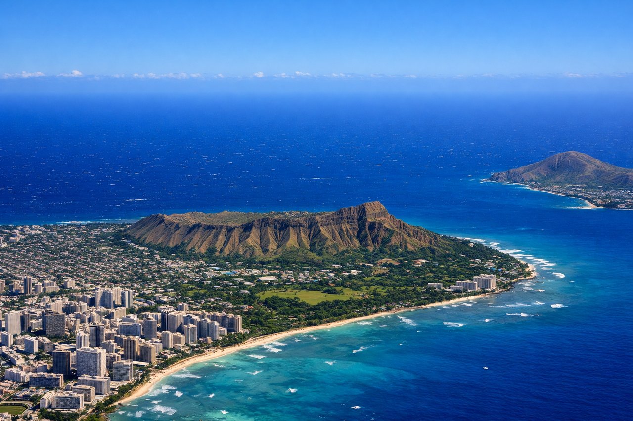
Takeoff from HNL
RIGHTRight-side seats capture the Ko'olau Range and windward Oahu's dramatic pali cliffs as you climb northeast. The left side shows the developed central plateau and airport grounds, which are less visually distinctive.
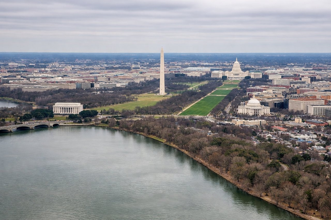
Landing at DCA
LEFTLeft-side seats offer the best views during the final approach to DCA. You'll see the Potomac River's distinctive curves, the National Mall layout, and the Arlington ridge across the river. Right-side views are blocked by the aircraft fuselage during typical westbound approaches.
Landmarks on this routeAll landmarks →
Will your flight be in sunlight?
See exactly which side of the plane gets sun and shade at your departure time.
About This Route
Which side of the plane should I sit on flying from Honolulu International (HNL) to Ronald Reagan Washington National (DCA)?
Sit on the Left side of the plane for the best views on flights from Honolulu to Washington. While the takeoff favors the right for Oahu's dramatic windward scenery, the landing view from the left—featuring the Potomac River, National Mall, and Arlington Cemetery—is more iconic and memorable. Most passengers prioritize the destination view.
What can I see during takeoff from Honolulu International in Honolulu?
During takeoff from Honolulu International (HNL), sit on the Right side for the best views. Right-side seats capture the Ko'olau Range and windward Oahu's dramatic pali cliffs as you climb northeast. The left side shows the developed central plateau and airport grounds, which are less visually distinctive. Notable sights include: Ko'olau Range (jagged volcanic ridgeline), Kailua Bay (turquoise water on windward coast), Kaneohe Bay (larger bay to the north), Pali Notches (distinctive saddle formations in the ridge).
What can I see when landing at Ronald Reagan Washington National in Washington?
When landing at Ronald Reagan Washington National (DCA), sit on the Left side for the best views. Left-side seats offer the best views during the final approach to DCA. You'll see the Potomac River's distinctive curves, the National Mall layout, and the Arlington ridge across the river. Right-side views are blocked by the aircraft fuselage during typical westbound approaches. Notable sights include: Potomac River (meandering waterway with visible bends), Arlington National Cemetery (geometric grid pattern on ridge south of river), National Mall (linear park with monuments visible as white dots), Theodore Roosevelt Island (wooded island in river channel).
How long is the flight from Honolulu to Washington?
The flight from Honolulu International (HNL) to Ronald Reagan Washington National (DCA) takes Approximately 10 hours 15 minutes.
What does the Honolulu to Washington flight path pass over?
This transpacific route crosses the North Pacific Ocean with no significant visible landmarks for roughly 8 hours. You'll pass north of the Hawaiian Islands within the first 90 minutes, then encounter open ocean. The flight path crosses near the Aleutian Islands region (not visible at cruise altitude due to distance and cloud cover), then approaches the North American continent near the Pacific Northwest coast. The continental US becomes visible approximately 2 hours before landing, with the Rocky Mountains potentially visible on clear days during the descent into the eastern US. The Appalachian Mountains may be visible in the final descent phase depending on weather and time of day.