The right side captures the most dramatic geography on departure (Ko'olau cliffs and Kaneohe Bay), and while landing favors the left, the takeoff view is more visually distinctive and memorable. The flight path itself offers limited mid-ocean landmarks, making the departure sequence the highlight.
Flight Path
The flight crosses the North Pacific with no significant landmarks visible for roughly 5 hours. You'll pass south of Guam's airspace (not visible on this routing). The approach to Fukuoka brings views of the Japanese coastline, including the Iki Island and Tsushima Island areas as you descend into Kyushu airspace, though these are typically visible only in the final 30-40 minutes of descent depending on cloud cover and visibility.
Great circle distance and headings ›

Phase by phase
Takeoff from HNL
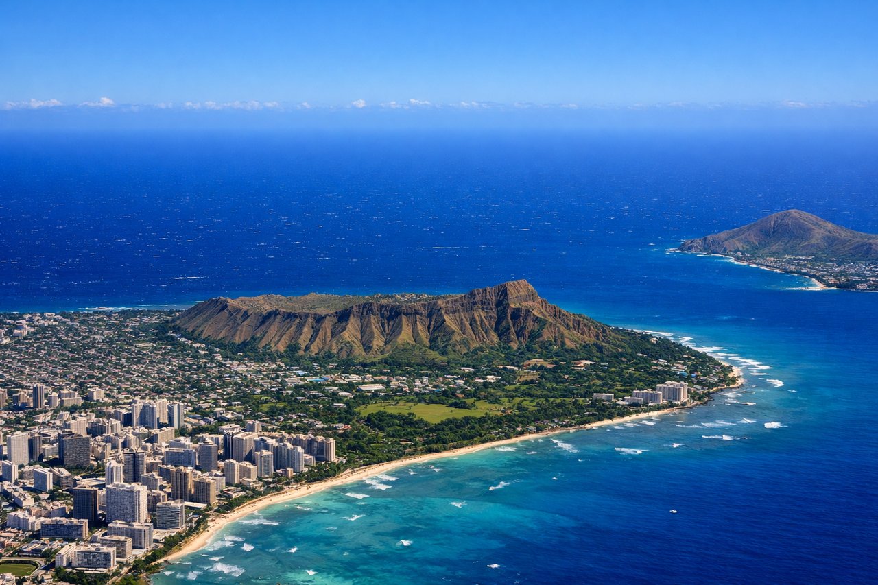
RIGHTRight-side seats capture the windward Koolau Range and the dramatic pali (cliffs) as you climb northeast from Runway 08L/08R. The Ko'olau ridgeline rises sharply inland and remains visible for the first 10-15 minutes of climb, creating a striking vertical relief against the ocean backdrop.
Landing at FUK
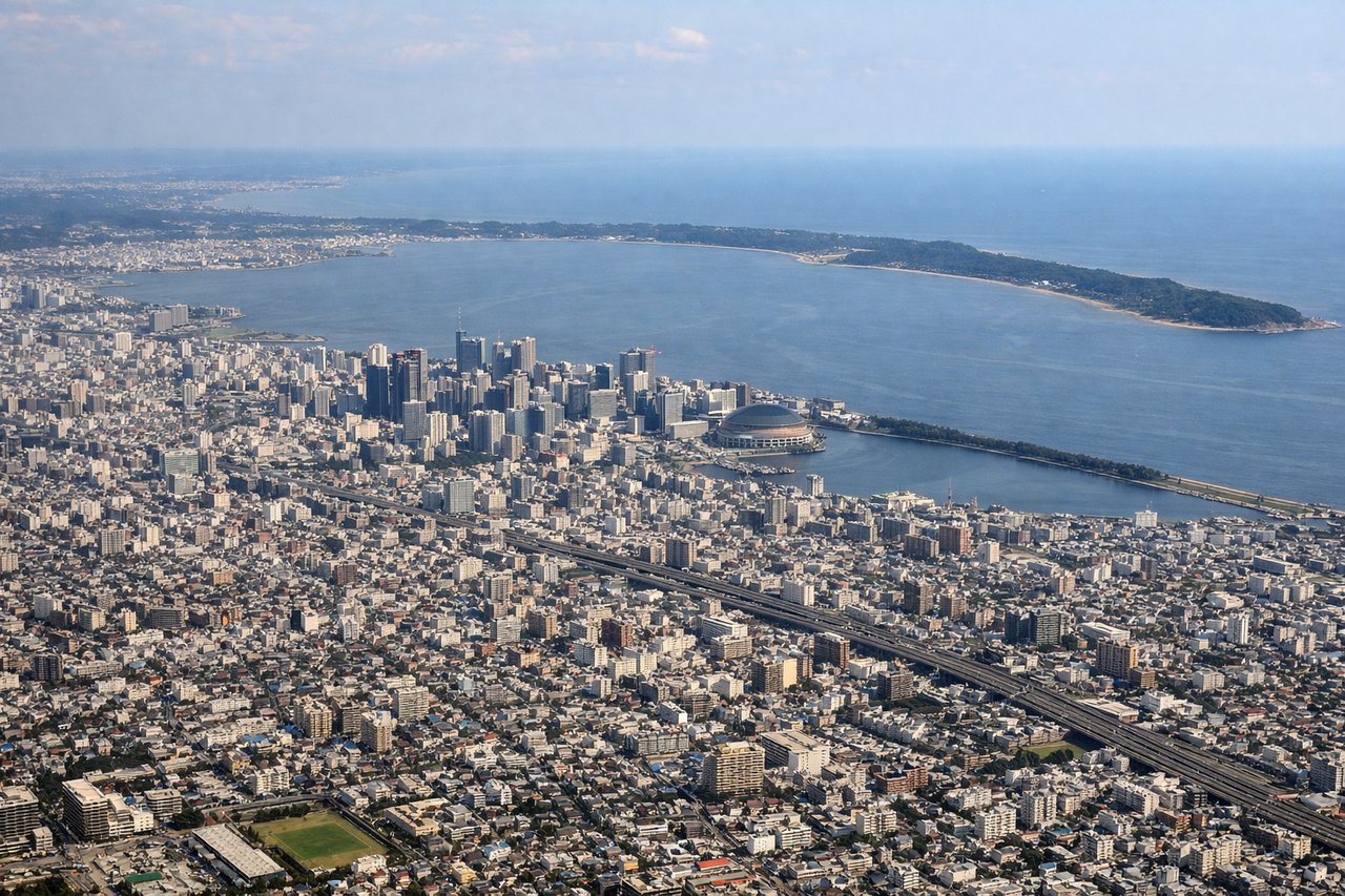
LEFTLeft-side seats offer the best view of Fukuoka's urban sprawl and Hakata Bay during descent. As you approach from the northeast on typical Runway 16L/16R, the left side reveals the city grid, Nishi Park, and the bay's distinctive shape with Shikano Island visible offshore.
Landmarks on this routeAll landmarks →
Will your flight be in sunlight?
See exactly which side of the plane gets sun and shade at your departure time.
About This Route
Which side of the plane should I sit on flying from Honolulu International (HNL) to Fukuoka (FUK)?
Sit on the Right side of the plane for the best views on flights from Honolulu to Fukuoka. The right side captures the most dramatic geography on departure (Ko'olau cliffs and Kaneohe Bay), and while landing favors the left, the takeoff view is more visually distinctive and memorable. The flight path itself offers limited mid-ocean landmarks, making the departure sequence the highlight.
What can I see during takeoff from Honolulu International in Honolulu?
During takeoff from Honolulu International (HNL), sit on the Right side for the best views. Right-side seats capture the windward Koolau Range and the dramatic pali (cliffs) as you climb northeast from Runway 08L/08R. The Ko'olau ridgeline rises sharply inland and remains visible for the first 10-15 minutes of climb, creating a striking vertical relief against the ocean backdrop. Notable sights include: Ko'olau Range (windward cliffs), Kaneohe Bay (turquoise lagoon to the northeast), Mokapu Peninsula, Pacific Ocean extending north toward Molokai Channel.
What can I see when landing at Fukuoka in Fukuoka?
When landing at Fukuoka (FUK), sit on the Left side for the best views. Left-side seats offer the best view of Fukuoka's urban sprawl and Hakata Bay during descent. As you approach from the northeast on typical Runway 16L/16R, the left side reveals the city grid, Nishi Park, and the bay's distinctive shape with Shikano Island visible offshore. Notable sights include: Hakata Bay (crescent-shaped water body), Fukuoka city grid and urban districts, Shikano Island (small island in the bay), Nishi Park (green space in central Fukuoka).
How long is the flight from Honolulu to Fukuoka?
The flight from Honolulu International (HNL) to Fukuoka (FUK) takes Approximately 6 hours 45 minutes to 7 hours 15 minutes.
What does the Honolulu to Fukuoka flight path pass over?
The flight crosses the North Pacific with no significant landmarks visible for roughly 5 hours. You'll pass south of Guam's airspace (not visible on this routing). The approach to Fukuoka brings views of the Japanese coastline, including the Iki Island and Tsushima Island areas as you descend into Kyushu airspace, though these are typically visible only in the final 30-40 minutes of descent depending on cloud cover and visibility.