Right side wins for takeoff's dramatic Ko'olau Range and Kailua Bay views, which are more visually striking than Majuro's lagoon approach. The outbound climb offers more varied topography than the landing sequence.
Flight Path
Open Pacific Ocean with no significant land features. The flight path crosses roughly 1,200 nautical miles of deep ocean between Oahu and Majuro. At cruise altitude (around 25,000-31,000 feet), you'll see only ocean, occasional cloud formations, and the curvature of the horizon. No islands or atolls are visible along the direct route—the Marshall Islands lie well east of the direct great-circle path from Honolulu.
Great circle distance and headings ›Phase by phase
Takeoff from HNL
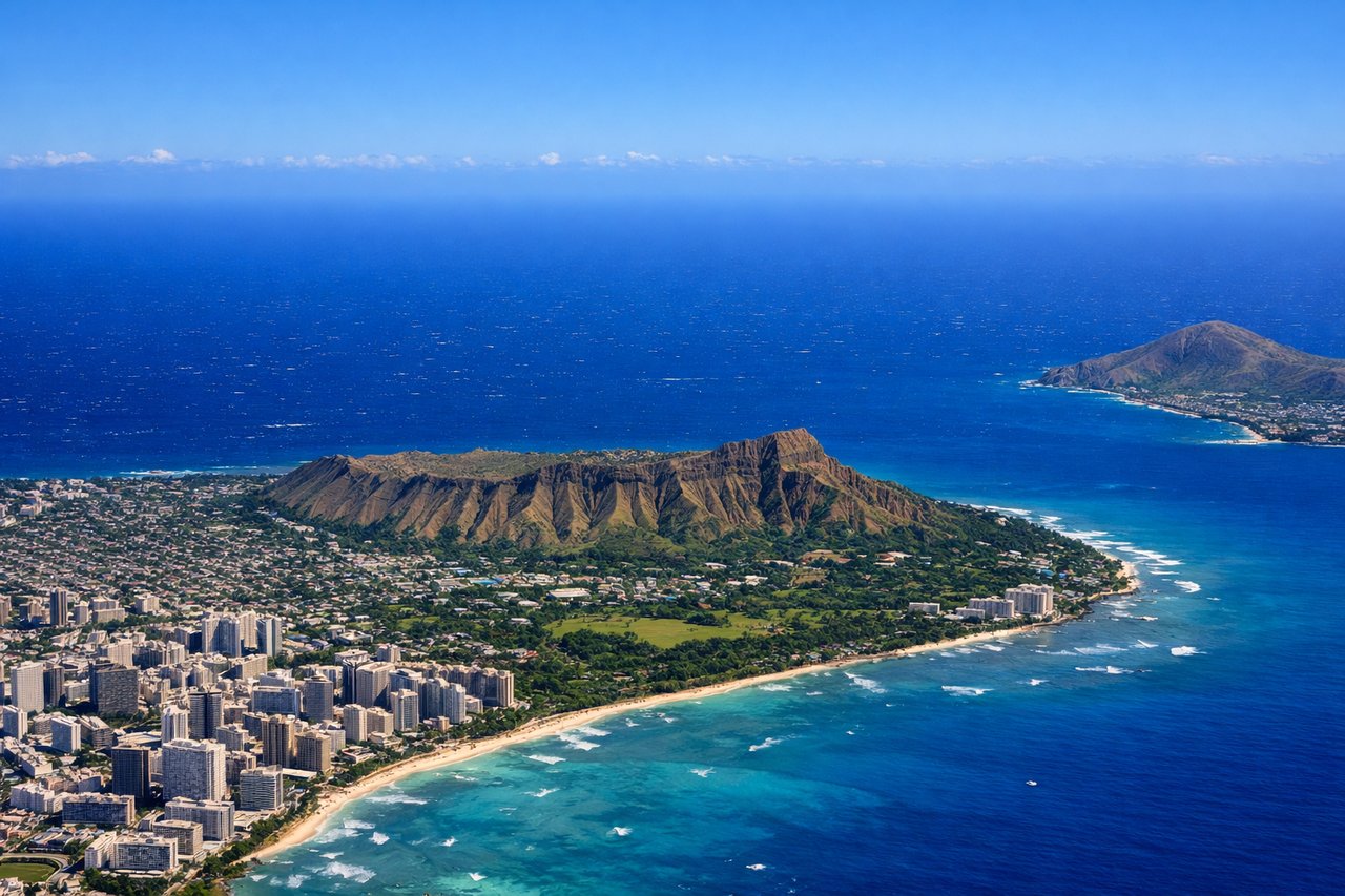
RIGHTRight-side seats capture the Ko'olau Range and windward Oahu as you climb out. Honolulu typically departs runway 08L/08R (eastbound), so right seats get the dramatic volcanic ridgeline and Kailua Bay during initial climb.
Landing at MAJ
LEFTLeft seats offer the best view of Majuro Atoll's lagoon and runway approach. Aircraft typically land on runway 09 (eastbound), so left-side passengers see the atoll's distinctive circular reef structure and the lagoon's bright turquoise water as you descend.
Landmarks on this routeAll landmarks →
Will your flight be in sunlight?
See exactly which side of the plane gets sun and shade at your departure time.
About This Route
Which side of the plane should I sit on flying from Honolulu International (HNL) to Marshall Islands International (MAJ)?
Sit on the Right side of the plane for the best views on flights from Honolulu to Majuro. Right side wins for takeoff's dramatic Ko'olau Range and Kailua Bay views, which are more visually striking than Majuro's lagoon approach. The outbound climb offers more varied topography than the landing sequence.
What can I see during takeoff from Honolulu International in Honolulu?
During takeoff from Honolulu International (HNL), sit on the Right side for the best views. Right-side seats capture the Ko'olau Range and windward Oahu as you climb out. Honolulu typically departs runway 08L/08R (eastbound), so right seats get the dramatic volcanic ridgeline and Kailua Bay during initial climb. Notable sights include: Ko'olau Range (jagged volcanic ridge), Kailua Bay (turquoise water east of Oahu), Windward Oahu coastline, Diamond Head crater (visible to the south as you turn).
What can I see when landing at Marshall Islands International in Majuro?
When landing at Marshall Islands International (MAJ), sit on the Left side for the best views. Left seats offer the best view of Majuro Atoll's lagoon and runway approach. Aircraft typically land on runway 09 (eastbound), so left-side passengers see the atoll's distinctive circular reef structure and the lagoon's bright turquoise water as you descend. Notable sights include: Majuro Atoll lagoon (bright turquoise enclosed water), outer reef (dark line marking atoll boundary), Rita Island and eastern islets, Pacific Ocean (deep blue beyond the reef).
How long is the flight from Honolulu to Majuro?
The flight from Honolulu International (HNL) to Marshall Islands International (MAJ) takes Approximately 3 hours 15 minutes.
What does the Honolulu to Majuro flight path pass over?
Open Pacific Ocean with no significant land features. The flight path crosses roughly 1,200 nautical miles of deep ocean between Oahu and Majuro. At cruise altitude (around 25,000-31,000 feet), you'll see only ocean, occasional cloud formations, and the curvature of the horizon. No islands or atolls are visible along the direct route—the Marshall Islands lie well east of the direct great-circle path from Honolulu.