Right-side seats capture the dramatic volcanic landscape on departure (Mauna Kea and Mauna Loa) and still provide reasonable views of West Maui's peaks during approach. The 50-minute flight path crosses the Alenuihaha Channel, where right-side seats see Maui growing larger throughout descent.
Flown ITO to OGG? Did we get it right?
Flight Path
Hilo to Kahului is 121 miles (195 km), a flight of about 50 minutes.
Alenuihaha Channel (deep ocean strait between Hawaii and Maui, typically 4,000-6,000 feet deep), Haleakala's windward slopes becoming increasingly prominent as you approach Maui, occasional views of Molokai to the northwest depending on flight path routing
Great circle distance and headings ›


Phase by phase
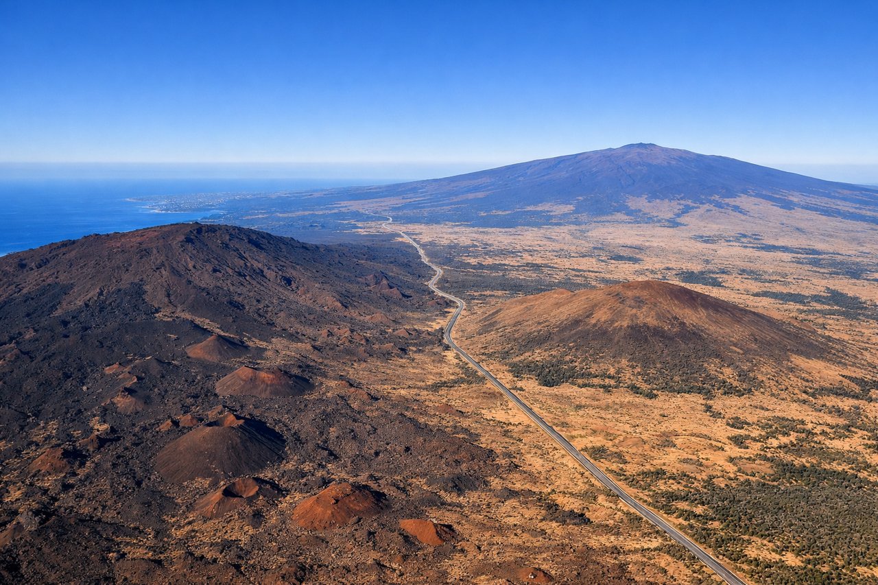
Takeoff from ITO
RIGHTHilo typically departs runway 08 (eastbound) or 26 (westbound). Right-side seats on either departure capture Mauna Kea and Mauna Loa's snow-capped summits rising inland, with Hilo Bay and the Hamakua Coast receding below. Westbound departures (runway 26) give the best angle on both shield volcanoes.
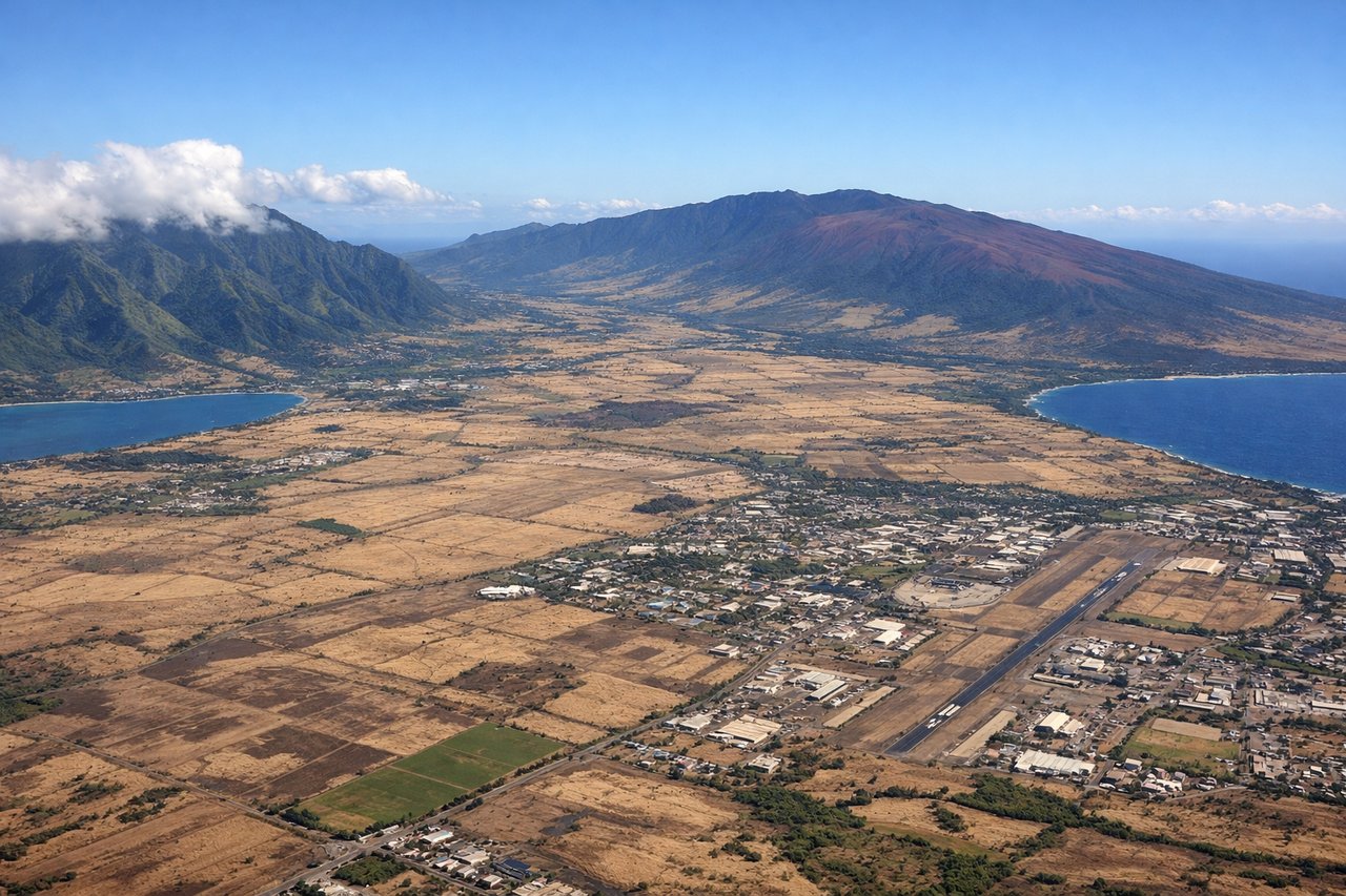
Landing at OGG
LEFTKahului typically lands runway 02 (northbound) or 20 (southbound). Left-side seats on northbound approaches (runway 02) provide clear views of West Maui's Pu'u Kukui summit and the West Maui watershed, with the isthmus and Haleakala on Maui's eastern side visible across the channel.
Will your flight be in sunlight?
Pick a date and time in the Sun Map to watch the sun move across your whole flight.
About This Route
Which side of the plane should I sit on flying from Hilo International (ITO) to Kahului (OGG)?
Sit on the Right side of the plane for the best views on flights from Hilo to Kahului. Right-side seats capture the dramatic volcanic landscape on departure (Mauna Kea and Mauna Loa) and still provide reasonable views of West Maui's peaks during approach. The 50-minute flight path crosses the Alenuihaha Channel, where right-side seats see Maui growing larger throughout descent.
What can I see during takeoff from Hilo International in Hilo?
During takeoff from Hilo International (ITO), sit on the Right side for the best views. Hilo typically departs runway 08 (eastbound) or 26 (westbound). Right-side seats on either departure capture Mauna Kea and Mauna Loa's snow-capped summits rising inland, with Hilo Bay and the Hamakua Coast receding below. Westbound departures (runway 26) give the best angle on both shield volcanoes. Notable sights include: Mauna Kea (13,796 ft, often snow-capped), Mauna Loa (13,681 ft), Hilo Bay, Hamakua Coast cliffs.
What can I see when landing at Kahului in Kahului?
When landing at Kahului (OGG), sit on the Left side for the best views. Kahului typically lands runway 02 (northbound) or 20 (southbound). Left-side seats on northbound approaches (runway 02) provide clear views of West Maui's Pu'u Kukui summit and the West Maui watershed, with the isthmus and Haleakala on Maui's eastern side visible across the channel. Notable sights include: Pu'u Kukui (5,788 ft, West Maui), Haleakala (10,023 ft, East Maui), Kahului Bay, Molokai's distant profile.
How long is the flight from Hilo to Kahului?
The flight from Hilo International (ITO) to Kahului (OGG) takes about 50 minutes. The shortest flight path between them is 121 miles (195 km); winds and air traffic control usually add a few percent.
What does the Hilo to Kahului flight path pass over?
Alenuihaha Channel (deep ocean strait between Hawaii and Maui, typically 4,000-6,000 feet deep), Haleakala's windward slopes becoming increasingly prominent as you approach Maui, occasional views of Molokai to the northwest depending on flight path routing