While the landing favors the left, the takeoff from Hilo is visually superior with the Big Island's dramatic volcanic peaks and varied terrain. The flight path itself crosses mostly open ocean and empty Arizona desert, so the endpoints matter most. Right-side seats capture the more spectacular scenery overall.
Flown ITO to PHX? Did we get it right?
Flight Path
Hilo to Phoenix is 2,800 miles (4,507 km), a flight of about 5 hours 15 minutes.
The flight crosses the Pacific Ocean for roughly 2,000 miles with no significant landmarks visible. You'll pass over open water with occasional cloud formations. As you approach Arizona airspace, the Colorado Plateau begins to appear on the horizon, but the central portion of the flight offers minimal scenic features—mostly ocean and then high-altitude desert with few distinctive landmarks until the Phoenix basin becomes visible during descent.
Great circle distance and headings ›

Phase by phase
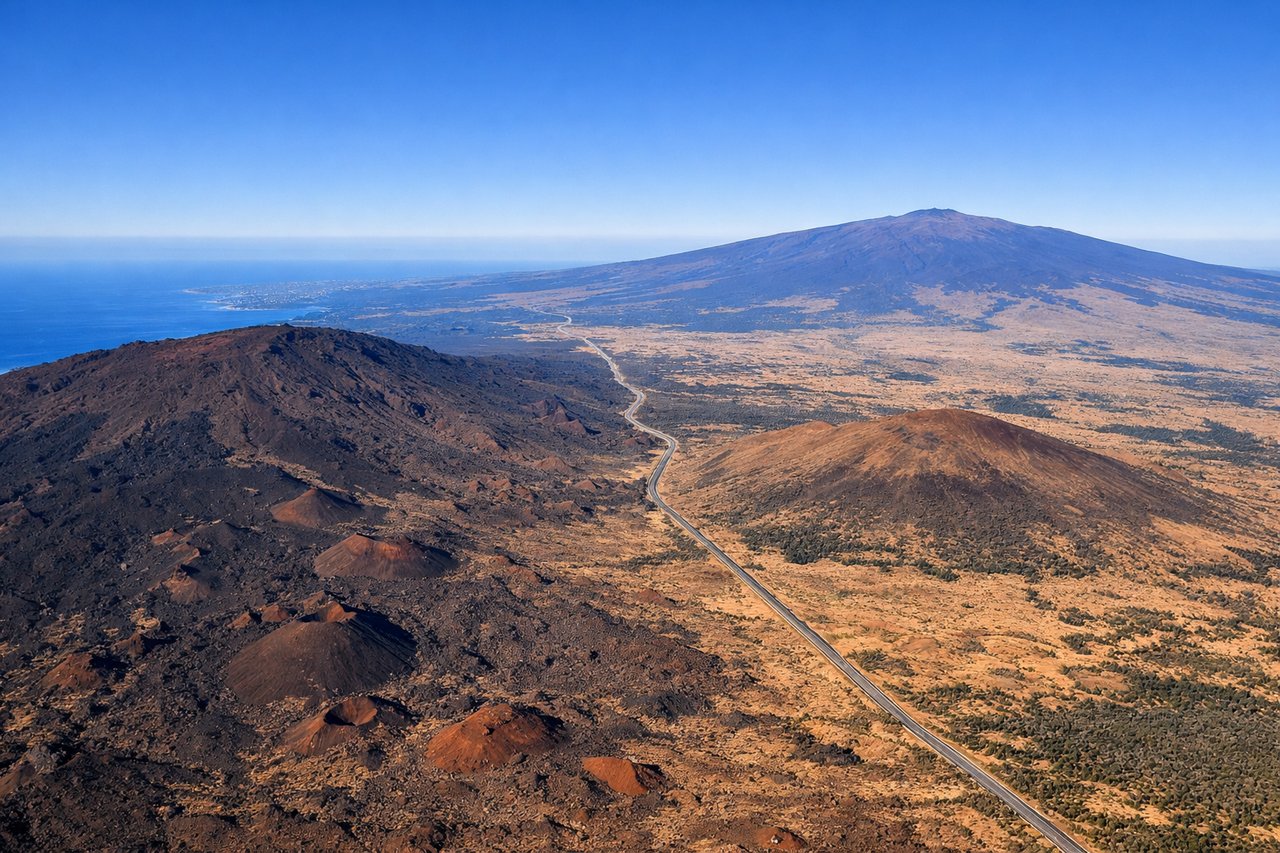
Takeoff from ITO
RIGHTRight-side seats capture the Big Island's dramatic volcanic landscape and the Mauna Kea and Mauna Loa massifs as you climb out over the island. The left side faces open ocean with minimal visual interest during departure.

Landing at PHX
LEFTLeft-side seats offer views of the Phoenix metropolitan area and the surrounding desert basin during approach. You'll see the Salt River, downtown Phoenix, and the surrounding Sonoran Desert terrain. Right-side views are mostly empty desert to the east.
Will your flight be in sunlight?
Pick a date and time in the Sun Map to watch the sun move across your whole flight.
About This Route
Which side of the plane should I sit on flying from Hilo International (ITO) to Phoenix Sky Harbor International (PHX)?
Sit on the Right side of the plane for the best views on flights from Hilo to Phoenix. While the landing favors the left, the takeoff from Hilo is visually superior with the Big Island's dramatic volcanic peaks and varied terrain. The flight path itself crosses mostly open ocean and empty Arizona desert, so the endpoints matter most. Right-side seats capture the more spectacular scenery overall.
What can I see during takeoff from Hilo International in Hilo?
During takeoff from Hilo International (ITO), sit on the Right side for the best views. Right-side seats capture the Big Island's dramatic volcanic landscape and the Mauna Kea and Mauna Loa massifs as you climb out over the island. The left side faces open ocean with minimal visual interest during departure. Notable sights include: Mauna Kea (13,796 ft summit visible in clear conditions), Mauna Loa shield volcano, Hilo Bay coastline, Saddle Road corridor between the two major peaks.
What can I see when landing at Phoenix Sky Harbor International in Phoenix?
When landing at Phoenix Sky Harbor International (PHX), sit on the Left side for the best views. Left-side seats offer views of the Phoenix metropolitan area and the surrounding desert basin during approach. You'll see the Salt River, downtown Phoenix, and the surrounding Sonoran Desert terrain. Right-side views are mostly empty desert to the east. Notable sights include: Phoenix downtown skyline and urban sprawl, Salt River (visible as a linear green corridor), South Mountain Park ridge, Superstition Mountains (distant eastern horizon).
How long is the flight from Hilo to Phoenix?
The flight from Hilo International (ITO) to Phoenix Sky Harbor International (PHX) takes about 5 hours 15 minutes. The shortest flight path between them is 2,800 miles (4,507 km); winds and air traffic control usually add a few percent.
What does the Hilo to Phoenix flight path pass over?
The flight crosses the Pacific Ocean for roughly 2,000 miles with no significant landmarks visible. You'll pass over open water with occasional cloud formations. As you approach Arizona airspace, the Colorado Plateau begins to appear on the horizon, but the central portion of the flight offers minimal scenic features—mostly ocean and then high-altitude desert with few distinctive landmarks until the Phoenix basin becomes visible during descent.