While both sides score equally for the full flight due to the ocean-dominated cruise phase (5+ hours over open Pacific), the left side edges ahead on landing quality. The approach to Hilo offers genuine volcanic scenery—Mauna Kea's distinctive dome and the windward coast—which outweighs the right side's open ocean views. Takeoff is comparable on both sides, but the landing experience tips the balance left.
Flown LAS to ITO? Did we get it right?
Flight Path
Las Vegas to Hilo is 2,661 miles (4,283 km), a flight of about 5 hours 45 minutes.
Open Pacific Ocean dominates the cruise phase. Passengers may glimpse the Big Island's leeward (Kona) coast approximately 30-40 minutes before landing, visible as a darker line on the horizon with Mauna Loa's massive profile (13,681 ft) rising behind it. The flight path typically crosses the channel between the Big Island and Maui, though Maui itself remains below the horizon for most cruising altitude. No significant landmarks are visible during the middle 3-4 hours of the flight—this is pure open ocean at 35,000 feet.
Great circle distance and headings ›Phase by phase
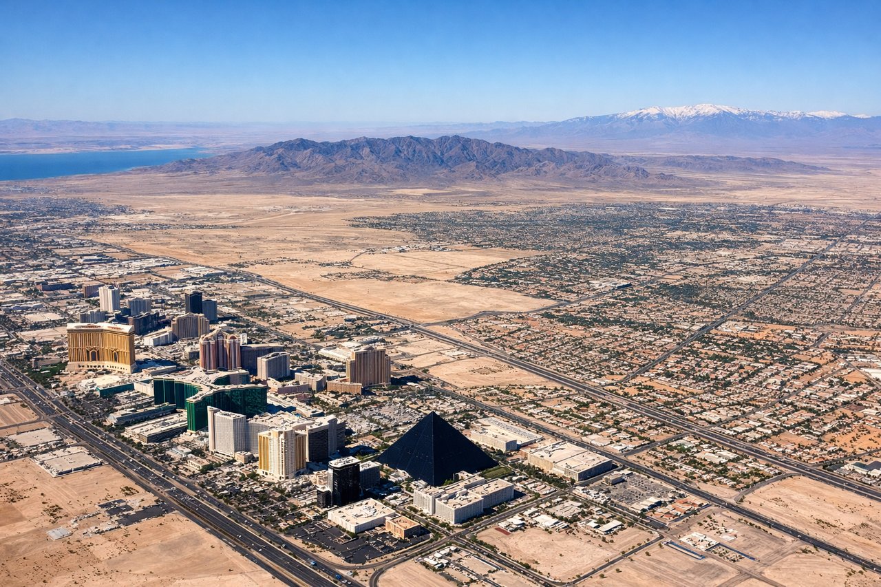
Takeoff from LAS
RIGHTDepartures from LAS typically use south-bound runways (01L/01R) for noise abatement, offering right-side views of Henderson and the southern Las Vegas Valley before climbing over the desert. Left side sees the city center and Strip but from a less favorable angle during initial climb.
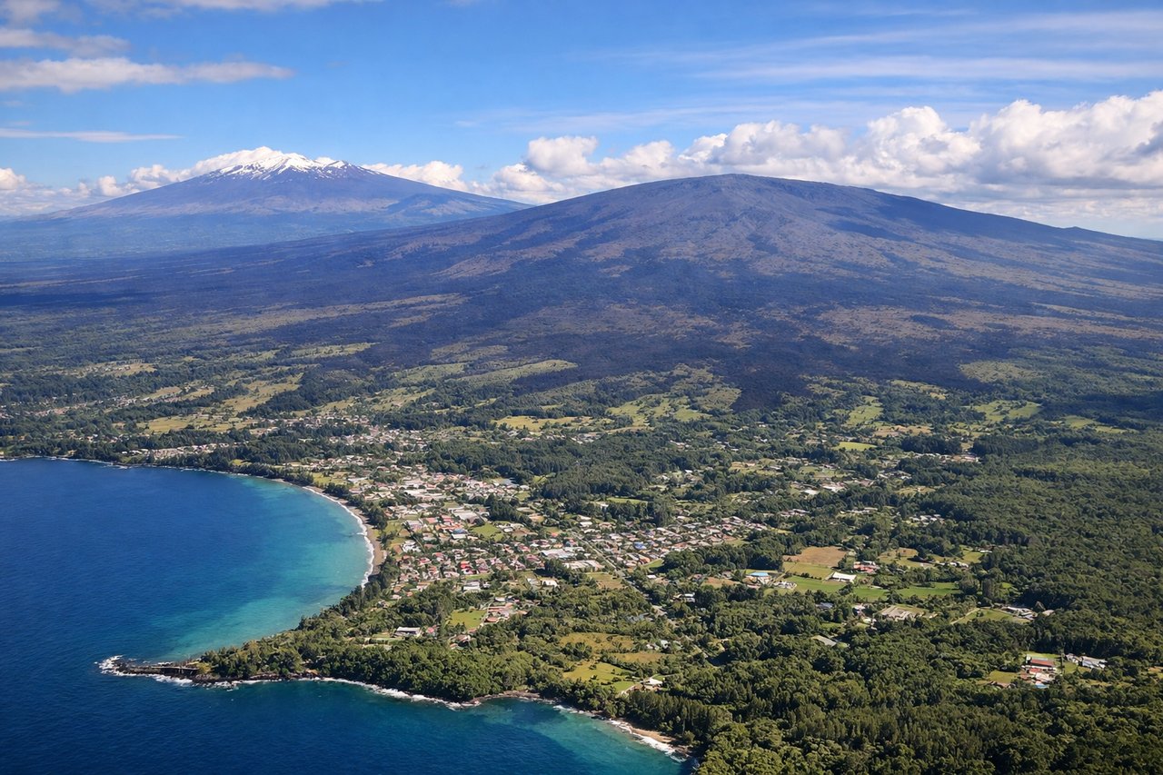
Landing at ITO
LEFTApproach to Hilo typically descends from the northeast over the Hilo Bay and coastal waters, with left-side views of the Big Island's windward coast, Mauna Kea volcano (visible as a massive dome), and Hilo Bay itself. Right side sees open Pacific Ocean for most of the descent.
Will your flight be in sunlight?
Pick a date and time in the Sun Map to watch the sun move across your whole flight.
About This Route
Which side of the plane should I sit on flying from Mc Carran International (LAS) to Hilo International (ITO)?
Sit on the Left side of the plane for the best views on flights from Las Vegas to Hilo. While both sides score equally for the full flight due to the ocean-dominated cruise phase (5+ hours over open Pacific), the left side edges ahead on landing quality. The approach to Hilo offers genuine volcanic scenery—Mauna Kea's distinctive dome and the windward coast—which outweighs the right side's open ocean views. Takeoff is comparable on both sides, but the landing experience tips the balance left.
What can I see during takeoff from Mc Carran International in Las Vegas?
During takeoff from Mc Carran International (LAS), sit on the Right side for the best views. Departures from LAS typically use south-bound runways (01L/01R) for noise abatement, offering right-side views of Henderson and the southern Las Vegas Valley before climbing over the desert. Left side sees the city center and Strip but from a less favorable angle during initial climb. Notable sights include: Henderson urban sprawl, southern Las Vegas Valley floor, Spring Mountain Range to the west (distant), Mojave Desert expanse.
What can I see when landing at Hilo International in Hilo?
When landing at Hilo International (ITO), sit on the Left side for the best views. Approach to Hilo typically descends from the northeast over the Hilo Bay and coastal waters, with left-side views of the Big Island's windward coast, Mauna Kea volcano (visible as a massive dome), and Hilo Bay itself. Right side sees open Pacific Ocean for most of the descent. Notable sights include: Mauna Kea volcano (13,796 ft, visible as a broad dome), Hilo Bay and harbor, windward coastal cliffs and vegetation, Saddle Road corridor between Mauna Kea and Mauna Loa.
How long is the flight from Las Vegas to Hilo?
The flight from Mc Carran International (LAS) to Hilo International (ITO) takes about 5 hours 45 minutes. The shortest flight path between them is 2,661 miles (4,283 km); winds and air traffic control usually add a few percent.
What does the Las Vegas to Hilo flight path pass over?
Open Pacific Ocean dominates the cruise phase. Passengers may glimpse the Big Island's leeward (Kona) coast approximately 30-40 minutes before landing, visible as a darker line on the horizon with Mauna Loa's massive profile (13,681 ft) rising behind it. The flight path typically crosses the channel between the Big Island and Maui, though Maui itself remains below the horizon for most cruising altitude. No significant landmarks are visible during the middle 3-4 hours of the flight—this is pure open ocean at 35,000 feet.