The right side wins overall because the departure from Manila delivers the most dramatic and varied scenery — Laguna de Bay, Taal Volcano, and the Sierra Madre — which are genuinely spectacular. The landing view on the left at Busan is good but more industrial. Right-side passengers also track the Philippine archipelago's northern islands and get glimpses of the East China Sea and the Korean coastline on descent.
Flown MNL to PUS? Did we get it right?
Flight Path
Manila to Kimhae is 1,511 miles (2,431 km), a flight of about 3 hours 55 minutes.
The flight tracks northeast over the northern Philippines including Luzon's Cagayan Valley and the Babuyan Islands, then crosses the Luzon Strait into the South China Sea / East China Sea transition zone, passes near Taiwan's northern tip (visible on clear days to the right), crosses the East China Sea, and approaches Korea over the Korea Strait. The Yellow Sea coastline of southern Korea comes into view on descent.
Great circle distance and headings ›Phase by phase
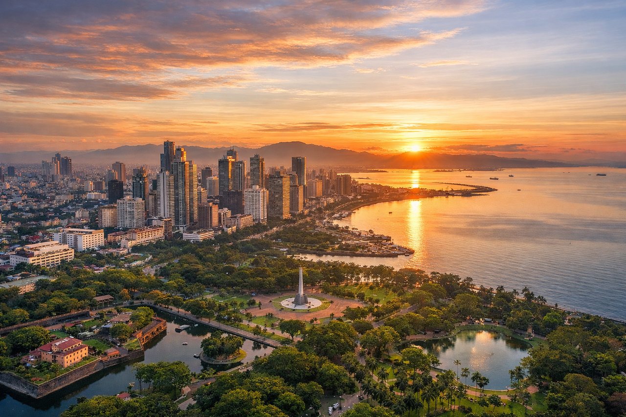
Takeoff from MNL
RIGHTNAIA's primary departure runway 06 sends aircraft northeast over Manila Bay on the left, but the right side captures Metro Manila's dense urban sprawl, the Pasig River threading through the city, and Laguna de Bay — the largest lake in the Philippines — coming into view as the aircraft climbs and turns northward. The right side also picks up the Sierra Madre mountain range along the eastern horizon.
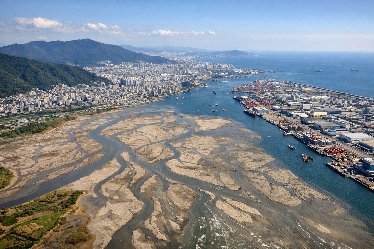
Landing at PUS
LEFTGimhae Airport sits at the mouth of the Nakdong River delta on the western edge of Busan. Runway 36R/18L is the primary runway, and arrivals from the south on runway 36 approach over the Korea Strait. The left side gives a clear view of the Nakdong River estuary, the densely built Busan metropolitan area, and the mountainous terrain of Gyeongsangnam-do province inland.
Will your flight be in sunlight?
Pick a date and time in the Sun Map to watch the sun move across your whole flight.
About This Route
Which side of the plane should I sit on flying from Ninoy Aquino International (MNL) to Gimhae International (PUS)?
Sit on the Right side of the plane for the best views on flights from Manila to Kimhae. The right side wins overall because the departure from Manila delivers the most dramatic and varied scenery — Laguna de Bay, Taal Volcano, and the Sierra Madre — which are genuinely spectacular. The landing view on the left at Busan is good but more industrial. Right-side passengers also track the Philippine archipelago's northern islands and get glimpses of the East China Sea and the Korean coastline on descent.
What can I see during takeoff from Ninoy Aquino International in Manila?
During takeoff from Ninoy Aquino International (MNL), sit on the Right side for the best views. NAIA's primary departure runway 06 sends aircraft northeast over Manila Bay on the left, but the right side captures Metro Manila's dense urban sprawl, the Pasig River threading through the city, and Laguna de Bay — the largest lake in the Philippines — coming into view as the aircraft climbs and turns northward. The right side also picks up the Sierra Madre mountain range along the eastern horizon. Notable sights include: Laguna de Bay (massive lake southeast of Manila), Sierra Madre mountain range (eastern horizon), Pasig River corridor through Metro Manila, Taal Volcano and Taal Lake (visible to the south on climb-out).
What can I see when landing at Gimhae International in Kimhae?
When landing at Gimhae International (PUS), sit on the Left side for the best views. Gimhae Airport sits at the mouth of the Nakdong River delta on the western edge of Busan. Runway 36R/18L is the primary runway, and arrivals from the south on runway 36 approach over the Korea Strait. The left side gives a clear view of the Nakdong River estuary, the densely built Busan metropolitan area, and the mountainous terrain of Gyeongsangnam-do province inland. Notable sights include: Nakdong River estuary and delta wetlands, Busan metropolitan skyline to the east, Korea Strait approach waters, Geoje Island visible to the south.
How long is the flight from Manila to Kimhae?
The flight from Ninoy Aquino International (MNL) to Gimhae International (PUS) takes about 3 hours 55 minutes. The shortest flight path between them is 1,511 miles (2,431 km); winds and air traffic control usually add a few percent.
What does the Manila to Kimhae flight path pass over?
The flight tracks northeast over the northern Philippines including Luzon's Cagayan Valley and the Babuyan Islands, then crosses the Luzon Strait into the South China Sea / East China Sea transition zone, passes near Taiwan's northern tip (visible on clear days to the right), crosses the East China Sea, and approaches Korea over the Korea Strait. The Yellow Sea coastline of southern Korea comes into view on descent.