The right side captures the dramatic Nakdong estuary and Busan coastal scenery on departure, and during the cruise over the South China Sea corridor offers views of the Philippine archipelago's eastern islands on approach. The Manila Bay landing view on the left is excellent, but the departure scenery on the right is more geographically distinctive and the right side also picks up views of the Luzon coastline during descent.
Flown PUS to MNL? Did we get it right?
Flight Path
Kimhae to Manila is 1,511 miles (2,431 km), a flight of about 3 hours 55 minutes.
The flight tracks southwest over the Korea Strait, then crosses the East China Sea passing well east of Taiwan's northern tip, before crossing the Luzon Strait and descending over the northern Philippine Sea toward Luzon. Visible features during cruise include scattered island chains of the Ryukyu arc on the far left horizon, the deep blue of the South China Sea transition zone, and the rugged green mountains of northern Luzon appearing as the aircraft begins descent over the Sierra Madre range.
Great circle distance and headings ›Phase by phase
Takeoff from PUS
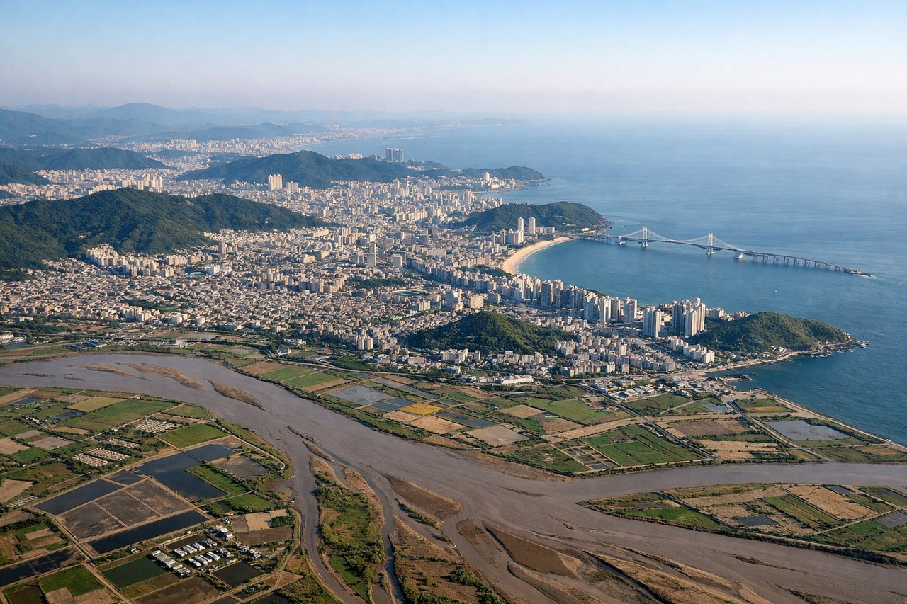
RIGHTGimhae's primary departure runway 36L/18R runs roughly north-south along the Nakdong River estuary. Departing northbound on 36L, a right turn toward the southwest puts the right side facing the Nakdong River delta and the open Korea Strait. The city of Busan's dense urban core and the Geumjeong Mountain ridge are visible on the right as the aircraft banks south.
Landing at MNL
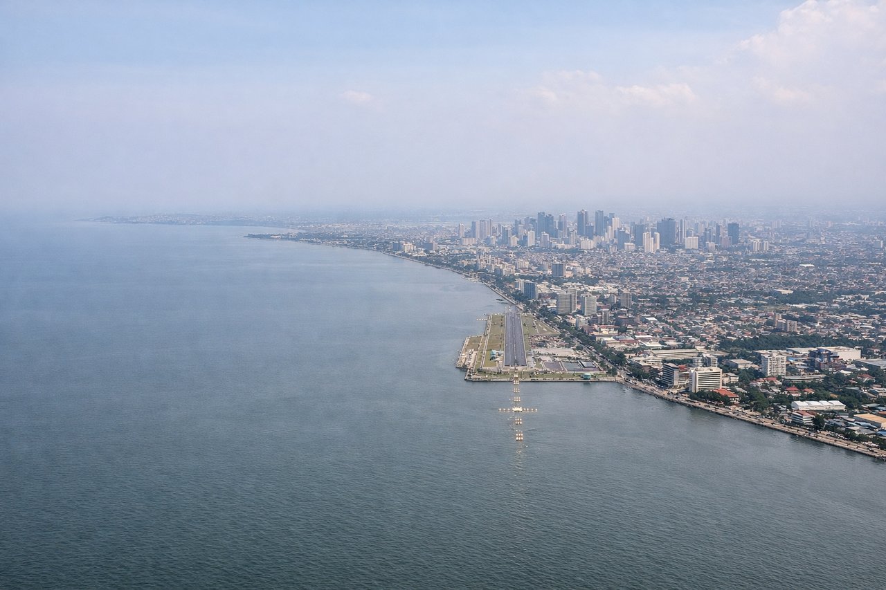
LEFTNAIA's primary arrival runway 06/24 has aircraft typically landing on runway 06, approaching from the west over Manila Bay. On this heading, the left side faces north over Manila Bay and the Manila city skyline, while the right side looks south over Laguna de Bay and Cavite. The left seat gives the iconic Manila Bay approach view with the city spread along the waterfront.
Will your flight be in sunlight?
Pick a date and time in the Sun Map to watch the sun move across your whole flight.
About This Route
Which side of the plane should I sit on flying from Gimhae International (PUS) to Ninoy Aquino International (MNL)?
Sit on the Right side of the plane for the best views on flights from Kimhae to Manila. The right side captures the dramatic Nakdong estuary and Busan coastal scenery on departure, and during the cruise over the South China Sea corridor offers views of the Philippine archipelago's eastern islands on approach. The Manila Bay landing view on the left is excellent, but the departure scenery on the right is more geographically distinctive and the right side also picks up views of the Luzon coastline during descent.
What can I see during takeoff from Gimhae International in Kimhae?
During takeoff from Gimhae International (PUS), sit on the Right side for the best views. Gimhae's primary departure runway 36L/18R runs roughly north-south along the Nakdong River estuary. Departing northbound on 36L, a right turn toward the southwest puts the right side facing the Nakdong River delta and the open Korea Strait. The city of Busan's dense urban core and the Geumjeong Mountain ridge are visible on the right as the aircraft banks south. Notable sights include: Nakdong River estuary and tidal flats, Busan city center and Gwangandaegyo Bridge, Korea Strait open water, Geumjeong Mountain ridge.
What can I see when landing at Ninoy Aquino International in Manila?
When landing at Ninoy Aquino International (MNL), sit on the Left side for the best views. NAIA's primary arrival runway 06/24 has aircraft typically landing on runway 06, approaching from the west over Manila Bay. On this heading, the left side faces north over Manila Bay and the Manila city skyline, while the right side looks south over Laguna de Bay and Cavite. The left seat gives the iconic Manila Bay approach view with the city spread along the waterfront. Notable sights include: Manila Bay and waterfront, Manila city skyline and Intramuros district, Laguna de Bay visible to the south, Bataan Peninsula across the bay.
How long is the flight from Kimhae to Manila?
The flight from Gimhae International (PUS) to Ninoy Aquino International (MNL) takes about 3 hours 55 minutes. The shortest flight path between them is 1,511 miles (2,431 km); winds and air traffic control usually add a few percent.
What does the Kimhae to Manila flight path pass over?
The flight tracks southwest over the Korea Strait, then crosses the East China Sea passing well east of Taiwan's northern tip, before crossing the Luzon Strait and descending over the northern Philippine Sea toward Luzon. Visible features during cruise include scattered island chains of the Ryukyu arc on the far left horizon, the deep blue of the South China Sea transition zone, and the rugged green mountains of northern Luzon appearing as the aircraft begins descent over the Sierra Madre range.