Manila to Vancouver is 6,558 miles (10,554 km), a flight of about 10 hours 45 minutes.
The left side strings together Manila Bay and the Bataan coastline at takeoff, likely glimpses of the Kamchatka Peninsula, Aleutian Islands and Gulf of Alaska coastline where the great-circle route runs close to land during cruise, and a mountain-framed descent into Vancouver — giving it more varied, land-based scenery across the full flight than the right side's largely featureless open-ocean view.
Flight Path
North Pacific Ocean, with the flight path passing near the Kamchatka Peninsula and the Aleutian Island chain before curving southeast over the Gulf of Alaska toward the British Columbia coast
Great circle distance and headings ›


Phase by phase
Takeoff from MNL
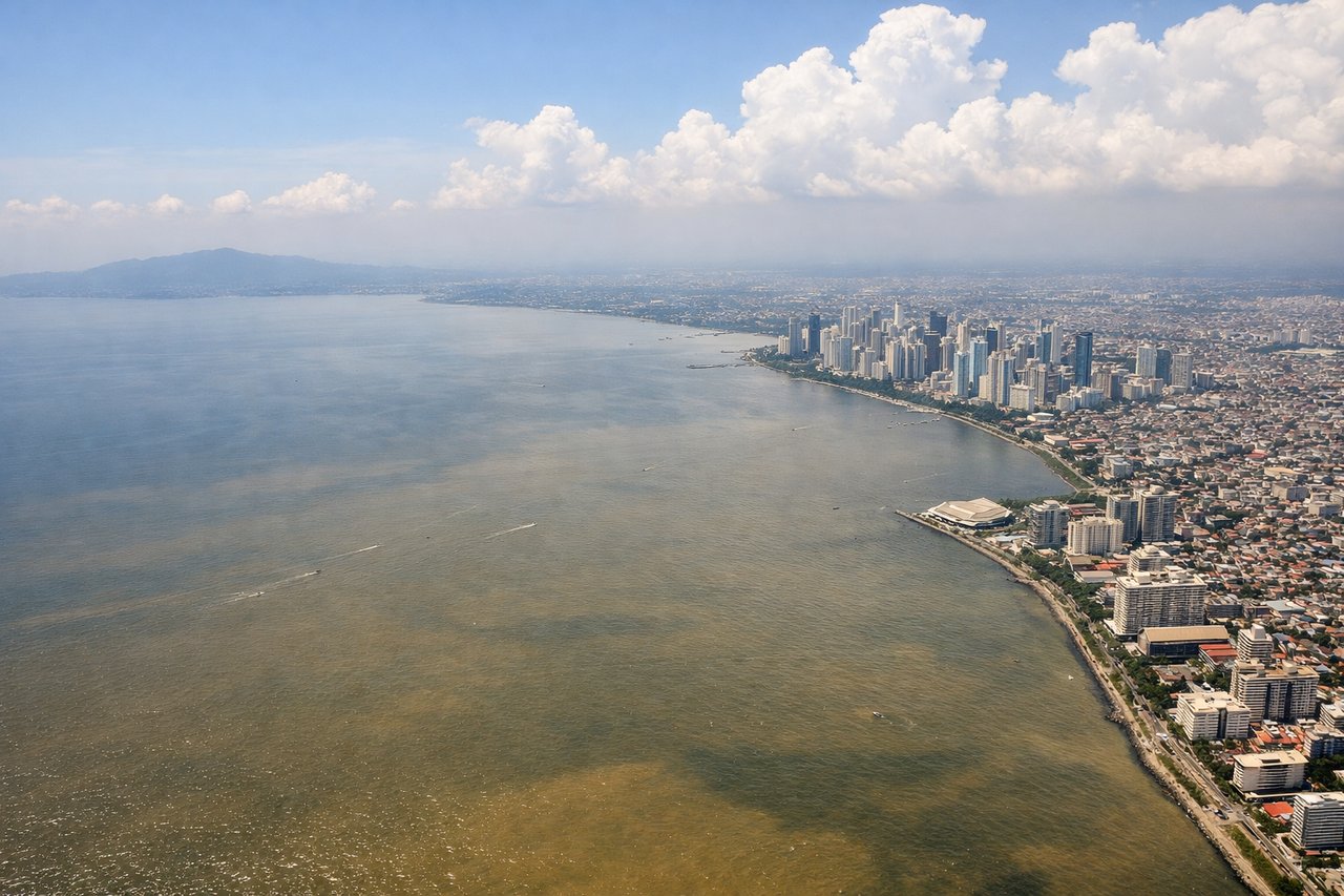
LEFTDeparting NAIA on runway 06, the initial northeast climb puts Manila Bay, the Bataan Peninsula and Corregidor Island on the left as the city's skyline falls away below. The right side only shows the flatter Laguna de Bay basin and hazy Sierra Madre foothills.
Landing at YVR
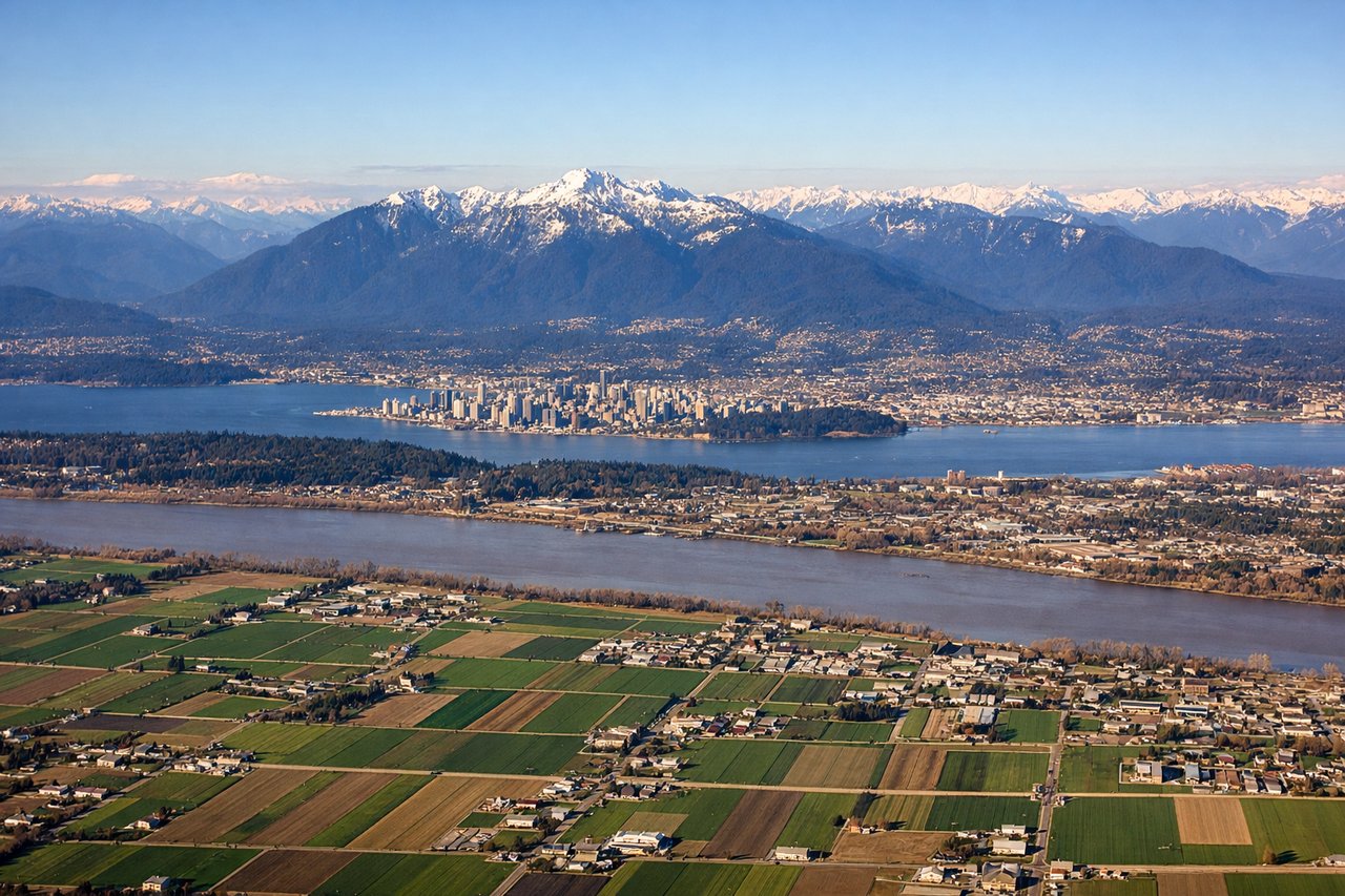
LEFTOn the descent into YVR from the north down the BC coast, the left side faces inland toward the snow-capped Coast Mountains and the Fraser Valley, offering a dramatic mountain backdrop as the plane lines up for landing. The right side mostly shows open water of the Strait of Georgia with less texture.
Landmarks on this routeAll landmarks →
Will your flight be in sunlight?
Pick a date and time in the Sun Map to watch the sun move across your whole flight.
About This Route
Which side of the plane should I sit on flying from Ninoy Aquino International (MNL) to Vancouver International (YVR)?
Sit on the Left side of the plane for the best views on flights from Manila to Vancouver. The left side strings together Manila Bay and the Bataan coastline at takeoff, likely glimpses of the Kamchatka Peninsula, Aleutian Islands and Gulf of Alaska coastline where the great-circle route runs close to land during cruise, and a mountain-framed descent into Vancouver — giving it more varied, land-based scenery across the full flight than the right side's largely featureless open-ocean view.
What can I see during takeoff from Ninoy Aquino International in Manila?
During takeoff from Ninoy Aquino International (MNL), sit on the Left side for the best views. Departing NAIA on runway 06, the initial northeast climb puts Manila Bay, the Bataan Peninsula and Corregidor Island on the left as the city's skyline falls away below. The right side only shows the flatter Laguna de Bay basin and hazy Sierra Madre foothills. Notable sights include: Manila Bay, Corregidor Island, Bataan Peninsula mountains, Manila/Makati skyline.
What can I see when landing at Vancouver International in Vancouver?
When landing at Vancouver International (YVR), sit on the Left side for the best views. On the descent into YVR from the north down the BC coast, the left side faces inland toward the snow-capped Coast Mountains and the Fraser Valley, offering a dramatic mountain backdrop as the plane lines up for landing. The right side mostly shows open water of the Strait of Georgia with less texture. Notable sights include: Coast Mountains, Mount Garibaldi, Fraser River delta, North Shore peaks (Grouse/Seymour).
How long is the flight from Manila to Vancouver?
The flight from Ninoy Aquino International (MNL) to Vancouver International (YVR) takes about 10 hours 45 minutes. The shortest flight path between them is 6,558 miles (10,554 km); winds and air traffic control usually add a few percent.
What does the Manila to Vancouver flight path pass over?
North Pacific Ocean, with the flight path passing near the Kamchatka Peninsula and the Aleutian Island chain before curving southeast over the Gulf of Alaska toward the British Columbia coast