The outbound climb from Narita offers more dramatic and iconic scenery with Mount Fuji and the Kanto Plain. While the Dulles approach provides good mountain views, Mount Fuji is a more visually distinctive landmark and the takeoff phase typically offers clearer, less hazy conditions than the descent into Washington.
Flown NRT to IAD? Did we get it right?
Flight Path
Tokyo to Washington is 6,738 miles (10,844 km), a flight of about 13 hours 30 minutes.
The flight path crosses the North Pacific, passing north of the Hawaiian Islands (typically not visible from cruise altitude on this route). Over the continental United States, the aircraft crosses the Rocky Mountains (visible as a major north-south mountain range during descent into the eastern U.S.), and the Great Plains (vast flat agricultural expanse). The Appalachian Mountains become visible during final descent into the Washington D.C. region.
Great circle distance and headings ›


Phase by phase
Takeoff from NRT
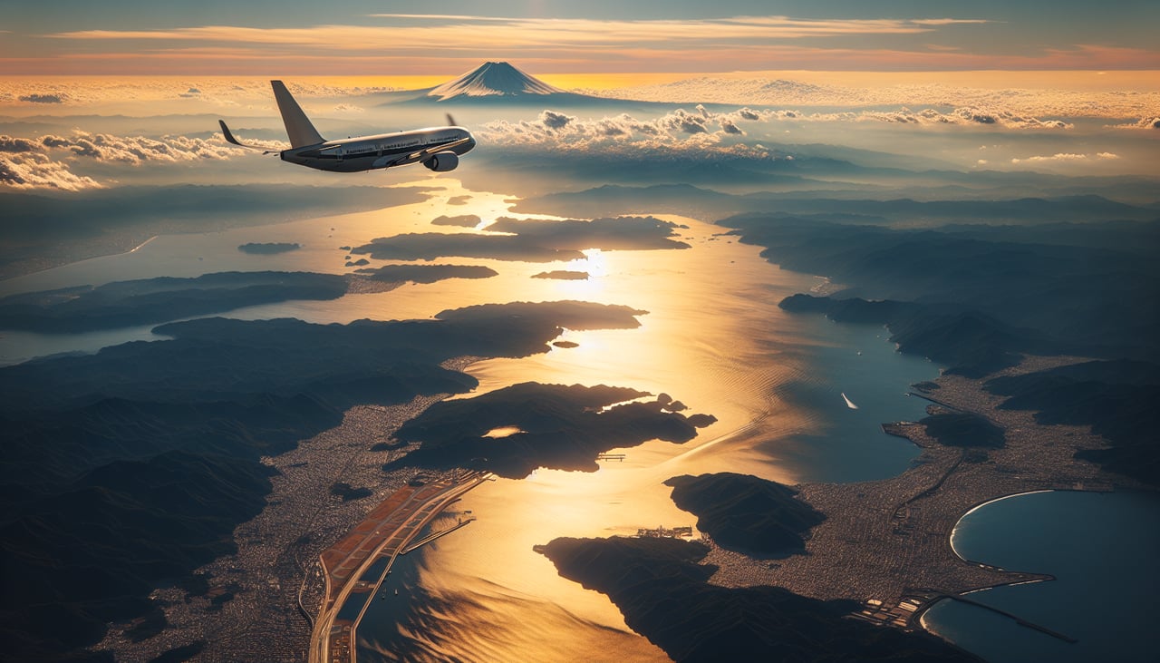
RIGHTRight-side seats offer views of Mount Fuji and the Kanto Plain as the aircraft climbs out westbound from Narita. The volcano sits southwest of the airport and becomes increasingly visible as altitude builds during the initial climb phase.
Landing at IAD
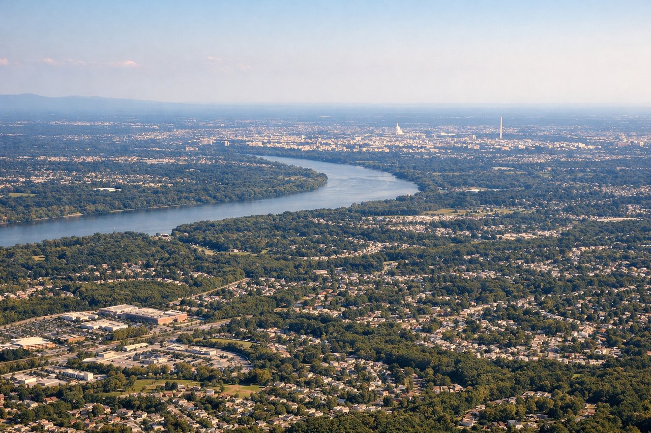
LEFTLeft-side seats provide excellent views during descent into Dulles. The aircraft approaches from the east, and left-side passengers see the Blue Ridge Mountains, Shenandoah Valley, and the Potomac River as the plane descends through Virginia airspace toward the airport.
Will your flight be in sunlight?
Pick a date and time in the Sun Map to watch the sun move across your whole flight.
About This Route
Which side of the plane should I sit on flying from New Tokyo International (NRT) to Washington Dulles International (IAD)?
Sit on the Right side of the plane for the best views on flights from Tokyo to Washington. The outbound climb from Narita offers more dramatic and iconic scenery with Mount Fuji and the Kanto Plain. While the Dulles approach provides good mountain views, Mount Fuji is a more visually distinctive landmark and the takeoff phase typically offers clearer, less hazy conditions than the descent into Washington.
What can I see during takeoff from New Tokyo International in Tokyo?
During takeoff from New Tokyo International (NRT), sit on the Right side for the best views. Right-side seats offer views of Mount Fuji and the Kanto Plain as the aircraft climbs out westbound from Narita. The volcano sits southwest of the airport and becomes increasingly visible as altitude builds during the initial climb phase. Notable sights include: Mount Fuji (3,776 m, visible as a distinctive snow-capped cone), Kanto Plain (flat agricultural expanse), Tokyo Bay (dark water body to the southwest), Izu Peninsula (mountainous landmass extending into the Pacific).
What can I see when landing at Washington Dulles International in Washington?
When landing at Washington Dulles International (IAD), sit on the Left side for the best views. Left-side seats provide excellent views during descent into Dulles. The aircraft approaches from the east, and left-side passengers see the Blue Ridge Mountains, Shenandoah Valley, and the Potomac River as the plane descends through Virginia airspace toward the airport. Notable sights include: Blue Ridge Mountains (ancient mountain range running north-south), Shenandoah Valley (broad valley between mountain ridges), Potomac River (major river flowing northeast toward Washington D.C.), Northern Virginia piedmont (rolling forested terrain).
How long is the flight from Tokyo to Washington?
The flight from New Tokyo International (NRT) to Washington Dulles International (IAD) takes about 13 hours 30 minutes. The shortest flight path between them is 6,738 miles (10,844 km); winds and air traffic control usually add a few percent.
What does the Tokyo to Washington flight path pass over?
The flight path crosses the North Pacific, passing north of the Hawaiian Islands (typically not visible from cruise altitude on this route). Over the continental United States, the aircraft crosses the Rocky Mountains (visible as a major north-south mountain range during descent into the eastern U.S.), and the Great Plains (vast flat agricultural expanse). The Appalachian Mountains become visible during final descent into the Washington D.C. region.