Right-side seats capture the more dramatic geography: Okinawa's interior and Kerama Islands on departure, then the flight path crosses the Okinawa Trough and approaches Taiwan from the northwest, offering views of Taiwan's northern mountains and coast on descent. Left seats see mostly open water during cruise.
Flown OKA to TPE? Did we get it right?
Flight Path
Naha to Taipei is 406 miles (654 km), a flight of about 1 hour 15 minutes.
The flight crosses the Okinawa Trough (deep ocean basin between Okinawa and Taiwan), passing over open East China Sea. At cruise altitude (around 25,000-30,000 feet), the Okinawa Trough itself is not visually distinct, but the transition from Okinawa's shallow waters to deeper blue ocean is noticeable. Taiwan's northern coast and the Yangmingshan volcanic plateau become visible approximately 30 minutes before landing. The Keelungshan Mountains (northern Taiwan's eastern ridge) may be visible on the right side during final descent if weather permits.
Great circle distance and headings ›Phase by phase
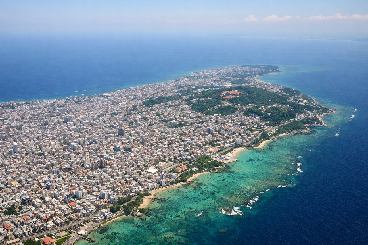
Takeoff from OKA
RIGHTNaha typically departs runway 32L/32R (northwesterly heading). Right-side seats face the Okinawa mainland and Kerama Islands immediately after takeoff, offering clear views of the island's interior terrain and the East China Sea.
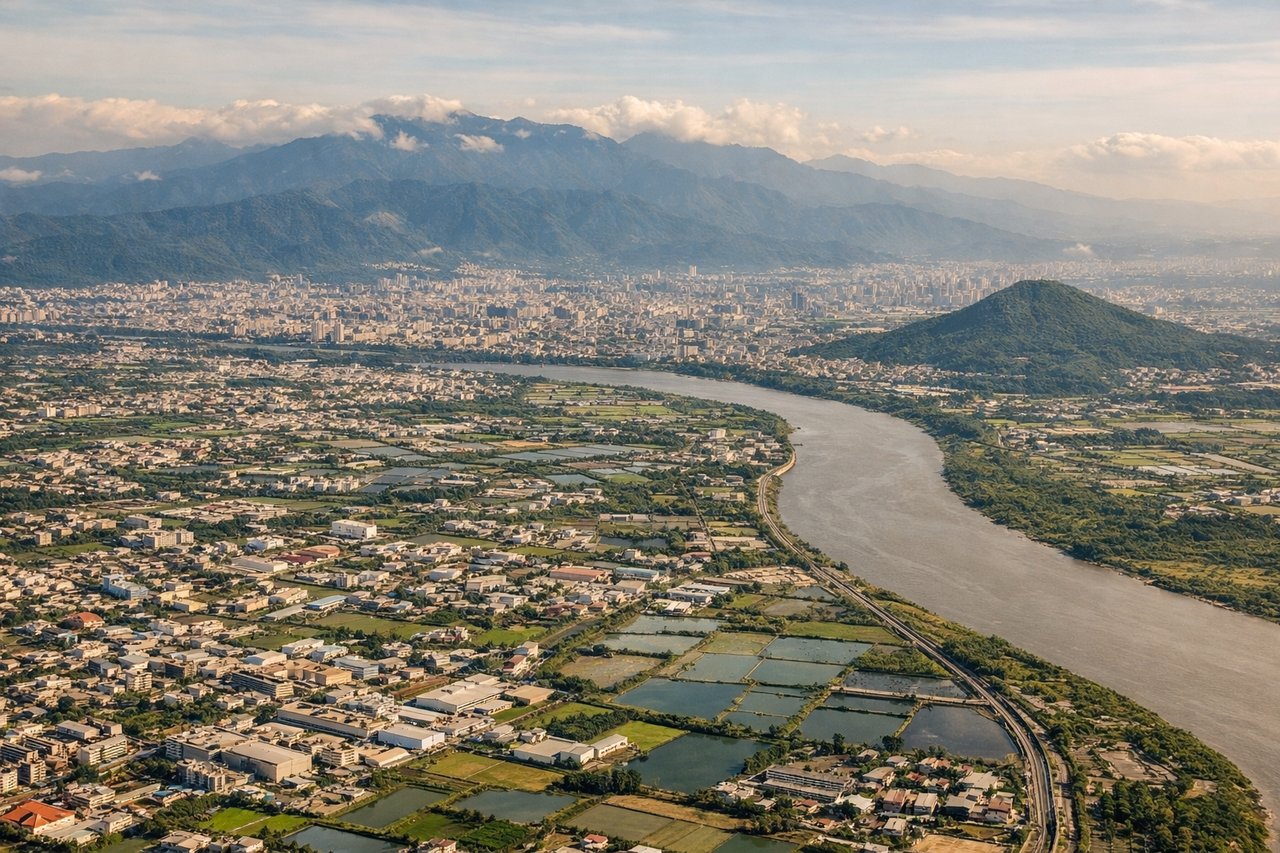
Landing at TPE
LEFTTaipei Taoyuan typically uses runways 05L/05R or 10L/10R (easterly or northeasterly approaches). Left-side seats on descent provide views of northern Taiwan's geography: the Yangmingshan volcanic plateau, Taipei Basin, and the Tamsui River valley as you descend toward the airport west of the city.
Will your flight be in sunlight?
Pick a date and time in the Sun Map to watch the sun move across your whole flight.
About This Route
Which side of the plane should I sit on flying from Naha (OKA) to Chiang Kai Shek International (TPE)?
Sit on the Right side of the plane for the best views on flights from Naha to Taipei. Right-side seats capture the more dramatic geography: Okinawa's interior and Kerama Islands on departure, then the flight path crosses the Okinawa Trough and approaches Taiwan from the northwest, offering views of Taiwan's northern mountains and coast on descent. Left seats see mostly open water during cruise.
What can I see during takeoff from Naha in Naha?
During takeoff from Naha (OKA), sit on the Right side for the best views. Naha typically departs runway 32L/32R (northwesterly heading). Right-side seats face the Okinawa mainland and Kerama Islands immediately after takeoff, offering clear views of the island's interior terrain and the East China Sea. Notable sights include: Kerama Islands (southwest of Naha), Okinawa's central ridge and forested interior, East China Sea coastline, Nakijin and northern Okinawa settlements.
What can I see when landing at Chiang Kai Shek International in Taipei?
When landing at Chiang Kai Shek International (TPE), sit on the Left side for the best views. Taipei Taoyuan typically uses runways 05L/05R or 10L/10R (easterly or northeasterly approaches). Left-side seats on descent provide views of northern Taiwan's geography: the Yangmingshan volcanic plateau, Taipei Basin, and the Tamsui River valley as you descend toward the airport west of the city. Notable sights include: Yangmingshan volcanic plateau (north of Taipei), Taipei Basin and urban sprawl, Tamsui River and its estuary, Taiwan's northern coastal plain.
How long is the flight from Naha to Taipei?
The flight from Naha (OKA) to Chiang Kai Shek International (TPE) takes about 1 hour 15 minutes. The shortest flight path between them is 406 miles (654 km); winds and air traffic control usually add a few percent.
What does the Naha to Taipei flight path pass over?
The flight crosses the Okinawa Trough (deep ocean basin between Okinawa and Taiwan), passing over open East China Sea. At cruise altitude (around 25,000-30,000 feet), the Okinawa Trough itself is not visually distinct, but the transition from Okinawa's shallow waters to deeper blue ocean is noticeable. Taiwan's northern coast and the Yangmingshan volcanic plateau become visible approximately 30 minutes before landing. The Keelungshan Mountains (northern Taiwan's eastern ridge) may be visible on the right side during final descent if weather permits.