While the Phoenix departure offers modest desert mountain scenery, the Honolulu arrival delivers an extraordinary volcanic island approach with crater, reef, and coastline all visible in sequence, easily outweighing the mid-flight ocean monotony common to both sides.
Flight Path
Open Pacific Ocean for several hours with no visible landmarks until the Hawaiian Islands appear near the end of the flight
Great circle distance and headings ›

Phase by phase

Takeoff from PHX
LEFTDeparting PHX westbound-turning-southwest, the left side offers views of South Mountain and the Sierra Estrella before the route heads over the sprawling Phoenix basin toward the Colorado River corridor and California desert ranges. The right side mostly shows flat valley floor and later empty desert with fewer distinct features.
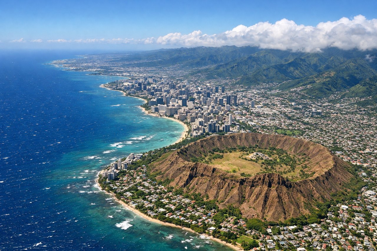
Landing at HNL
RIGHTOn approach to Honolulu, flights typically curve in over the Pacific and Oahu's windward side, giving right-side passengers dramatic views of the volcanic Koolau Range, Diamond Head crater, and the turquoise reef-lined coastline near Waikiki. This is one of the most visually striking approaches in commercial aviation.
Landmarks on this routeAll landmarks →
Will your flight be in sunlight?
See exactly which side of the plane gets sun and shade at your departure time.
About This Route
Which side of the plane should I sit on flying from Phoenix Sky Harbor International (PHX) to Honolulu International (HNL)?
Sit on the Right side of the plane for the best views on flights from Phoenix to Honolulu. While the Phoenix departure offers modest desert mountain scenery, the Honolulu arrival delivers an extraordinary volcanic island approach with crater, reef, and coastline all visible in sequence, easily outweighing the mid-flight ocean monotony common to both sides.
What can I see during takeoff from Phoenix Sky Harbor International in Phoenix?
During takeoff from Phoenix Sky Harbor International (PHX), sit on the Left side for the best views. Departing PHX westbound-turning-southwest, the left side offers views of South Mountain and the Sierra Estrella before the route heads over the sprawling Phoenix basin toward the Colorado River corridor and California desert ranges. The right side mostly shows flat valley floor and later empty desert with fewer distinct features. Notable sights include: South Mountain Park, Sierra Estrella, Gila River bed, Phoenix metro sprawl.
What can I see when landing at Honolulu International in Honolulu?
When landing at Honolulu International (HNL), sit on the Right side for the best views. On approach to Honolulu, flights typically curve in over the Pacific and Oahu's windward side, giving right-side passengers dramatic views of the volcanic Koolau Range, Diamond Head crater, and the turquoise reef-lined coastline near Waikiki. This is one of the most visually striking approaches in commercial aviation. Notable sights include: Koolau Range, Diamond Head crater, Waikiki coastline, Pearl Harbor.
How long is the flight from Phoenix to Honolulu?
The flight from Phoenix Sky Harbor International (PHX) to Honolulu International (HNL) takes 5h 15m.
What does the Phoenix to Honolulu flight path pass over?
Open Pacific Ocean for several hours with no visible landmarks until the Hawaiian Islands appear near the end of the flight