Left side wins both ends of the flight. During the cruise over Nevada, Oregon, and southern Washington, the left side also tracks closer to the Cascade Range, giving periodic views of volcanic peaks like Mount Hood and Mount Adams as distant horizon features. Right side has merit over the Rockies in Utah but the left side delivers more consistently throughout.
Flown PHX to YVR? Did we get it right?
Flight Path
Phoenix to Vancouver is 1,231 miles (1,981 km), a flight of about 2 hours 55 minutes.
The flight crosses the Nevada desert and Basin and Range terrain north of Las Vegas, then tracks over the high desert of southern Oregon. The Cascade Range runs roughly parallel to the left side of the aircraft through Oregon and Washington, with Mount Hood (11,249 ft) and Mount Adams (12,281 ft) potentially visible as snow-capped volcanic cones on the horizon. The Columbia River Gorge may be visible as the flight descends into the Pacific Northwest.
Great circle distance and headings ›


Phase by phase
Takeoff from PHX
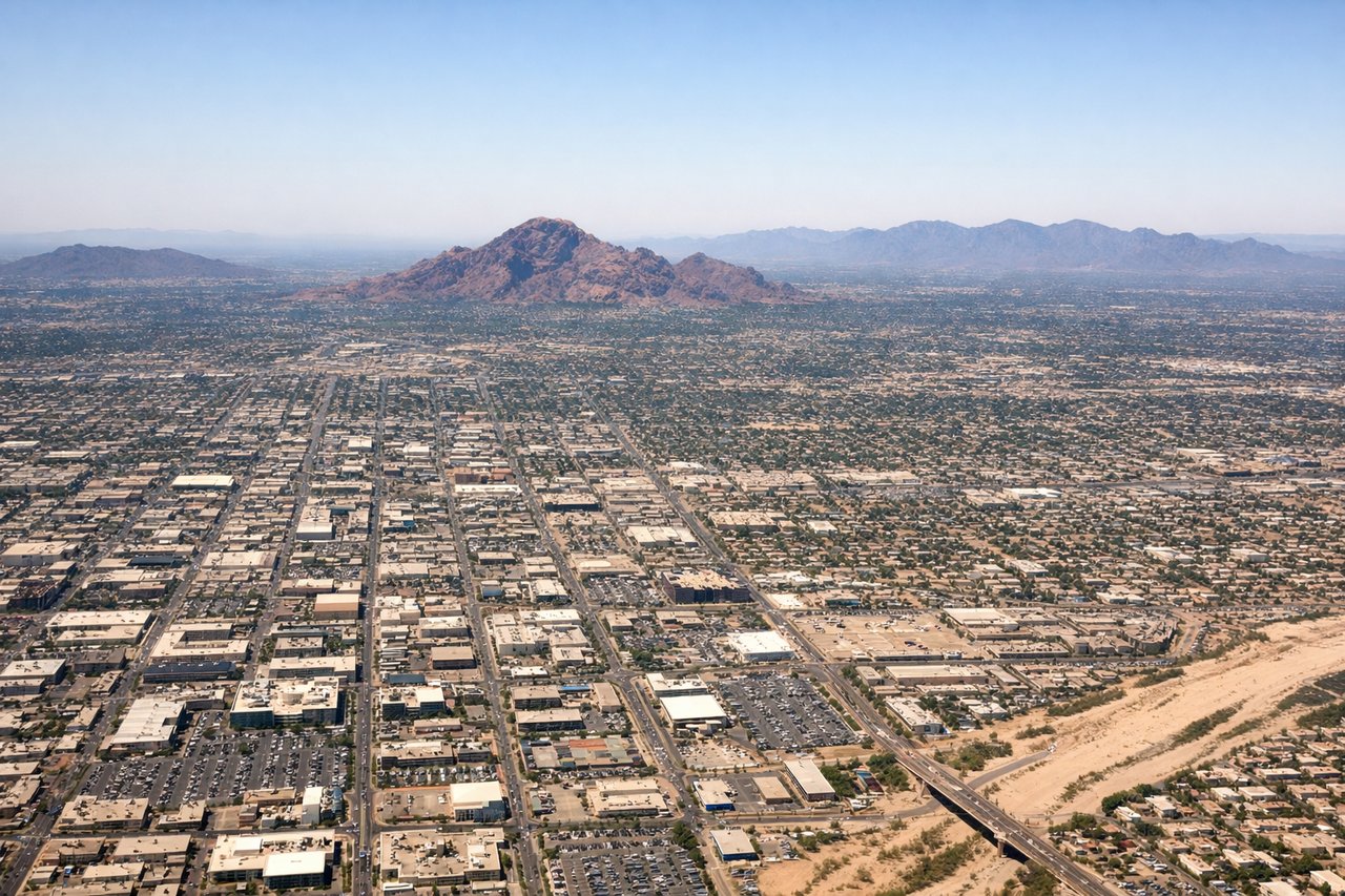
LEFTPHX typically departs westbound on runway 26 or northbound on runway 8. On a northbound departure, the left (west) side gives you a clear view back over downtown Phoenix, the grid of the Valley of the Sun, and the distinctive profile of South Mountain Park. On a westbound departure, the left side tracks south toward the Estrella Mountains.
Landing at YVR
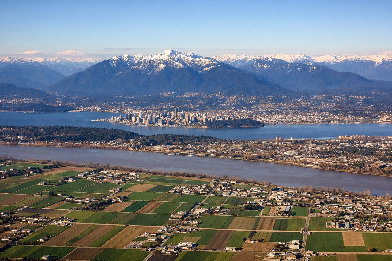
LEFTYVR approaches typically come from the south or east on runway 26L/26R, meaning the aircraft tracks westward over the Fraser River delta. The left (south) side gives you the best view of the Fraser River, the farmland of the delta, and the Olympic Mountains across the Strait of Georgia in Washington State. The right side faces north toward Vancouver city and the North Shore mountains but is partially obscured by the fuselage angle.
Will your flight be in sunlight?
Pick a date and time in the Sun Map to watch the sun move across your whole flight.
About This Route
Which side of the plane should I sit on flying from Phoenix Sky Harbor International (PHX) to Vancouver International (YVR)?
Sit on the Left side of the plane for the best views on flights from Phoenix to Vancouver. Left side wins both ends of the flight. During the cruise over Nevada, Oregon, and southern Washington, the left side also tracks closer to the Cascade Range, giving periodic views of volcanic peaks like Mount Hood and Mount Adams as distant horizon features. Right side has merit over the Rockies in Utah but the left side delivers more consistently throughout.
What can I see during takeoff from Phoenix Sky Harbor International in Phoenix?
During takeoff from Phoenix Sky Harbor International (PHX), sit on the Left side for the best views. PHX typically departs westbound on runway 26 or northbound on runway 8. On a northbound departure, the left (west) side gives you a clear view back over downtown Phoenix, the grid of the Valley of the Sun, and the distinctive profile of South Mountain Park. On a westbound departure, the left side tracks south toward the Estrella Mountains. Notable sights include: South Mountain Park, downtown Phoenix skyline, Camelback Mountain, Salt River bed.
What can I see when landing at Vancouver International in Vancouver?
When landing at Vancouver International (YVR), sit on the Left side for the best views. YVR approaches typically come from the south or east on runway 26L/26R, meaning the aircraft tracks westward over the Fraser River delta. The left (south) side gives you the best view of the Fraser River, the farmland of the delta, and the Olympic Mountains across the Strait of Georgia in Washington State. The right side faces north toward Vancouver city and the North Shore mountains but is partially obscured by the fuselage angle. Notable sights include: Fraser River delta, Strait of Georgia, Olympic Mountains (Washington State), Richmond farmland grid.
How long is the flight from Phoenix to Vancouver?
The flight from Phoenix Sky Harbor International (PHX) to Vancouver International (YVR) takes about 2 hours 55 minutes. The shortest flight path between them is 1,231 miles (1,981 km); winds and air traffic control usually add a few percent.
What does the Phoenix to Vancouver flight path pass over?
The flight crosses the Nevada desert and Basin and Range terrain north of Las Vegas, then tracks over the high desert of southern Oregon. The Cascade Range runs roughly parallel to the left side of the aircraft through Oregon and Washington, with Mount Hood (11,249 ft) and Mount Adams (12,281 ft) potentially visible as snow-capped volcanic cones on the horizon. The Columbia River Gorge may be visible as the flight descends into the Pacific Northwest.