The right side delivers a much richer visual sequence — Pacific coastal islands and Cascade volcanoes at takeoff, Sierra Nevada and Great Basin terrain during cruise, and a clear desert-mountain approach into Phoenix — while the left side mostly shows the flatter interior Northwest and Great Basin with fewer standout landmarks.
Flown YVR to PHX? Did we get it right?
Flight Path
Vancouver to Phoenix is 1,231 miles (1,981 km), a flight of about 2 hours 45 minutes.
Cascade Range volcanoes (Mount Hood, Mount Shasta), the Sierra Nevada near Lake Tahoe, and the arid basins of Nevada give way to the Mojave Desert before the route descends into the Sonoran Desert near Phoenix.
Great circle distance and headings ›


Phase by phase

Takeoff from YVR
RIGHTDeparting YVR to the west before turning south, the right side gives a sweeping view over the Strait of Georgia, the Gulf Islands, and the North Shore mountains falling away behind, followed by Puget Sound and Mount Rainier's snowcapped cone as the climb continues southward.
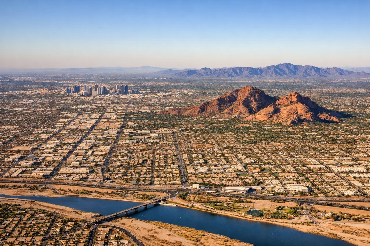
Landing at PHX
RIGHTOn approach into PHX from the north, the right side overlooks the sprawling Phoenix valley with the White Tank Mountains and Sonoran desert terrain unfolding below, offering a clear view of the city grid against the desert backdrop as the plane banks toward the runway.
Will your flight be in sunlight?
Pick a date and time in the Sun Map to watch the sun move across your whole flight.
About This Route
Which side of the plane should I sit on flying from Vancouver International (YVR) to Phoenix Sky Harbor International (PHX)?
Sit on the Right side of the plane for the best views on flights from Vancouver to Phoenix. The right side delivers a much richer visual sequence — Pacific coastal islands and Cascade volcanoes at takeoff, Sierra Nevada and Great Basin terrain during cruise, and a clear desert-mountain approach into Phoenix — while the left side mostly shows the flatter interior Northwest and Great Basin with fewer standout landmarks.
What can I see during takeoff from Vancouver International in Vancouver?
During takeoff from Vancouver International (YVR), sit on the Right side for the best views. Departing YVR to the west before turning south, the right side gives a sweeping view over the Strait of Georgia, the Gulf Islands, and the North Shore mountains falling away behind, followed by Puget Sound and Mount Rainier's snowcapped cone as the climb continues southward. Notable sights include: Strait of Georgia, Gulf Islands, North Shore Mountains, Mount Rainier.
What can I see when landing at Phoenix Sky Harbor International in Phoenix?
When landing at Phoenix Sky Harbor International (PHX), sit on the Right side for the best views. On approach into PHX from the north, the right side overlooks the sprawling Phoenix valley with the White Tank Mountains and Sonoran desert terrain unfolding below, offering a clear view of the city grid against the desert backdrop as the plane banks toward the runway. Notable sights include: White Tank Mountains, Sonoran Desert, Phoenix valley grid, Camelback Mountain.
How long is the flight from Vancouver to Phoenix?
The flight from Vancouver International (YVR) to Phoenix Sky Harbor International (PHX) takes about 2 hours 45 minutes. The shortest flight path between them is 1,231 miles (1,981 km); winds and air traffic control usually add a few percent.
What does the Vancouver to Phoenix flight path pass over?
Cascade Range volcanoes (Mount Hood, Mount Shasta), the Sierra Nevada near Lake Tahoe, and the arid basins of Nevada give way to the Mojave Desert before the route descends into the Sonoran Desert near Phoenix.