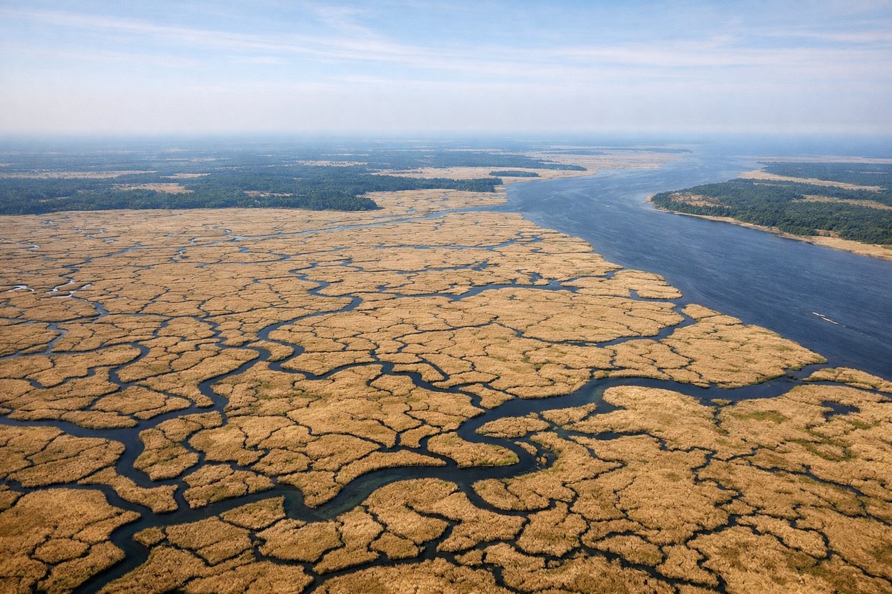
While the landing view of Mount Hood from the left is spectacular, the takeoff from Savannah offers more consistent scenic value over a longer portion of the flight. The right side captures the unique coastal marshlands and barrier islands that are visually distinctive and less commonly seen from aircraft.
Flown SAV to PDX? Did we get it right?
Flight Path
Savannah to Portland is 2,382 miles (3,833 km), a flight of about 5 hours.
The flight path crosses the Appalachian region including the Blue Ridge Mountains and Great Smoky Mountains (visible from altitude as a hazy ridge system running northeast-southwest through Tennessee and North Carolina). The Mississippi River valley becomes visible in the western portion of the flight, appearing as a wide, meandering river corridor. The Great Plains transition into the Pacific Northwest as you approach Oregon, with the terrain becoming increasingly mountainous and forested.
Great circle distance and headings ›


Phase by phase
Takeoff from SAV
RIGHTRight-side seats offer views of the Atlantic coastline and Calibogue Sound as the aircraft climbs out over the Savannah area. You'll see the barrier islands and tidal marshes that define the Low Country geography.
Landing at PDX
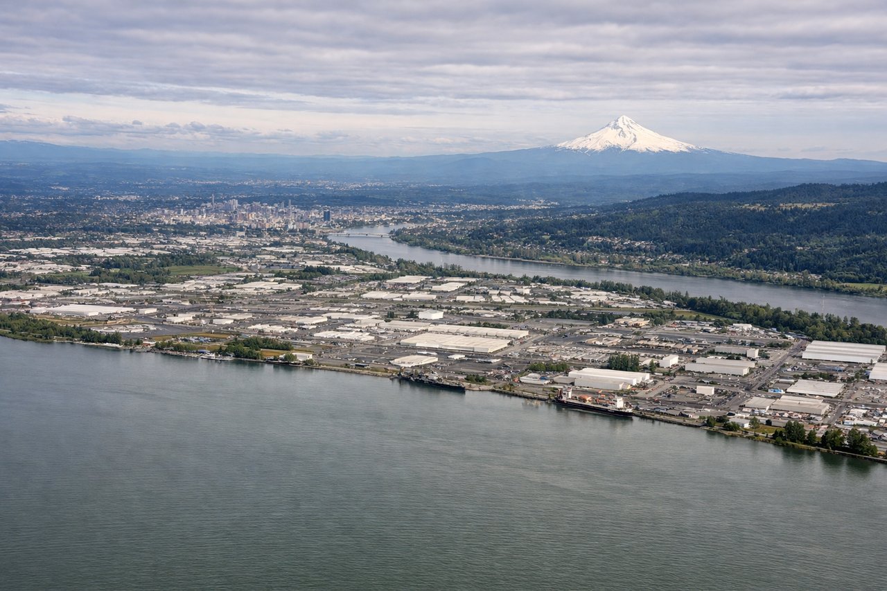
LEFTLeft-side seats provide excellent views of the Cascade Range and Mount Hood during the descent into Portland. As you approach from the east, the Willamette Valley spreads below with the volcanic peaks dominating the eastern horizon.
Will your flight be in sunlight?
Pick a date and time in the Sun Map to watch the sun move across your whole flight.
About This Route
Which side of the plane should I sit on flying from Savannah Hilton Head International (SAV) to Portland International (PDX)?
Sit on the Right side of the plane for the best views on flights from Savannah to Portland. While the landing view of Mount Hood from the left is spectacular, the takeoff from Savannah offers more consistent scenic value over a longer portion of the flight. The right side captures the unique coastal marshlands and barrier islands that are visually distinctive and less commonly seen from aircraft.
What can I see during takeoff from Savannah Hilton Head International in Savannah?
During takeoff from Savannah Hilton Head International (SAV), sit on the Right side for the best views. Right-side seats offer views of the Atlantic coastline and Calibogue Sound as the aircraft climbs out over the Savannah area. You'll see the barrier islands and tidal marshes that define the Low Country geography. Notable sights include: Tybee Island, Calibogue Sound, Savannah River estuary, Atlantic coastline.
What can I see when landing at Portland International in Portland?
When landing at Portland International (PDX), sit on the Left side for the best views. Left-side seats provide excellent views of the Cascade Range and Mount Hood during the descent into Portland. As you approach from the east, the Willamette Valley spreads below with the volcanic peaks dominating the eastern horizon. Notable sights include: Mount Hood, Cascade Range, Willamette Valley, Columbia River.
How long is the flight from Savannah to Portland?
The flight from Savannah Hilton Head International (SAV) to Portland International (PDX) takes about 5 hours. The shortest flight path between them is 2,382 miles (3,833 km); winds and air traffic control usually add a few percent.
What does the Savannah to Portland flight path pass over?
The flight path crosses the Appalachian region including the Blue Ridge Mountains and Great Smoky Mountains (visible from altitude as a hazy ridge system running northeast-southwest through Tennessee and North Carolina). The Mississippi River valley becomes visible in the western portion of the flight, appearing as a wide, meandering river corridor. The Great Plains transition into the Pacific Northwest as you approach Oregon, with the terrain becoming increasingly mountainous and forested.