While left is better at SFO departure, the right seat wins overall. The Amazon approach into IQT is the most dramatic visual payoff of the flight, and right seats also capture the Central American Pacific coastline and parts of the Andes during the long southward cruise. The landing view alone justifies the choice.
Flight Path
The flight tracks south-southeast over the Baja California Peninsula, then crosses the Pacific coast of Mexico and Central America. Over Colombia the route crosses the northern Andes, with the Cordillera Occidental and Cordillera Central visible as snow-capped ridgelines at cruise altitude. Descending into Peru the terrain flattens abruptly into the vast Amazon Basin, with the Rio Ucayali and its braided channels visible well before Iquitos. The transition from Andean cloud forest to flat Amazonian jungle is one of the most geographically dramatic shifts visible from a commercial aircraft.
Great circle distance and headings ›


Phase by phase
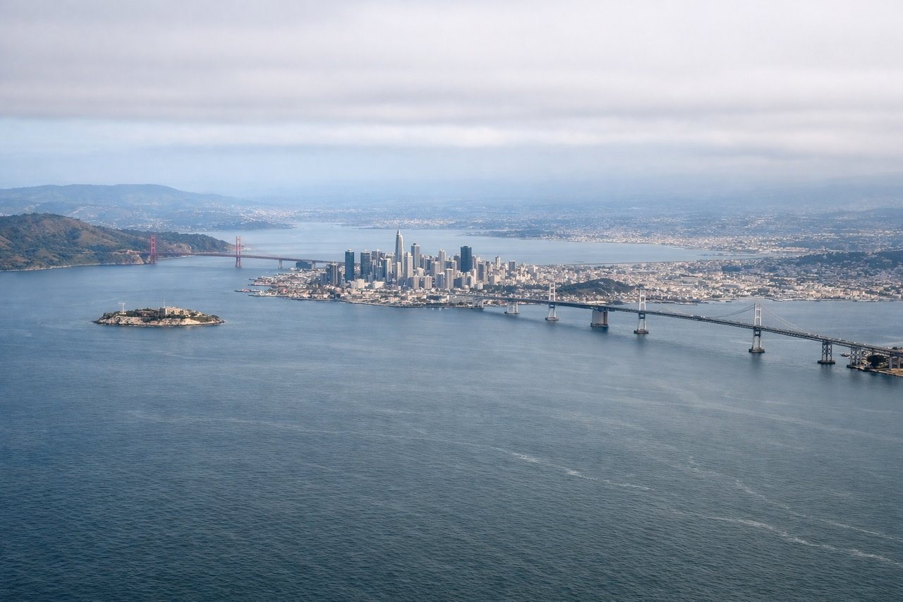
Takeoff from SFO
LEFTSFO's primary departure runways (28L/28R) head west over the bay before turning south. A left window seat gives you San Francisco Bay, the city skyline, and the Peninsula as you climb out. Right seats face the open Pacific almost immediately.
Landing at IQT
RIGHTIQT sits on the south bank of the Amazon River. Arrivals typically come in from the east or southeast, meaning a right window seat gives you the Amazon floodplain, the Rio Nanay confluence, and the city of Iquitos itself on final approach. Left seats face jungle with fewer distinguishing features.
Landmarks on this routeAll landmarks →
Will your flight be in sunlight?
See exactly which side of the plane gets sun and shade at your departure time.
About This Route
Which side of the plane should I sit on flying from San Francisco International (SFO) to Coronel Fap Francisco Secada Vignetta (IQT)?
Sit on the Right side of the plane for the best views on flights from San Francisco to Iquitos. While left is better at SFO departure, the right seat wins overall. The Amazon approach into IQT is the most dramatic visual payoff of the flight, and right seats also capture the Central American Pacific coastline and parts of the Andes during the long southward cruise. The landing view alone justifies the choice.
What can I see during takeoff from San Francisco International in San Francisco?
During takeoff from San Francisco International (SFO), sit on the Left side for the best views. SFO's primary departure runways (28L/28R) head west over the bay before turning south. A left window seat gives you San Francisco Bay, the city skyline, and the Peninsula as you climb out. Right seats face the open Pacific almost immediately. Notable sights include: San Francisco Bay, downtown SF skyline, San Mateo Bridge, Santa Cruz Mountains.
What can I see when landing at Coronel Fap Francisco Secada Vignetta in Iquitos?
When landing at Coronel Fap Francisco Secada Vignetta (IQT), sit on the Right side for the best views. IQT sits on the south bank of the Amazon River. Arrivals typically come in from the east or southeast, meaning a right window seat gives you the Amazon floodplain, the Rio Nanay confluence, and the city of Iquitos itself on final approach. Left seats face jungle with fewer distinguishing features. Notable sights include: Amazon River main channel, Rio Nanay confluence, Iquitos city waterfront, Amazonian floodplain lakes.
How long is the flight from San Francisco to Iquitos?
The flight from San Francisco International (SFO) to Coronel Fap Francisco Secada Vignetta (IQT) takes Approximately 8 to 9 hours with a typical connection through Lima or Bogota; a hypothetical direct routing would be roughly 7.5 hours.
What does the San Francisco to Iquitos flight path pass over?
The flight tracks south-southeast over the Baja California Peninsula, then crosses the Pacific coast of Mexico and Central America. Over Colombia the route crosses the northern Andes, with the Cordillera Occidental and Cordillera Central visible as snow-capped ridgelines at cruise altitude. Descending into Peru the terrain flattens abruptly into the vast Amazon Basin, with the Rio Ucayali and its braided channels visible well before Iquitos. The transition from Andean cloud forest to flat Amazonian jungle is one of the most geographically dramatic shifts visible from a commercial aircraft.