The left side scores marginally higher due to the superior takeoff experience over San Francisco Bay and the Golden Gate Bridge, which is one of the world's most recognizable landmarks. While landing views are comparable on both sides, the dramatic departure sequence from SFO outweighs the modest advantage on arrival at KWJ. Both sides are limited by the long ocean crossing (5+ hours) that dominates the cruise phase, capping the overall score.
Flown SFO to KWJ? Did we get it right?
Flight Path
San Francisco to Kwangju is 5,738 miles (9,235 km), a flight of about 11 hours 15 minutes.
The flight crosses the North Pacific Ocean for approximately 5-6 hours with minimal visible landmarks. The route typically passes north of Hawaii (not directly overhead), crosses the International Date Line, and approaches the Asian continent near Japan. Visible features include: the Aleutian Islands chain (if routed northerly), the Kuril Islands south of Kamchatka, and the Japanese archipelago (Hokkaido and Honshu) as the aircraft descends toward Korean airspace. The Sea of Japan separates Japan from the Korean peninsula. Coastal mountains and the Korean peninsula's western coastline become visible during the final descent phase into Gwangju.
Great circle distance and headings ›Phase by phase
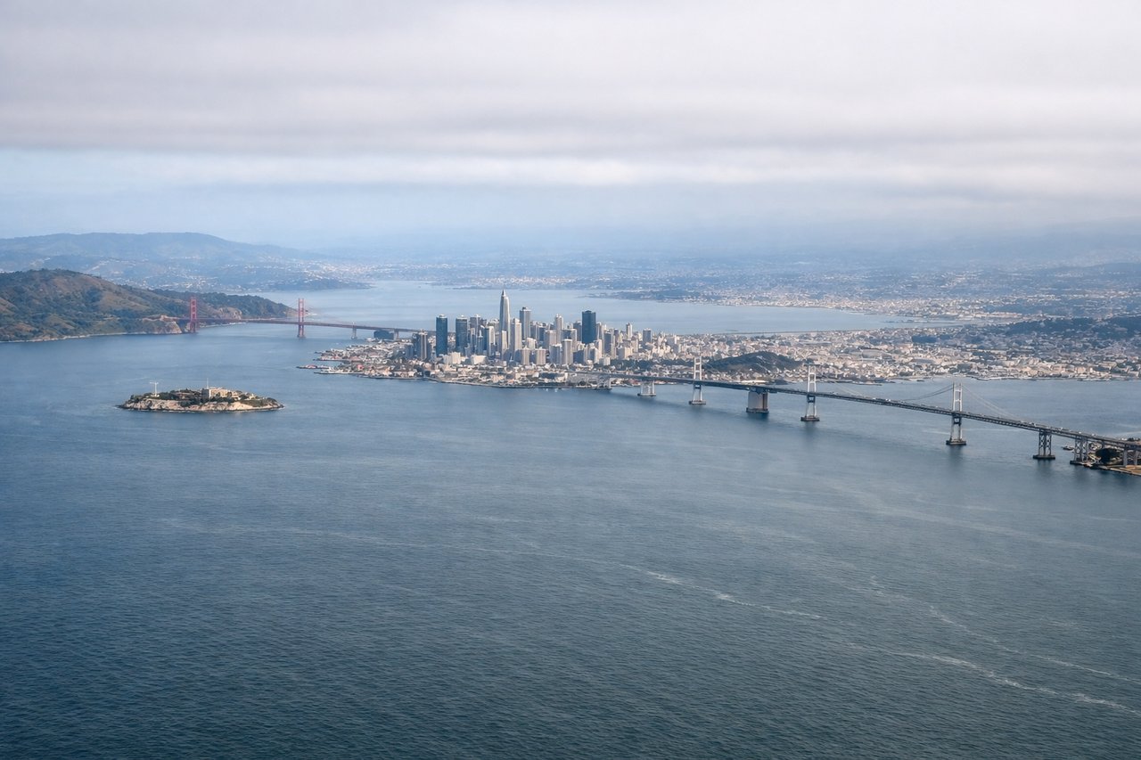
Takeoff from SFO
LEFTLeft side (north) captures San Francisco Bay, the Golden Gate Bridge area, and Marin Headlands during the initial climb-out from eastern runways. Right side faces inland toward the East Bay hills with less dramatic urban-water contrast.
Landing at KWJ
RIGHTRight side (south/southeast) during approach to KWJ offers views of the Gwangju metropolitan area, surrounding agricultural plains, and the transition from rural to urban terrain as the aircraft descends. Left side faces open terrain with fewer distinctive landmarks during final approach.
Will your flight be in sunlight?
Pick a date and time in the Sun Map to watch the sun move across your whole flight.
About This Route
Which side of the plane should I sit on flying from San Francisco International (SFO) to Gwangju (KWJ)?
Sit on the Left side of the plane for the best views on flights from San Francisco to Kwangju. The left side scores marginally higher due to the superior takeoff experience over San Francisco Bay and the Golden Gate Bridge, which is one of the world's most recognizable landmarks. While landing views are comparable on both sides, the dramatic departure sequence from SFO outweighs the modest advantage on arrival at KWJ. Both sides are limited by the long ocean crossing (5+ hours) that dominates the cruise phase, capping the overall score.
What can I see during takeoff from San Francisco International in San Francisco?
During takeoff from San Francisco International (SFO), sit on the Left side for the best views. Left side (north) captures San Francisco Bay, the Golden Gate Bridge area, and Marin Headlands during the initial climb-out from eastern runways. Right side faces inland toward the East Bay hills with less dramatic urban-water contrast. Notable sights include: San Francisco Bay, Golden Gate Bridge, Marin Headlands, Oakland/Berkeley shoreline.
What can I see when landing at Gwangju in Kwangju?
When landing at Gwangju (KWJ), sit on the Right side for the best views. Right side (south/southeast) during approach to KWJ offers views of the Gwangju metropolitan area, surrounding agricultural plains, and the transition from rural to urban terrain as the aircraft descends. Left side faces open terrain with fewer distinctive landmarks during final approach. Notable sights include: Gwangju city sprawl, surrounding agricultural plains, Mudeung Mountain to the north, Yeongsan River valley.
How long is the flight from San Francisco to Kwangju?
The flight from San Francisco International (SFO) to Gwangju (KWJ) takes about 11 hours 15 minutes. The shortest flight path between them is 5,738 miles (9,235 km); winds and air traffic control usually add a few percent.
What does the San Francisco to Kwangju flight path pass over?
The flight crosses the North Pacific Ocean for approximately 5-6 hours with minimal visible landmarks. The route typically passes north of Hawaii (not directly overhead), crosses the International Date Line, and approaches the Asian continent near Japan. Visible features include: the Aleutian Islands chain (if routed northerly), the Kuril Islands south of Kamchatka, and the Japanese archipelago (Hokkaido and Honshu) as the aircraft descends toward Korean airspace. The Sea of Japan separates Japan from the Korean peninsula. Coastal mountains and the Korean peninsula's western coastline become visible during the final descent phase into Gwangju.