With roughly thirteen hours of open North Pacific in between, the trip is decided by its bookends: the Manila Bay approach—with its islands, peninsula silhouette, and skyline—offers a slightly richer, more varied scene than the quick San Francisco climb-out, giving the right side a marginal edge overall.
Flight Path
Great-circle track passes south of the Aleutian Islands, near the Kamchatka Peninsula, along the eastern coast of Japan (Honshu), across the East China Sea, and through the Luzon Strait before making landfall over northern Luzon and Manila Bay.
Great circle distance and headings ›Phase by phase
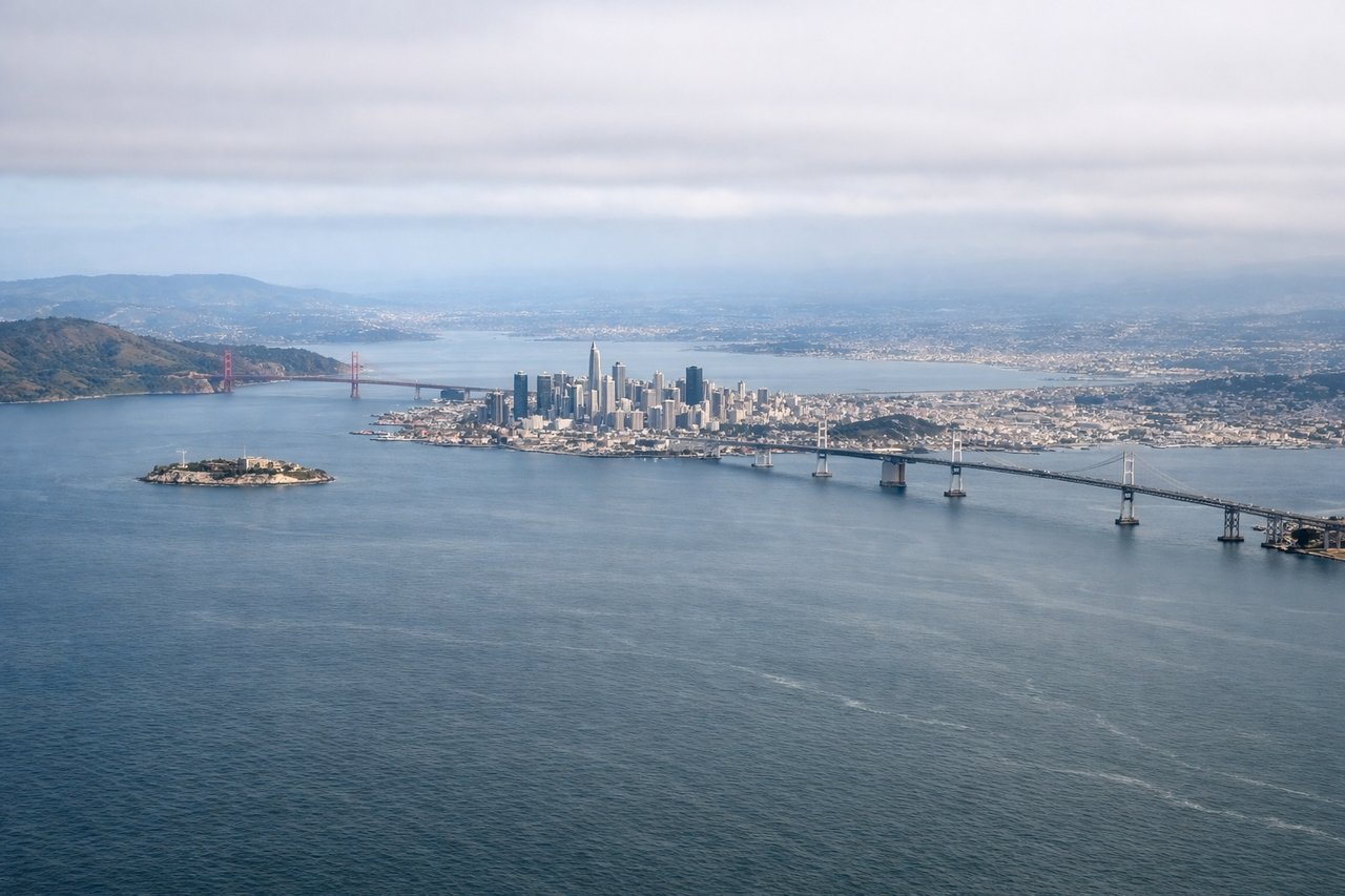
Takeoff from SFO
LEFTDepartures off SFO's eastern runways climb out over the Bay before banking north-northwest onto the transpacific track, swinging the left side toward San Francisco. Passengers get a brief but classic view of the city skyline, the Golden Gate Bridge, and the Marin Headlands before the coastline falls away into open ocean.

Landing at MNL
RIGHTOn approach into NAIA, the flight path crosses Manila Bay before touchdown, and the right-side windows face northwest across the water toward Corregidor Island and the Bataan Peninsula. The Metro Manila skyline—Makati and BGC's towers—also unfolds below as the aircraft descends over the bay's edge.
Landmarks on this routeAll landmarks →
Will your flight be in sunlight?
See exactly which side of the plane gets sun and shade at your departure time.
About This Route
Which side of the plane should I sit on flying from San Francisco International (SFO) to Ninoy Aquino International (MNL)?
Sit on the Right side of the plane for the best views on flights from San Francisco to Manila. With roughly thirteen hours of open North Pacific in between, the trip is decided by its bookends: the Manila Bay approach—with its islands, peninsula silhouette, and skyline—offers a slightly richer, more varied scene than the quick San Francisco climb-out, giving the right side a marginal edge overall.
What can I see during takeoff from San Francisco International in San Francisco?
During takeoff from San Francisco International (SFO), sit on the Left side for the best views. Departures off SFO's eastern runways climb out over the Bay before banking north-northwest onto the transpacific track, swinging the left side toward San Francisco. Passengers get a brief but classic view of the city skyline, the Golden Gate Bridge, and the Marin Headlands before the coastline falls away into open ocean. Notable sights include: San Francisco skyline, Golden Gate Bridge, Marin Headlands, Point Reyes coastline.
What can I see when landing at Ninoy Aquino International in Manila?
When landing at Ninoy Aquino International (MNL), sit on the Right side for the best views. On approach into NAIA, the flight path crosses Manila Bay before touchdown, and the right-side windows face northwest across the water toward Corregidor Island and the Bataan Peninsula. The Metro Manila skyline—Makati and BGC's towers—also unfolds below as the aircraft descends over the bay's edge. Notable sights include: Manila Bay, Corregidor Island, Bataan Peninsula, Makati/BGC skyline.
How long is the flight from San Francisco to Manila?
The flight from San Francisco International (SFO) to Ninoy Aquino International (MNL) takes 15h 05m.
What does the San Francisco to Manila flight path pass over?
Great-circle track passes south of the Aleutian Islands, near the Kamchatka Peninsula, along the eastern coast of Japan (Honshu), across the East China Sea, and through the Luzon Strait before making landfall over northern Luzon and Manila Bay.