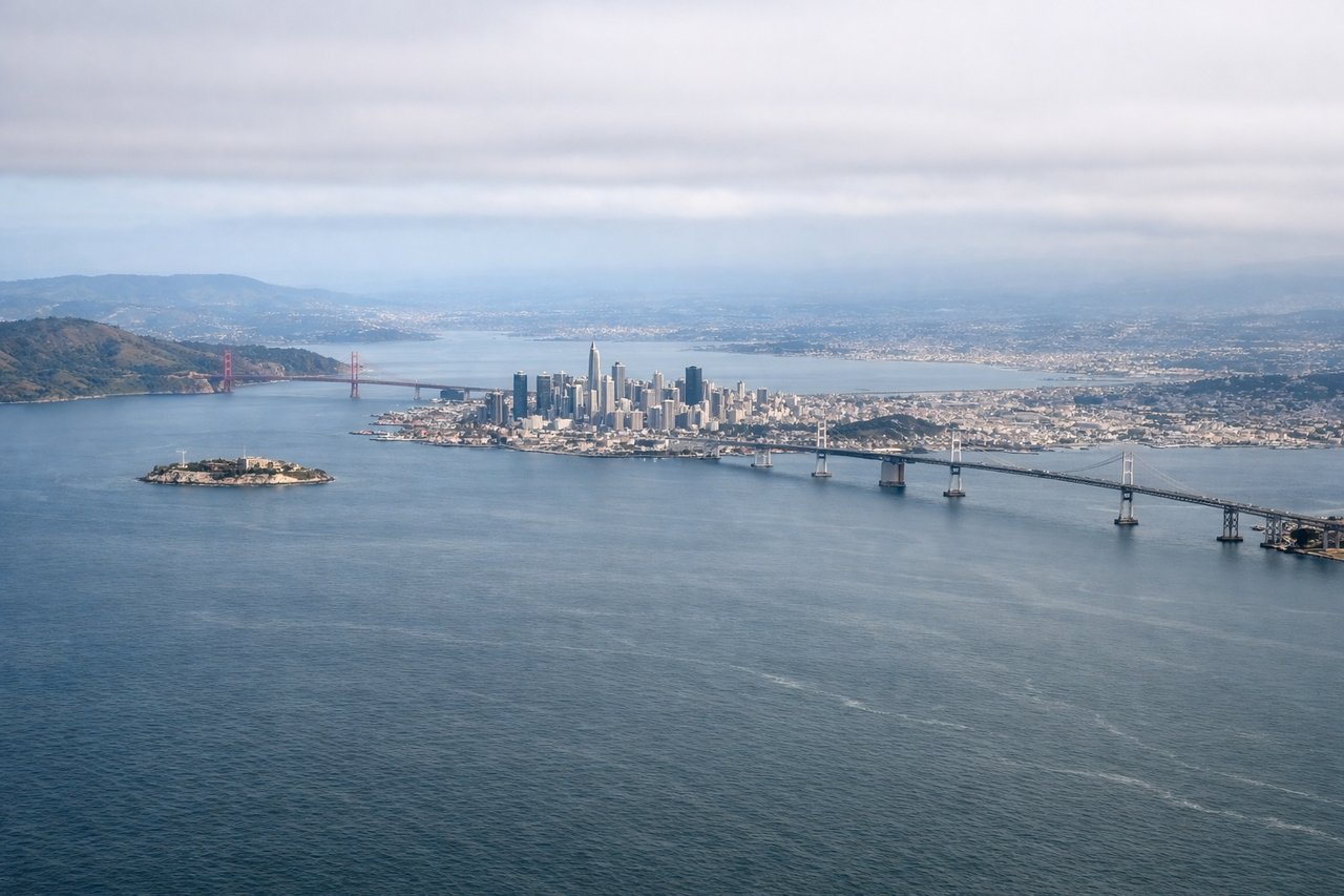
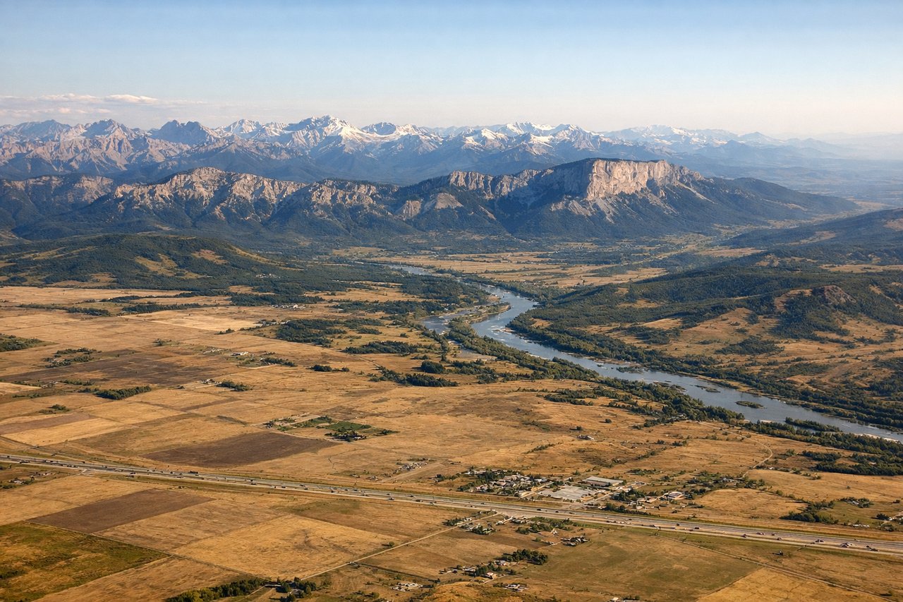
The left side strings together the two most dramatic moments of the flight: the San Francisco Bay skyline and coastline at departure, and the Canadian Rocky Mountains on descent into Calgary, with Cascade volcanic peaks visible along the cruise portion in between. The right side offers only the Sierra Nevada foothills briefly and otherwise flat interior terrain and prairie.
Flight Path
Route passes near Mount Shasta and the southern Cascade Range in northern California, then tracks north past Mount Hood and Mount Rainier in Oregon and Washington, crosses the Columbia River basin, and continues over the Okanagan Valley and interior plateau of British Columbia before descending toward the Rocky Mountain foothills near Calgary.
Great circle distance and headings ›
.jpg?width=600)

Phase by phase
Takeoff from SFO
LEFTSFO departures roll out over the bay and then arc north toward Canada, and during that turn the left side faces the city itself — San Francisco's skyline, the Golden Gate, and the Marin Headlands sweep into view before the coastline falls away. The right side mostly shows the flatter East Bay suburbs and hills.
Landing at YYC
LEFTCalgary sits right at the edge of the Rockies, and arrival maneuvering typically brings the front ranges into view on the west side of the aircraft during descent. The right side instead faces the flat prairie stretching east of the city, which is comparatively featureless.
Landmarks on this routeAll landmarks →
Will your flight be in sunlight?
See exactly which side of the plane gets sun and shade at your departure time.
About This Route
Which side of the plane should I sit on flying from San Francisco International (SFO) to Calgary International (YYC)?
Sit on the Left side of the plane for the best views on flights from San Francisco to Calgary. The left side strings together the two most dramatic moments of the flight: the San Francisco Bay skyline and coastline at departure, and the Canadian Rocky Mountains on descent into Calgary, with Cascade volcanic peaks visible along the cruise portion in between. The right side offers only the Sierra Nevada foothills briefly and otherwise flat interior terrain and prairie.
What can I see during takeoff from San Francisco International in San Francisco?
During takeoff from San Francisco International (SFO), sit on the Left side for the best views. SFO departures roll out over the bay and then arc north toward Canada, and during that turn the left side faces the city itself — San Francisco's skyline, the Golden Gate, and the Marin Headlands sweep into view before the coastline falls away. The right side mostly shows the flatter East Bay suburbs and hills. Notable sights include: San Francisco skyline, Golden Gate Bridge, Marin Headlands, San Francisco Bay.
What can I see when landing at Calgary International in Calgary?
When landing at Calgary International (YYC), sit on the Left side for the best views. Calgary sits right at the edge of the Rockies, and arrival maneuvering typically brings the front ranges into view on the west side of the aircraft during descent. The right side instead faces the flat prairie stretching east of the city, which is comparatively featureless. Notable sights include: Canadian Rocky Mountain front ranges, foothill ranchland, Bow River valley, Calgary skyline.
How long is the flight from San Francisco to Calgary?
The flight from San Francisco International (SFO) to Calgary International (YYC) takes 2h 45m.
What does the San Francisco to Calgary flight path pass over?
Route passes near Mount Shasta and the southern Cascade Range in northern California, then tracks north past Mount Hood and Mount Rainier in Oregon and Washington, crosses the Columbia River basin, and continues over the Okanagan Valley and interior plateau of British Columbia before descending toward the Rocky Mountain foothills near Calgary.