Basse Terre to London is 4,109 miles (6,613 km), a flight of about 7 hours 45 minutes.
While takeoff from Saint Kitts favors the right, the landing approach into Gatwick on the left side offers more dramatic and varied scenery—the North Downs, Thames valley, and the approach to London's urban landscape provide more visual interest than the outbound Caribbean seascape.
Flight Path
The flight path crosses the Atlantic Ocean for approximately 3,000 nautical miles. Notable features include: the Azores archipelago (optional routing, typically 800nm northeast of departure); the Bay of Biscay and its continental shelf waters; the Iberian Peninsula and western France coastlines (visible on northern routing); the English Channel and southern England's coastline approaching Gatwick. Most of the mid-Atlantic crossing offers open ocean with no visible landmarks from cruise altitude.
Great circle distance and headings ›Phase by phase
Takeoff from SKB
RIGHTRight-side seats offer views of the southeastern Caribbean as the aircraft climbs northeastward. You'll see the island of Nevis and the surrounding turquoise waters of the Caribbean Sea, with the Atlantic horizon beyond.
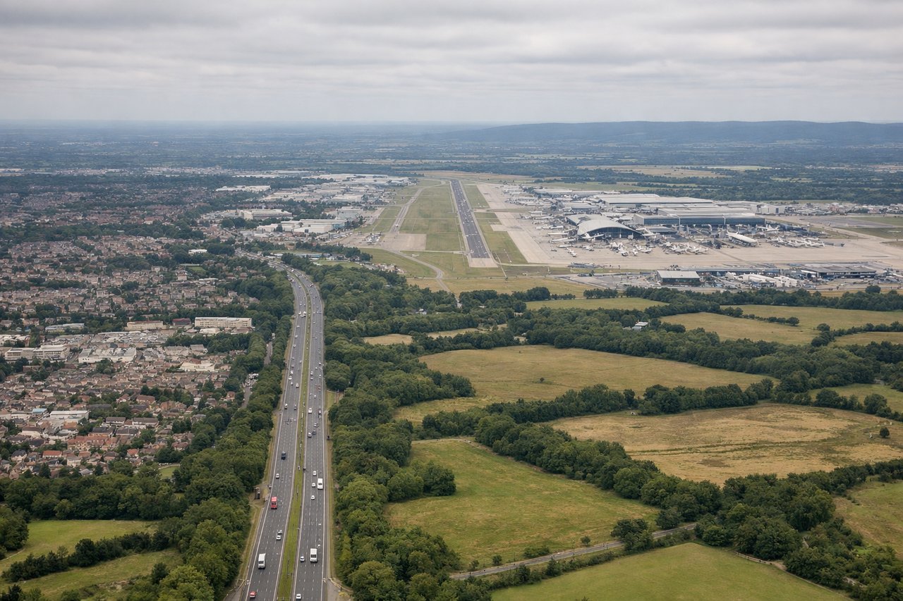
Landing at LGW
LEFTLeft-side seats provide excellent views during the approach to Gatwick. You'll see the North Downs, the Thames valley, and the patchwork of southern England's farmland and towns as you descend toward London.
Landmarks on this routeAll landmarks →
Will your flight be in sunlight?
Pick a date and time in the Sun Map to watch the sun move across your whole flight.
About This Route
Which side of the plane should I sit on flying from Robert L Bradshaw (SKB) to Gatwick (LGW)?
Sit on the Left side of the plane for the best views on flights from Basse Terre to London. While takeoff from Saint Kitts favors the right, the landing approach into Gatwick on the left side offers more dramatic and varied scenery—the North Downs, Thames valley, and the approach to London's urban landscape provide more visual interest than the outbound Caribbean seascape.
What can I see during takeoff from Robert L Bradshaw in Basse Terre?
During takeoff from Robert L Bradshaw (SKB), sit on the Right side for the best views. Right-side seats offer views of the southeastern Caribbean as the aircraft climbs northeastward. You'll see the island of Nevis and the surrounding turquoise waters of the Caribbean Sea, with the Atlantic horizon beyond. Notable sights include: Nevis island, Caribbean Sea, Basseterre valley, Atlantic Ocean horizon.
What can I see when landing at Gatwick in London?
When landing at Gatwick (LGW), sit on the Left side for the best views. Left-side seats provide excellent views during the approach to Gatwick. You'll see the North Downs, the Thames valley, and the patchwork of southern England's farmland and towns as you descend toward London. Notable sights include: North Downs ridge, Thames valley, Surrey/Sussex countryside, London urban sprawl.
How long is the flight from Basse Terre to London?
The flight from Robert L Bradshaw (SKB) to Gatwick (LGW) takes about 7 hours 45 minutes. The shortest flight path between them is 4,109 miles (6,613 km); winds and air traffic control usually add a few percent.
What does the Basse Terre to London flight path pass over?
The flight path crosses the Atlantic Ocean for approximately 3,000 nautical miles. Notable features include: the Azores archipelago (optional routing, typically 800nm northeast of departure); the Bay of Biscay and its continental shelf waters; the Iberian Peninsula and western France coastlines (visible on northern routing); the English Channel and southern England's coastline approaching Gatwick. Most of the mid-Atlantic crossing offers open ocean with no visible landmarks from cruise altitude.