Vancouver to Keffallinia is 6,009 miles (9,670 km), a flight of about 11 hours.
While takeoff favors the left, the landing view from the right is significantly more dramatic and geographically distinctive. The approach to Kefallinia over the Ionian Sea with the island's western cliffs provides a more memorable final segment than the departure.
Flight Path
The flight path crosses the Atlantic northeast toward the UK/Ireland, then over the North Sea and continental Europe. Notable features include: the Greenland ice sheet (far north on polar routing), the British Isles and North Sea, the Alps (visible on the southern approach to Greece), and the Balkans. The route typically passes south of Scandinavia and north of the Mediterranean, making the Alps the most visually distinctive midpoint landmark if flying at optimal altitude during daylight.
Great circle distance and headings ›
.jpg?width=600)


Phase by phase
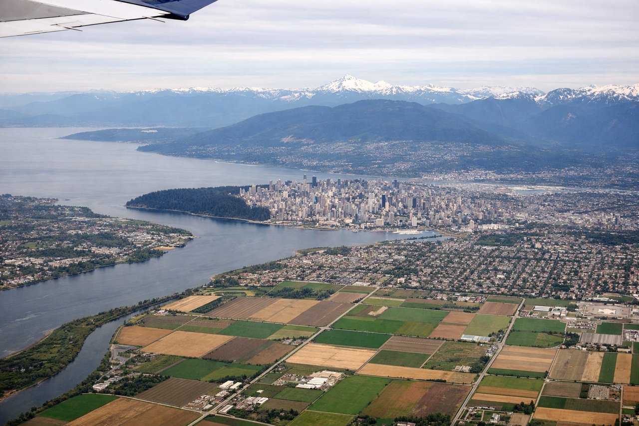
Takeoff from YVR
LEFTYVR typically departs runways 26L/26R (westbound) or 08L/08R (eastbound). For this eastbound transatlantic routing, expect 08L/08R departure. Left seats capture the North Shore Mountains immediately after rotation, then the Strait of Georgia and Vancouver Island as you climb eastbound.
Landing at EFL
RIGHTKefallinia (Cephalonia) airport sits on the island's western coast. Approach vectors typically come from the northwest over the Ionian Sea. Right-side seats face the island's dramatic western cliffs and the approach path over water, providing clear views of the island's mountainous terrain and the final descent.
Landmarks on this routeAll landmarks →
Will your flight be in sunlight?
Pick a date and time in the Sun Map to watch the sun move across your whole flight.
About This Route
Which side of the plane should I sit on flying from Vancouver International (YVR) to Kefallinia (EFL)?
Sit on the Right side of the plane for the best views on flights from Vancouver to Keffallinia. While takeoff favors the left, the landing view from the right is significantly more dramatic and geographically distinctive. The approach to Kefallinia over the Ionian Sea with the island's western cliffs provides a more memorable final segment than the departure.
What can I see during takeoff from Vancouver International in Vancouver?
During takeoff from Vancouver International (YVR), sit on the Left side for the best views. YVR typically departs runways 26L/26R (westbound) or 08L/08R (eastbound). For this eastbound transatlantic routing, expect 08L/08R departure. Left seats capture the North Shore Mountains immediately after rotation, then the Strait of Georgia and Vancouver Island as you climb eastbound. Notable sights include: North Shore Mountains (Grouse, Seymour peaks), Strait of Georgia, Vancouver Island's northern coast, Howe Sound to the northwest.
What can I see when landing at Kefallinia in Keffallinia?
When landing at Kefallinia (EFL), sit on the Right side for the best views. Kefallinia (Cephalonia) airport sits on the island's western coast. Approach vectors typically come from the northwest over the Ionian Sea. Right-side seats face the island's dramatic western cliffs and the approach path over water, providing clear views of the island's mountainous terrain and the final descent. Notable sights include: Ionian Sea, Kefallinia's western cliffs and Mount Aenos (1,628m), Zakynthos Island to the south, Albanian/Greek mainland coast to the east.
How long is the flight from Vancouver to Keffallinia?
The flight from Vancouver International (YVR) to Kefallinia (EFL) takes about 11 hours. The shortest flight path between them is 6,009 miles (9,670 km); winds and air traffic control usually add a few percent.
What does the Vancouver to Keffallinia flight path pass over?
The flight path crosses the Atlantic northeast toward the UK/Ireland, then over the North Sea and continental Europe. Notable features include: the Greenland ice sheet (far north on polar routing), the British Isles and North Sea, the Alps (visible on the southern approach to Greece), and the Balkans. The route typically passes south of Scandinavia and north of the Mediterranean, making the Alps the most visually distinctive midpoint landmark if flying at optimal altitude during daylight.