Right side scores higher due to the dramatic Central Mountain Range visible during the entire cruise phase over the Pacific and the scenic approach into Taichung with coastal and mountain features. Left side's Vancouver departure is scenic but the 11+ hour cruise over open ocean dominates the flight, offering minimal visual interest. Right side's landing approach compensates with strong terrain drama.
Flown YVR to RMQ? Did we get it right?
Flight Path
Vancouver to Taichung is 6,028 miles (9,701 km), a flight of about 11 hours 15 minutes.
The flight path crosses the North Pacific at high altitude (35,000+ feet) with minimal visible landmarks for approximately 10 hours. Departing YVR northwestward, the route passes over the Queen Charlotte Islands and Aleutian waters before turning southwest toward Japan. The midpoint occurs over open Pacific Ocean with no visible land. As the aircraft approaches Taiwan, the Ryukyu Islands chain (Okinawa region) may be visible on the southern horizon 1-2 hours before landing, though typically at too great a distance for clear detail. The final 90 minutes show Taiwan's northern coast, the Taiwan Strait, and the Central Mountain Range becoming progressively more defined as altitude decreases.
Great circle distance and headings ›

Phase by phase
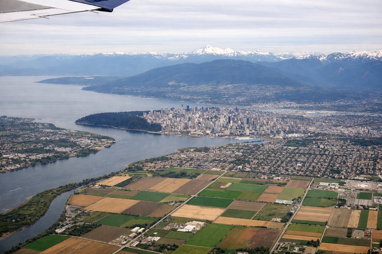
Takeoff from YVR
LEFTLeft side captures Vancouver's dramatic coastal departure with North Shore Mountains rising immediately behind the airport, plus views of Burrard Inlet and the Georgia Strait. Right side faces inland toward flat Fraser River delta and suburban sprawl.
Landing at RMQ
RIGHTRight side offers superior approach views of Taiwan's west coast, the Taiwan Strait, and the dramatic Central Mountain Range rising inland from Taichung. Left side faces the Pacific Ocean with minimal coastal detail during final descent.
Will your flight be in sunlight?
Pick a date and time in the Sun Map to watch the sun move across your whole flight.
About This Route
Which side of the plane should I sit on flying from Vancouver International (YVR) to Taichung International Airport / Ching Chuang Kang Air Base (RMQ)?
Sit on the Right side of the plane for the best views on flights from Vancouver to Taichung. Right side scores higher due to the dramatic Central Mountain Range visible during the entire cruise phase over the Pacific and the scenic approach into Taichung with coastal and mountain features. Left side's Vancouver departure is scenic but the 11+ hour cruise over open ocean dominates the flight, offering minimal visual interest. Right side's landing approach compensates with strong terrain drama.
What can I see during takeoff from Vancouver International in Vancouver?
During takeoff from Vancouver International (YVR), sit on the Left side for the best views. Left side captures Vancouver's dramatic coastal departure with North Shore Mountains rising immediately behind the airport, plus views of Burrard Inlet and the Georgia Strait. Right side faces inland toward flat Fraser River delta and suburban sprawl. Notable sights include: North Shore Mountains (Grouse, Seymour peaks), Burrard Inlet, Vancouver harbor and downtown skyline, Georgia Strait opening northward.
What can I see when landing at Taichung International Airport / Ching Chuang Kang Air Base in Taichung?
When landing at Taichung International Airport / Ching Chuang Kang Air Base (RMQ), sit on the Right side for the best views. Right side offers superior approach views of Taiwan's west coast, the Taiwan Strait, and the dramatic Central Mountain Range rising inland from Taichung. Left side faces the Pacific Ocean with minimal coastal detail during final descent. Notable sights include: Taiwan Strait (visible as the water body below), Taichung coastal plain and harbor, Central Mountain Range (Xueshan and Alishan ranges) rising sharply inland, Qingshui cliffs and coastal features.
How long is the flight from Vancouver to Taichung?
The flight from Vancouver International (YVR) to Taichung International Airport / Ching Chuang Kang Air Base (RMQ) takes about 11 hours 15 minutes. The shortest flight path between them is 6,028 miles (9,701 km); winds and air traffic control usually add a few percent.
What does the Vancouver to Taichung flight path pass over?
The flight path crosses the North Pacific at high altitude (35,000+ feet) with minimal visible landmarks for approximately 10 hours. Departing YVR northwestward, the route passes over the Queen Charlotte Islands and Aleutian waters before turning southwest toward Japan. The midpoint occurs over open Pacific Ocean with no visible land. As the aircraft approaches Taiwan, the Ryukyu Islands chain (Okinawa region) may be visible on the southern horizon 1-2 hours before landing, though typically at too great a distance for clear detail. The final 90 minutes show Taiwan's northern coast, the Taiwan Strait, and the Central Mountain Range becoming progressively more defined as altitude decreases.