Left seats provide superior views for the entire flight. Takeoff offers the dramatic North Shore Mountains and Strait crossing context, and throughout the 25-minute flight, left seats face the mainland coast and mountains you're departing from, maintaining geographic orientation.
Flown YVR to YCD? Did we get it right?
Flight Path
Vancouver to Nanaimo is 32 miles (52 km), a flight of about 30 minutes.
The flight crosses the Strait of Georgia at its narrowest point in this sector (roughly 20 nautical miles). Midway, you'll see Hornby Island and Denman Island as small forested landmasses below. The route passes over the northern portion of Vancouver Island's coastal forest. Weather permitting, the entire North Shore Mountains chain remains visible to the left throughout the climb and cruise, with Mount Baker (Washington State, 10,781 ft) sometimes visible on clear days as a distant white peak on the southern horizon.
Great circle distance and headings ›Phase by phase
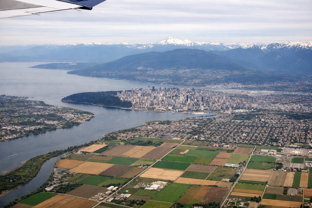
Takeoff from YVR
LEFTYVR typically departs to the west or northwest over the Strait of Georgia. Left seats face north toward the North Shore Mountains and the coastal geography you're about to cross, giving immediate context for the route ahead.
Landing at YCD
RIGHTApproaching Nanaimo from the south, right seats face east toward Vancouver Island's interior and the Nanaimo area itself. You'll see the approach path over the island and get direct views of Nanaimo Harbour and the landing zone.
Will your flight be in sunlight?
Pick a date and time in the Sun Map to watch the sun move across your whole flight.
About This Route
Which side of the plane should I sit on flying from Vancouver International (YVR) to Nanaimo (YCD)?
Sit on the Left side of the plane for the best views on flights from Vancouver to Nanaimo. Left seats provide superior views for the entire flight. Takeoff offers the dramatic North Shore Mountains and Strait crossing context, and throughout the 25-minute flight, left seats face the mainland coast and mountains you're departing from, maintaining geographic orientation.
What can I see during takeoff from Vancouver International in Vancouver?
During takeoff from Vancouver International (YVR), sit on the Left side for the best views. YVR typically departs to the west or northwest over the Strait of Georgia. Left seats face north toward the North Shore Mountains and the coastal geography you're about to cross, giving immediate context for the route ahead. Notable sights include: North Shore Mountains (Grouse, Seymour peaks), Strait of Georgia, Bowen Island, Howe Sound.
What can I see when landing at Nanaimo in Nanaimo?
When landing at Nanaimo (YCD), sit on the Right side for the best views. Approaching Nanaimo from the south, right seats face east toward Vancouver Island's interior and the Nanaimo area itself. You'll see the approach path over the island and get direct views of Nanaimo Harbour and the landing zone. Notable sights include: Nanaimo Harbour, Departure Bay, Vancouver Island interior forest, Georgia Strait (receding behind).
How long is the flight from Vancouver to Nanaimo?
The flight from Vancouver International (YVR) to Nanaimo (YCD) takes about 30 minutes. The shortest flight path between them is 32 miles (52 km); winds and air traffic control usually add a few percent.
What does the Vancouver to Nanaimo flight path pass over?
The flight crosses the Strait of Georgia at its narrowest point in this sector (roughly 20 nautical miles). Midway, you'll see Hornby Island and Denman Island as small forested landmasses below. The route passes over the northern portion of Vancouver Island's coastal forest. Weather permitting, the entire North Shore Mountains chain remains visible to the left throughout the climb and cruise, with Mount Baker (Washington State, 10,781 ft) sometimes visible on clear days as a distant white peak on the southern horizon.