While takeoff offers dramatic mountain scenery, the landing approach provides more sustained and varied views of the Interior Plateau landscape and the Thompson River valley—the defining geography of this route. Right seats capture both the descent corridor and the river's distinctive meanders.
Flown YVR to YKA? Did we get it right?
Flight Path
Vancouver to Kamloops is 160 miles (258 km), a flight of about 1 hour 15 minutes.
Fraser River canyon (visible during climb-out heading northeast), transition from coastal mountains to interior plateau, Cache Creek area, semi-arid grassland terrain of the Interior Plateau, Thompson River valley approaching Kamloops
Great circle distance and headings ›Phase by phase
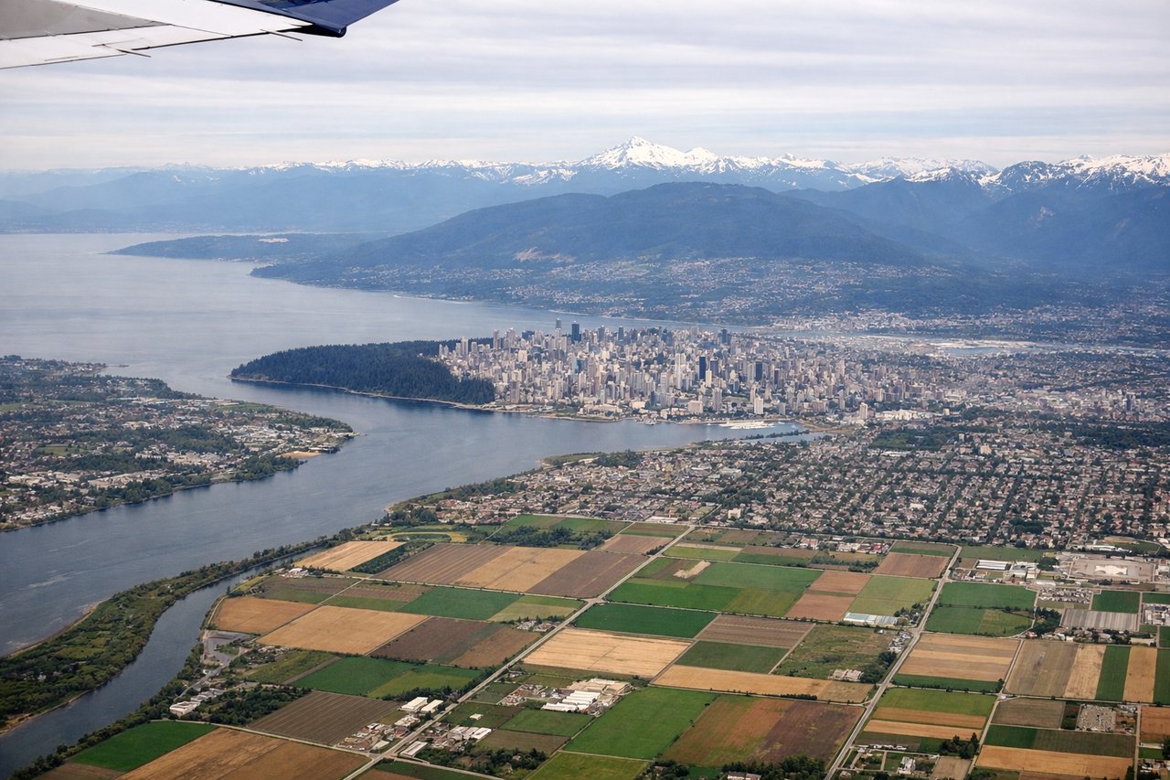
Takeoff from YVR
LEFTLeft seats offer immediate views of the North Shore Mountains as you climb out over Burrard Inlet. The peaks rise dramatically to the north and west, creating a striking backdrop during the initial climb phase.
Landing at YKA
RIGHTRight seats provide excellent views during descent into Kamloops. You'll see the Thompson River valley opening up, with the city nestled in the semi-arid plateau landscape. The river's distinctive meandering path is clearly visible from altitude.
Will your flight be in sunlight?
Pick a date and time in the Sun Map to watch the sun move across your whole flight.
About This Route
Which side of the plane should I sit on flying from Vancouver International (YVR) to Kamloops (YKA)?
Sit on the Right side of the plane for the best views on flights from Vancouver to Kamloops. While takeoff offers dramatic mountain scenery, the landing approach provides more sustained and varied views of the Interior Plateau landscape and the Thompson River valley—the defining geography of this route. Right seats capture both the descent corridor and the river's distinctive meanders.
What can I see during takeoff from Vancouver International in Vancouver?
During takeoff from Vancouver International (YVR), sit on the Left side for the best views. Left seats offer immediate views of the North Shore Mountains as you climb out over Burrard Inlet. The peaks rise dramatically to the north and west, creating a striking backdrop during the initial climb phase. Notable sights include: North Shore Mountains (Grouse, Seymour, Cypress peaks), Burrard Inlet, Vancouver city grid and downtown core, Coast Mountains extending northeast.
What can I see when landing at Kamloops in Kamloops?
When landing at Kamloops (YKA), sit on the Right side for the best views. Right seats provide excellent views during descent into Kamloops. You'll see the Thompson River valley opening up, with the city nestled in the semi-arid plateau landscape. The river's distinctive meandering path is clearly visible from altitude. Notable sights include: Thompson River and its valley, Kamloops city and airport, Interior Plateau terrain, Cascade Range foothills to the west.
How long is the flight from Vancouver to Kamloops?
The flight from Vancouver International (YVR) to Kamloops (YKA) takes about 1 hour 15 minutes. The shortest flight path between them is 160 miles (258 km); winds and air traffic control usually add a few percent.
What does the Vancouver to Kamloops flight path pass over?
Fraser River canyon (visible during climb-out heading northeast), transition from coastal mountains to interior plateau, Cache Creek area, semi-arid grassland terrain of the Interior Plateau, Thompson River valley approaching Kamloops