While left offers excellent takeoff views of the North Shore Mountains, the right side delivers more consistent scenic value throughout the flight, particularly during descent into PEI's distinctive red soil landscape and the Northumberland Strait approach.
Flown YVR to YYG? Did we get it right?
Flight Path
Vancouver to Charlottetown is 2,724 miles (4,383 km), a flight of about 5 hours 15 minutes.
Canadian Rockies (Alberta/British Columbia border) visible during cruise at altitude, including peaks near Banff and Lake Louise; the Great Lakes region (Ontario) during mid-flight; transition from western mountains through prairie provinces to Atlantic maritime landscape; the St. Lawrence River valley approaching eastern Canada
Great circle distance and headings ›


Phase by phase
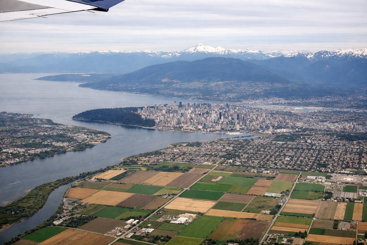
Takeoff from YVR
LEFTLeft side offers immediate views of the North Shore Mountains and Burrard Inlet as you climb out westbound over the Strait of Georgia. The right side faces inland toward less dramatic terrain.
Landing at YYG
RIGHTRight side provides views of Prince Edward Island's distinctive red soil landscape and the Northumberland Strait as you descend into Charlottetown. The left side faces Nova Scotia across the water with less dramatic terrain.
Will your flight be in sunlight?
Pick a date and time in the Sun Map to watch the sun move across your whole flight.
About This Route
Which side of the plane should I sit on flying from Vancouver International (YVR) to Charlottetown (YYG)?
Sit on the Right side of the plane for the best views on flights from Vancouver to Charlottetown. While left offers excellent takeoff views of the North Shore Mountains, the right side delivers more consistent scenic value throughout the flight, particularly during descent into PEI's distinctive red soil landscape and the Northumberland Strait approach.
What can I see during takeoff from Vancouver International in Vancouver?
During takeoff from Vancouver International (YVR), sit on the Left side for the best views. Left side offers immediate views of the North Shore Mountains and Burrard Inlet as you climb out westbound over the Strait of Georgia. The right side faces inland toward less dramatic terrain. Notable sights include: North Shore Mountains (Grouse, Seymour peaks), Burrard Inlet, Strait of Georgia, Vancouver city grid.
What can I see when landing at Charlottetown in Charlottetown?
When landing at Charlottetown (YYG), sit on the Right side for the best views. Right side provides views of Prince Edward Island's distinctive red soil landscape and the Northumberland Strait as you descend into Charlottetown. The left side faces Nova Scotia across the water with less dramatic terrain. Notable sights include: Northumberland Strait, Prince Edward Island's red soil fields, Charlottetown harbor, rolling agricultural landscape.
How long is the flight from Vancouver to Charlottetown?
The flight from Vancouver International (YVR) to Charlottetown (YYG) takes about 5 hours 15 minutes. The shortest flight path between them is 2,724 miles (4,383 km); winds and air traffic control usually add a few percent.
What does the Vancouver to Charlottetown flight path pass over?
Canadian Rockies (Alberta/British Columbia border) visible during cruise at altitude, including peaks near Banff and Lake Louise; the Great Lakes region (Ontario) during mid-flight; transition from western mountains through prairie provinces to Atlantic maritime landscape; the St. Lawrence River valley approaching eastern Canada