Vancouver to Sandspit is 467 miles (751 km), a flight of about 1 hour 15 minutes.
While takeoff favors the left for North Shore views, the landing approach to YZP offers more dramatic and sustained scenery on the right side—the Haida Gwaii coastline and inlet are the visual highlight of this route. The approach descent provides better window views than the takeoff climb.
Flight Path
The flight path crosses the Strait of Georgia, passes over the northern BC coast including the Inside Passage waters, and approaches through Queen Charlotte Sound. Notable midpoint geography includes the rugged mainland coast north of Desolation Sound, numerous islands of the Inside Passage, and the transition from temperate to subarctic forest as you move north. Hecate Strait separates the mainland from Haida Gwaii's western shore.
Great circle distance and headings ›Phase by phase
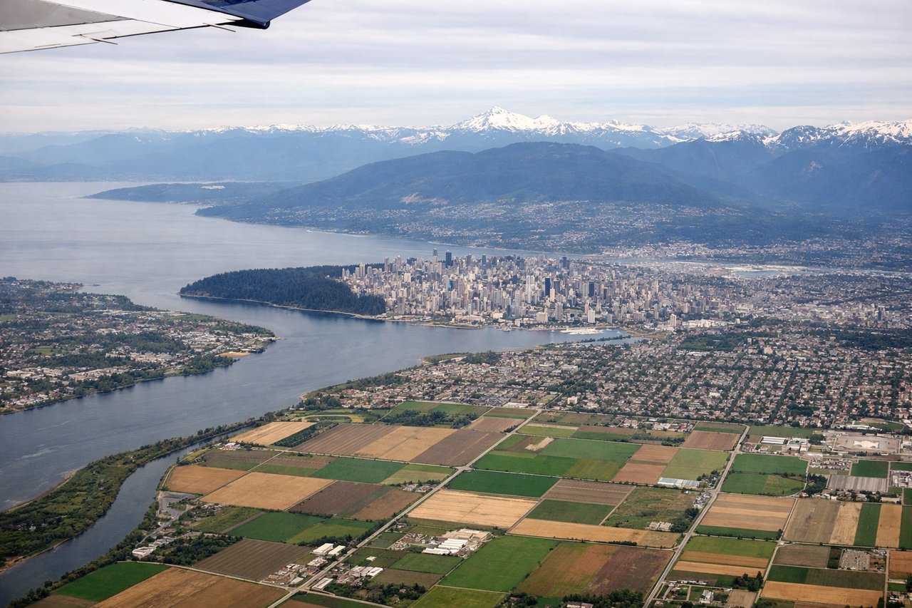
Takeoff from YVR
LEFTYVR typically departs to the north or northeast. Left-side seats offer views of the North Shore Mountains and Burrard Inlet as you climb out, with the dramatic peaks of the Coast Range rising immediately north of the airport.
Landing at YZP
RIGHTApproaching YZP from the south typically means descending over Hecate Strait and the eastern shore of Haida Gwaii. Right-side seats capture the dramatic coastline, forested terrain, and the inlet leading to Sandspit as you descend toward the runway.
Landmarks on this routeAll landmarks →
Will your flight be in sunlight?
Pick a date and time in the Sun Map to watch the sun move across your whole flight.
About This Route
Which side of the plane should I sit on flying from Vancouver International (YVR) to Sandspit (YZP)?
Sit on the Right side of the plane for the best views on flights from Vancouver to Sandspit. While takeoff favors the left for North Shore views, the landing approach to YZP offers more dramatic and sustained scenery on the right side—the Haida Gwaii coastline and inlet are the visual highlight of this route. The approach descent provides better window views than the takeoff climb.
What can I see during takeoff from Vancouver International in Vancouver?
During takeoff from Vancouver International (YVR), sit on the Left side for the best views. YVR typically departs to the north or northeast. Left-side seats offer views of the North Shore Mountains and Burrard Inlet as you climb out, with the dramatic peaks of the Coast Range rising immediately north of the airport. Notable sights include: North Shore Mountains (Grouse, Seymour, Cypress peaks), Burrard Inlet, Strait of Georgia, Vancouver city grid.
What can I see when landing at Sandspit in Sandspit?
When landing at Sandspit (YZP), sit on the Right side for the best views. Approaching YZP from the south typically means descending over Hecate Strait and the eastern shore of Haida Gwaii. Right-side seats capture the dramatic coastline, forested terrain, and the inlet leading to Sandspit as you descend toward the runway. Notable sights include: Haida Gwaii forested coastline, Hecate Strait, Sandspit inlet and tidal flats, Queen Charlotte Sound.
How long is the flight from Vancouver to Sandspit?
The flight from Vancouver International (YVR) to Sandspit (YZP) takes about 1 hour 15 minutes. The shortest flight path between them is 467 miles (751 km); winds and air traffic control usually add a few percent.
What does the Vancouver to Sandspit flight path pass over?
The flight path crosses the Strait of Georgia, passes over the northern BC coast including the Inside Passage waters, and approaches through Queen Charlotte Sound. Notable midpoint geography includes the rugged mainland coast north of Desolation Sound, numerous islands of the Inside Passage, and the transition from temperate to subarctic forest as you move north. Hecate Strait separates the mainland from Haida Gwaii's western shore.