While the right side wins the takeoff sequence with Charlotte's skyline and the first Blue Ridge foothills, the left side compounds a decent cruise-phase view of Colorado's southern Rockies with a genuinely dramatic, close-range Wasatch Range finale on landing, giving it the stronger full-flight experience.
Flown CLT to SLC? Did we get it right?
Flight Path
Charlotte to Salt Lake City is 1,724 miles (2,774 km), a flight of about 4 hours 15 minutes.
The route crosses the southern Appalachians near the Great Smoky Mountains, the Tennessee River valley, the Mississippi River near Memphis, the Ozark Plateau, the High Plains of Kansas and eastern Colorado, and the southern Rocky Mountains before descending toward the Wasatch Front.
Great circle distance and headings ›


Phase by phase

Takeoff from CLT
RIGHTDeparting CLT in typical south-flow operations, the aircraft climbs south then banks right toward its westbound cruise heading, swinging the right side toward Charlotte's Uptown skyline and the rolling Piedmont foothills that rise toward the Blue Ridge. Lake Norman's blue fingers are also briefly visible off the nose during the turn.
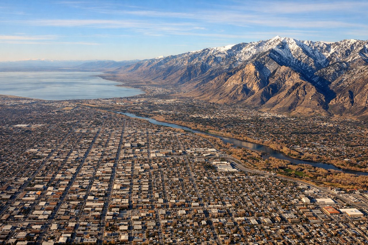
Landing at SLC
LEFTSLC's valley setting means arrivals descending from the north and landing to the south put the Wasatch Range directly on the left side, with peaks like Mount Olympus rising steeply just east of the runway. This close mountain wall is far more dramatic than the flatter lakebed scenery on the opposite side.
Will your flight be in sunlight?
Pick a date and time in the Sun Map to watch the sun move across your whole flight.
About This Route
Which side of the plane should I sit on flying from Charlotte Douglas International (CLT) to Salt Lake City International (SLC)?
Sit on the Left side of the plane for the best views on flights from Charlotte to Salt Lake City. While the right side wins the takeoff sequence with Charlotte's skyline and the first Blue Ridge foothills, the left side compounds a decent cruise-phase view of Colorado's southern Rockies with a genuinely dramatic, close-range Wasatch Range finale on landing, giving it the stronger full-flight experience.
What can I see during takeoff from Charlotte Douglas International in Charlotte?
During takeoff from Charlotte Douglas International (CLT), sit on the Right side for the best views. Departing CLT in typical south-flow operations, the aircraft climbs south then banks right toward its westbound cruise heading, swinging the right side toward Charlotte's Uptown skyline and the rolling Piedmont foothills that rise toward the Blue Ridge. Lake Norman's blue fingers are also briefly visible off the nose during the turn. Notable sights include: Charlotte Uptown skyline, Lake Norman, South Mountains, distant Blue Ridge ridgelines.
What can I see when landing at Salt Lake City International in Salt Lake City?
When landing at Salt Lake City International (SLC), sit on the Left side for the best views. SLC's valley setting means arrivals descending from the north and landing to the south put the Wasatch Range directly on the left side, with peaks like Mount Olympus rising steeply just east of the runway. This close mountain wall is far more dramatic than the flatter lakebed scenery on the opposite side. Notable sights include: Wasatch Range (Mount Olympus, Twin Peaks), Salt Lake Valley floor, Traverse Mountains to the south, Salt Lake City skyline at the mountain base.
How long is the flight from Charlotte to Salt Lake City?
The flight from Charlotte Douglas International (CLT) to Salt Lake City International (SLC) takes about 4 hours 15 minutes. The shortest flight path between them is 1,724 miles (2,774 km); winds and air traffic control usually add a few percent.
What does the Charlotte to Salt Lake City flight path pass over?
The route crosses the southern Appalachians near the Great Smoky Mountains, the Tennessee River valley, the Mississippi River near Memphis, the Ozark Plateau, the High Plains of Kansas and eastern Colorado, and the southern Rocky Mountains before descending toward the Wasatch Front.